Date of Hike: Saturday, February, 20, 2016
Total Distance: 5.14 Miles
Avg speed: 1.8 MPH
Total Time: 2:54:21
Conditions: Sunny, 60 Degrees
Difficulty: Easy, Moderate, Difficult
On Saturday, February 20th, I took a ride out to Monocacy Hill Recreation Area and what a beautiful day it was for a hike! I have to admit, after winter storm Jonas hit the area, I haven't been out much since I just don't have the gear for hiking in the snow. I know, it's a lame excuse, but have you ever tried hiking in 30 inches of snow? It's not easy hiking in only a few inches of snow!
As you likely already know, most of the snow has melted and my procrastination means that my endurance isn't as good as it used to be. Now I have to get myself back in the swing and rebuild that lost endurance which I paid a price for during this adventure (actually, I took two adventures over the weekend, another blog post coming soon). It was worth every step though.
Approximate address:
43 Geiger Road
Douglassville, PA 19518
GPS: 40.280882, -75.753465
Take note that the parking lot at Monocacy Hill is small and can probably fit 8-9 tightly packed vehicles at the most. If you get there and the parking lot is full, you can park alongside Geiger Road on the same side as the parking lot. Had I known this ahead of time, I probably would have parked alongside the road instead of squeezing my car into the parking lot.
For a copy of the trail map, click here.

As you can see stated below, the Monocacy Hill Recreation Area was acquired by Amity Township in 1967 from a company by the name of John T. Dyer Quarry Company, and local resident George Thompson, at a cost of $51,000. Monocacy Hill is the township's largest recreation area at a total of now, 428 acres, and has approximately 6 miles of trails.

Not far from the parking lot is this picnic area. As you walk a little further in, there are a few more of them.

Posted close to the entrance are a number of different items you can check out. The first is this booklet looking podium with the names of wildflowers you'll find within Monocacy Hill and what time of year you should expect to see them.

Monocacy Hill has an interesting donation program going with Redners Markets. If you shop there and use your Redners gas card (likely the same as the loyalty card), drop off your receipt to this receipt box and Monocacy Hill will receive 1% of the base points (located on the bottom of your receipt). Click here for more details. What I don't know is if this agreement is with a local Redners or if all of them are partaking in this.

When you first start your adventure, you can go one of two different directions. The first will bring you west alongside Geiger Road for a short distance, then cut to the southwest. The other, and the direction I went to start my adventure, was to the southwest on the Lower Trail.

Throughout different areas of the preserve, you'll find these kiosk type stations providing information about the habitats in the area.

All of the trails at Monocacy Hill are well marked and well maintained. There are plenty of trail markers to keep you aware of what trail you're on the the trails themselves are relatively clean.

The first intersecting trail is the Creek Trail and was where I initially turned off the Lower Trail, now heading in a southward direction. I'm curious to know what the "MH" markers represent. I saw them scattered throughout the park, all of which had a different number on them. They look to be some sort of location marker, perhaps for hunting and/or maintenance?


The Creek Trail, while mostly headed in a southerly direction did make a few twists and turns along the way.


Just next to the trail was this low lying area. In this section of the park, there were quite a few of them. Really, the trail itself was in a low lying area!


This was one of the few areas where there was still snow and ice covering the trail although it didn't stretch too far.


It's a bit difficult to tell from the pictures but giving the time of year and the amount of rain that's recently fallen here in Southeast PA (along with melting snow from Jonas), the trails were pretty soggy throughout the adventure.


Numerous trees throughout Monocacy Hill were labeled with information about the type of tree, height, etc. The orange in the picture is the reflection off the sign from my shirt as the area is open to hunting. I seriously doubt there were hunters though, the place was pretty busy with hikers since it was such a nice day. I'd rather be safe than sorry!
Apparently at one time, hunting was outlawed at Monocacy Hill up until 1970 where it was once again allowed and still is to this day. This reminds me, if you plan on visiting Monocacy Hill, please be sure to check their website for closures of the recreation area for hunting or contact the Monocacy Hill Conservation Association to inquire. I attempted to explore Monocacy Hill around mid-December and found out the hard way it was closed to hunting. Of course, you can avoid all of this and just go on a Sunday!

Besides the currently unnamed creek, there were also a few smaller streams snaking through as well. There were also a number of other trails in the area that looked to be leading towards homes. The green sign you see below is a rules and regulations sign, likely for those who used the unmarked trail from those homes to get into the recreation area.

Somewhere in this area, the trail takes a turn to the northwest, more west than north.

This section is very nice and as of right now, I cannot locate the name of the creek this bridge is crossing over. Once the Creek Trail crosses over the creek, it cuts alongside it for a short distance.


Once of the rocky parts of the trail. Although there wasn't too much of this, it wasn't the only spot where there were rocks to walk over.

There are a number of stone walls scattered throughout the recreation area, likely used as property boundaries from homesteads that were in the area when it was settled in the 1770's.

Now back to the Lower Trail, I took a turn to the north heading in the direction of the parking lot.


After heading north for a short distance, I turned to the southwest on the Stone Wall Trail.


Eventually, the Stone Wall Trail makes its way back to the Lower Trail and from there, continues heading in a westerly direction.


The Lower Trail slowly makes a turn heading in a northwest direction, more west than north.


A short distance past the Railbed Trail, the Monocacy Hill Trail intersects heading in a northerly direction, changing direction a few times before turning to the northeast.

By far, this is the toughest section of Monocacy Hill with an elevation gain of almost 300 feet within a relatively short distance. I hadn't run into a challenge like this since my adventure last year at Hawk Mountain and giving I hadn't been hiking too much in the month of January and into February, to say getting up this hill was difficult would be an understatement. I had to stop three times to catch my breath before reaching the top! In the end, the effort used getting up the hill was (and is) worth it.
As you get to about the halfway point, maybe a little further, the fun of getting up this side of the hill only gets better with a steep stone stairway leading up to the top.


Almost to the top of Monocacy Hill, the trail sort of levels out but doesn't get any easier as you have to climb over rocks to keep going on the Monocacy Hill Trail.

This made the climb well worth while. Technically, this isn't the top of the hill but it's where there's an opening to get a good view of the valley below. I believe this is looking in a southward direction. If you look to the left side of the below picture, you can see a small section of the Schuylkill River.

I took a number of shots looking over the valley before taking a break to admire the view, grab a quick snack, and continuing along my way.


Pennsylvania is affectionately known by some hikers as Rocksylvania...I couldn't imagine why? The rocks weren't as big but this area reminded me of Hawk Mountain a little bit since the trail took you through the rocks and not around them.

I'm not sure if this is true or not but as I was researching Monocacy Hill and its history, I stumbled upon an old news article from the Reading Eagle where there's mention of a cavern somewhere under Monocacy Hill where gold, silver, and platinum had been found in 1730's. Two Englishmen named Cove and Draper were shown the area by Native Americans (likely Lenni Lenape) and after their discovery, wrote and then set sail back to England to get supplies and were never seen or heard from again. According to the article, the ship and its crew may have been lost at sea.
In 1886, the letters assisted someone (who wasn't named) in locating Monocacy Hill who was preparing to secure leases from the land owners to tunnel under the rock. Whether or not this actually happened is unknown as this is where the article comes to an end and I was unable to find additional articles referencing any mining operations around that time period.


Unfortunately, there's really no good view of the area from the very top of Monocacy Hill, not like the overlook from a short distance back.


Once you get done climbing over the rocks to follow the Monocacy Hill Trail and still heading in a northeasterly direction, the trail levels out some, then gradually starts to take you down the opposite side of the hill, only much less steep!


Back to the Lower Trail again, I then took a turn to the south.

Since I was overlapping some of the areas on the Lower Trail that I had already hiked, I didn't take many pictures for a distance.


As you get to the southernmost edge of Monocacy Hill Recreation Area, there's what looks to be some sort of race or stunt track just next to the trail. I'm not sure if this is private property or not but I sure wouldn't mind seeing a race or two. Other than what I can see on Google Earth/Maps, I cannot seem to find any additional information about what this is.


Once I was done checking out whatever this track was, I continued on my way. By now the Lower Trail had taken a turn to the west skirting the southern edge of the recreation area.

Since there was some additional overlapping on the Lower Trail in this area, again, I didn't take too many pictures. Somewhere along the way, I made a turn onto the Railbed Trail, now heading in a northwesterly direction.

The Railbed Trail makes a sharp turn to the southwest (right).

Along the way, the Railbed Trail turns to the west, then making another turn to the north.


An unnamed stream alongside the trail still had some ice covering it, I love the designs ice can make!


Gradually, the Railbed Trail starts turning to the northeast.


Now back to the Lower Trail, I was almost done with my adventure for the day. It wasn't over yet though!


Getting close to finishing my hike for the day, I hiked across these ruins. As usual when it comes to finding ruins of something, I have to investigate and go a little crazy with the pictures but it's worth it to me. Apparently, while the John T. Dyer Quarry Company was in business in the 1920's, they had intentions of quarrying the stone out of Monocacy Hill. It was at that time where the concrete structure you see in this picture (and several below) was built with the intention of crushing the stone and loading it into railroad cars.
In 1925 and after much protest from local residents, the quarry company was unable to finish the project and the operation was abandoned. Whether or not the protests from local residents had anything to do with the abandonment of the project is unknown.


On the opposite side of the trail were the remnants of a few more structures although I'm not sure what they were supposed to be. My guess is that since the larger structure was supposed to be for crushing stone and loading rail cars, perhaps these were going to be used for transporting the stone to the crusher.


Scattered throughout the woods in this area there were a number of these steel rods sticking out of the ground.

Finding information about the history of Monocacy Hill online is a bit difficult, I was able to pull some of what's in this blog from the below sign.

Just beyond the stone crushing structure were the remnants of a building although I'm not sure what it might have been at one time.


I can't help myself, any time I find ruins, I have to check them out and take lots of pictures! After I was done exploring the ruins, I was on my way again. Once getting past these ruins, the trail turns to the south, then makes another turn to the east bringing you alongside Geiger Road.


Once you get alongside Geiger Road, it's a short walk back to the parking lot. This was also where I found out you can park alongside the road if the parking lot is full.
That was the end of my adventure for the day. In all, it was a pretty good hike, especially the view from the top of Monocacy Hill. The trails are well defined, well maintained, well marked, and easy to follow. Topping off the trail conditions, there's a good amount of varied terrain to keep you interested. As a bonus (besides the awesome view) was checking out the ruins of the old quarry operation from the early 1900's. It wasn't much to look at but it's always cool to find remnants of a small piece of history. I hope to return to the Monocacy Hill Recreation Area sometime in the future as it was well worth the drive to get out there!
Until next time, happy hiking and happy exploring!
On Saturday, February 20th, I took a ride out to Monocacy Hill Recreation Area and what a beautiful day it was for a hike! I have to admit, after winter storm Jonas hit the area, I haven't been out much since I just don't have the gear for hiking in the snow. I know, it's a lame excuse, but have you ever tried hiking in 30 inches of snow? It's not easy hiking in only a few inches of snow!
As you likely already know, most of the snow has melted and my procrastination means that my endurance isn't as good as it used to be. Now I have to get myself back in the swing and rebuild that lost endurance which I paid a price for during this adventure (actually, I took two adventures over the weekend, another blog post coming soon). It was worth every step though.
Approximate address:
43 Geiger Road
Douglassville, PA 19518
GPS: 40.280882, -75.753465
Take note that the parking lot at Monocacy Hill is small and can probably fit 8-9 tightly packed vehicles at the most. If you get there and the parking lot is full, you can park alongside Geiger Road on the same side as the parking lot. Had I known this ahead of time, I probably would have parked alongside the road instead of squeezing my car into the parking lot.
For a copy of the trail map, click here.

As you can see stated below, the Monocacy Hill Recreation Area was acquired by Amity Township in 1967 from a company by the name of John T. Dyer Quarry Company, and local resident George Thompson, at a cost of $51,000. Monocacy Hill is the township's largest recreation area at a total of now, 428 acres, and has approximately 6 miles of trails.

Not far from the parking lot is this picnic area. As you walk a little further in, there are a few more of them.

Posted close to the entrance are a number of different items you can check out. The first is this booklet looking podium with the names of wildflowers you'll find within Monocacy Hill and what time of year you should expect to see them.

Monocacy Hill has an interesting donation program going with Redners Markets. If you shop there and use your Redners gas card (likely the same as the loyalty card), drop off your receipt to this receipt box and Monocacy Hill will receive 1% of the base points (located on the bottom of your receipt). Click here for more details. What I don't know is if this agreement is with a local Redners or if all of them are partaking in this.

 |
| Information on the Redners "Save-A-Tape" program |
When you first start your adventure, you can go one of two different directions. The first will bring you west alongside Geiger Road for a short distance, then cut to the southwest. The other, and the direction I went to start my adventure, was to the southwest on the Lower Trail.

Throughout different areas of the preserve, you'll find these kiosk type stations providing information about the habitats in the area.

All of the trails at Monocacy Hill are well marked and well maintained. There are plenty of trail markers to keep you aware of what trail you're on the the trails themselves are relatively clean.

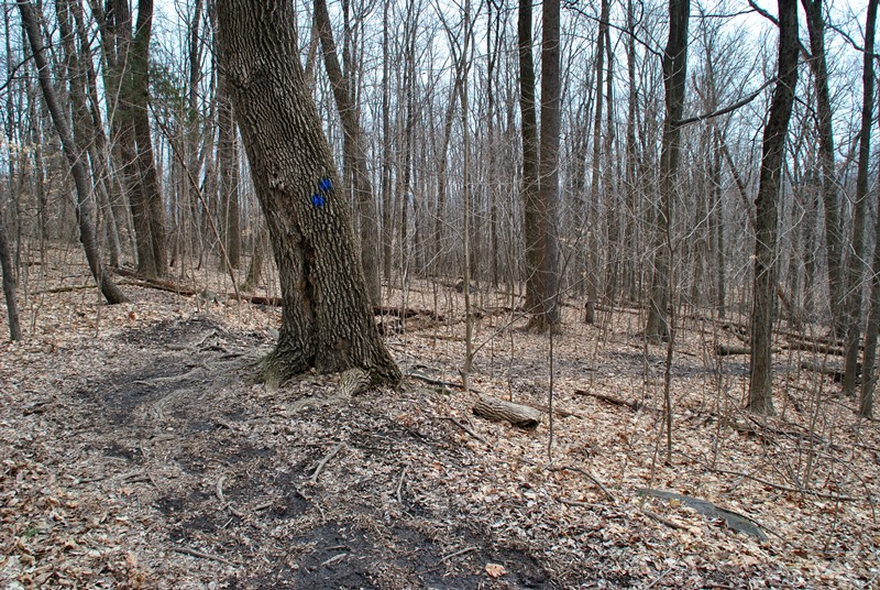
The first intersecting trail is the Creek Trail and was where I initially turned off the Lower Trail, now heading in a southward direction. I'm curious to know what the "MH" markers represent. I saw them scattered throughout the park, all of which had a different number on them. They look to be some sort of location marker, perhaps for hunting and/or maintenance?


The Creek Trail, while mostly headed in a southerly direction did make a few twists and turns along the way.


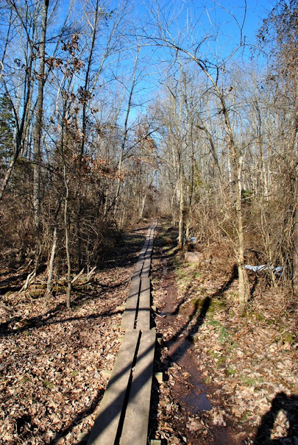
Just next to the trail was this low lying area. In this section of the park, there were quite a few of them. Really, the trail itself was in a low lying area!


This was one of the few areas where there was still snow and ice covering the trail although it didn't stretch too far.


 |
| Nice overlook area looking towards the small creek (I can't seem to find the name of it). |
It's a bit difficult to tell from the pictures but giving the time of year and the amount of rain that's recently fallen here in Southeast PA (along with melting snow from Jonas), the trails were pretty soggy throughout the adventure.


Numerous trees throughout Monocacy Hill were labeled with information about the type of tree, height, etc. The orange in the picture is the reflection off the sign from my shirt as the area is open to hunting. I seriously doubt there were hunters though, the place was pretty busy with hikers since it was such a nice day. I'd rather be safe than sorry!
Apparently at one time, hunting was outlawed at Monocacy Hill up until 1970 where it was once again allowed and still is to this day. This reminds me, if you plan on visiting Monocacy Hill, please be sure to check their website for closures of the recreation area for hunting or contact the Monocacy Hill Conservation Association to inquire. I attempted to explore Monocacy Hill around mid-December and found out the hard way it was closed to hunting. Of course, you can avoid all of this and just go on a Sunday!

Besides the currently unnamed creek, there were also a few smaller streams snaking through as well. There were also a number of other trails in the area that looked to be leading towards homes. The green sign you see below is a rules and regulations sign, likely for those who used the unmarked trail from those homes to get into the recreation area.

Somewhere in this area, the trail takes a turn to the northwest, more west than north.

This section is very nice and as of right now, I cannot locate the name of the creek this bridge is crossing over. Once the Creek Trail crosses over the creek, it cuts alongside it for a short distance.

 |
| Looking downstream from the bridge crossing over the creek |
 |
| Small waterfall just upstream from the bridge |
 |
| View looking downstream from just past the small waterfall, bridge is in the background |

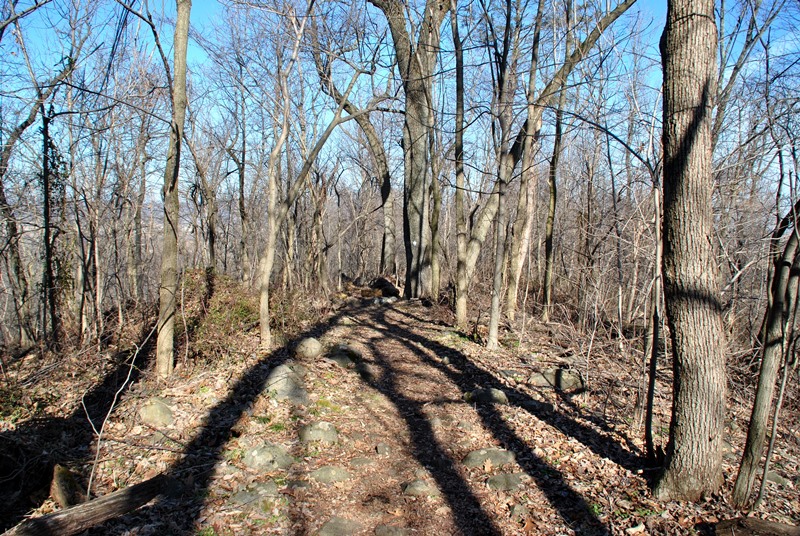
Once of the rocky parts of the trail. Although there wasn't too much of this, it wasn't the only spot where there were rocks to walk over.

There are a number of stone walls scattered throughout the recreation area, likely used as property boundaries from homesteads that were in the area when it was settled in the 1770's.

Now back to the Lower Trail, I took a turn to the north heading in the direction of the parking lot.


After heading north for a short distance, I turned to the southwest on the Stone Wall Trail.


 |
| The Stone Wall Trail gradually takes a turn to the west |
 |
| Appropriate name for the trail as it ran alongside a stone wall |

Eventually, the Stone Wall Trail makes its way back to the Lower Trail and from there, continues heading in a westerly direction.

 |
| This was on the sign with the trail names |

 |
| Large rock formation alongside the Lower Trail |
The Lower Trail slowly makes a turn heading in a northwest direction, more west than north.


 |
| Another cliff alongside the Lower Trail |
 |
| For the time being, I skipped past this trail (Railbed Trail) |
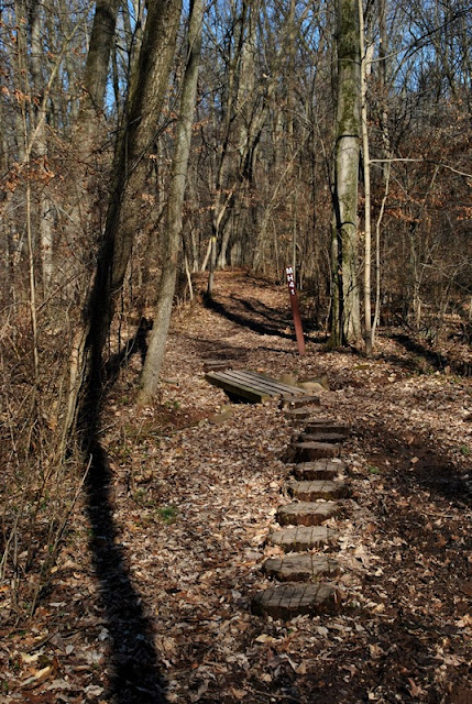
A short distance past the Railbed Trail, the Monocacy Hill Trail intersects heading in a northerly direction, changing direction a few times before turning to the northeast.

By far, this is the toughest section of Monocacy Hill with an elevation gain of almost 300 feet within a relatively short distance. I hadn't run into a challenge like this since my adventure last year at Hawk Mountain and giving I hadn't been hiking too much in the month of January and into February, to say getting up this hill was difficult would be an understatement. I had to stop three times to catch my breath before reaching the top! In the end, the effort used getting up the hill was (and is) worth it.
 |
| Looking up the Monocacy Hill Trail |
 |
| Looking back down the hill |
As you get to about the halfway point, maybe a little further, the fun of getting up this side of the hill only gets better with a steep stone stairway leading up to the top.


 |
| Top of the stairway and almost to the top of the hill |
 |
| Looking back down the hill I had just climbed |
Almost to the top of Monocacy Hill, the trail sort of levels out but doesn't get any easier as you have to climb over rocks to keep going on the Monocacy Hill Trail.

This made the climb well worth while. Technically, this isn't the top of the hill but it's where there's an opening to get a good view of the valley below. I believe this is looking in a southward direction. If you look to the left side of the below picture, you can see a small section of the Schuylkill River.

I took a number of shots looking over the valley before taking a break to admire the view, grab a quick snack, and continuing along my way.


 |
| One last shot looking back down the hill I had climbed to get to the top |
Pennsylvania is affectionately known by some hikers as Rocksylvania...I couldn't imagine why? The rocks weren't as big but this area reminded me of Hawk Mountain a little bit since the trail took you through the rocks and not around them.

I'm not sure if this is true or not but as I was researching Monocacy Hill and its history, I stumbled upon an old news article from the Reading Eagle where there's mention of a cavern somewhere under Monocacy Hill where gold, silver, and platinum had been found in 1730's. Two Englishmen named Cove and Draper were shown the area by Native Americans (likely Lenni Lenape) and after their discovery, wrote and then set sail back to England to get supplies and were never seen or heard from again. According to the article, the ship and its crew may have been lost at sea.
In 1886, the letters assisted someone (who wasn't named) in locating Monocacy Hill who was preparing to secure leases from the land owners to tunnel under the rock. Whether or not this actually happened is unknown as this is where the article comes to an end and I was unable to find additional articles referencing any mining operations around that time period.


Unfortunately, there's really no good view of the area from the very top of Monocacy Hill, not like the overlook from a short distance back.


Once you get done climbing over the rocks to follow the Monocacy Hill Trail and still heading in a northeasterly direction, the trail levels out some, then gradually starts to take you down the opposite side of the hill, only much less steep!


Back to the Lower Trail again, I then took a turn to the south.

Since I was overlapping some of the areas on the Lower Trail that I had already hiked, I didn't take many pictures for a distance.

 |
| One of the many soggy spots on the trail |

As you get to the southernmost edge of Monocacy Hill Recreation Area, there's what looks to be some sort of race or stunt track just next to the trail. I'm not sure if this is private property or not but I sure wouldn't mind seeing a race or two. Other than what I can see on Google Earth/Maps, I cannot seem to find any additional information about what this is.


Once I was done checking out whatever this track was, I continued on my way. By now the Lower Trail had taken a turn to the west skirting the southern edge of the recreation area.

Since there was some additional overlapping on the Lower Trail in this area, again, I didn't take too many pictures. Somewhere along the way, I made a turn onto the Railbed Trail, now heading in a northwesterly direction.

The Railbed Trail makes a sharp turn to the southwest (right).

Along the way, the Railbed Trail turns to the west, then making another turn to the north.


An unnamed stream alongside the trail still had some ice covering it, I love the designs ice can make!


Gradually, the Railbed Trail starts turning to the northeast.


Now back to the Lower Trail, I was almost done with my adventure for the day. It wasn't over yet though!


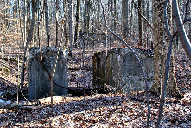
Getting close to finishing my hike for the day, I hiked across these ruins. As usual when it comes to finding ruins of something, I have to investigate and go a little crazy with the pictures but it's worth it to me. Apparently, while the John T. Dyer Quarry Company was in business in the 1920's, they had intentions of quarrying the stone out of Monocacy Hill. It was at that time where the concrete structure you see in this picture (and several below) was built with the intention of crushing the stone and loading it into railroad cars.
In 1925 and after much protest from local residents, the quarry company was unable to finish the project and the operation was abandoned. Whether or not the protests from local residents had anything to do with the abandonment of the project is unknown.


On the opposite side of the trail were the remnants of a few more structures although I'm not sure what they were supposed to be. My guess is that since the larger structure was supposed to be for crushing stone and loading rail cars, perhaps these were going to be used for transporting the stone to the crusher.


Scattered throughout the woods in this area there were a number of these steel rods sticking out of the ground.

Finding information about the history of Monocacy Hill online is a bit difficult, I was able to pull some of what's in this blog from the below sign.

 |
| Back to the stone crushing structure! |
Just beyond the stone crushing structure were the remnants of a building although I'm not sure what it might have been at one time.


 |
| I took a few more shots of the stone crushing structure |

 |
| Looking up through a hole in the top of the stone crushing structure |

I can't help myself, any time I find ruins, I have to check them out and take lots of pictures! After I was done exploring the ruins, I was on my way again. Once getting past these ruins, the trail turns to the south, then makes another turn to the east bringing you alongside Geiger Road.


Once you get alongside Geiger Road, it's a short walk back to the parking lot. This was also where I found out you can park alongside the road if the parking lot is full.
That was the end of my adventure for the day. In all, it was a pretty good hike, especially the view from the top of Monocacy Hill. The trails are well defined, well maintained, well marked, and easy to follow. Topping off the trail conditions, there's a good amount of varied terrain to keep you interested. As a bonus (besides the awesome view) was checking out the ruins of the old quarry operation from the early 1900's. It wasn't much to look at but it's always cool to find remnants of a small piece of history. I hope to return to the Monocacy Hill Recreation Area sometime in the future as it was well worth the drive to get out there!
Until next time, happy hiking and happy exploring!
No comments:
Post a Comment