Date of Hike: Sunday, September 27, 2015
Total Distance: 11.96 Miles
Avg speed: 2.1 MPH
Total Time: 5:41:16
Conditions: Partly Cloudy, 68 Degrees
Difficulty: Easy, Moderate
On Sunday, September 27, I took a ride to Hibernia County Park. Officially dedicated on October 4, 1964, Hibernia County Park is the largest of the parks within Chester County, excluding state parks. Like a number of other parks I've visited recently, Hibernia also has a history with the iron industry.
Approximate address:
111 Camp Stewart Road
Coatesville, PA 19320
GPS: 40.0143911,-75.8454567
There are two different entrances to this parking lot. If you approach the park from the south, the other is on Hatfield Road. There are also a number of other parking lots throughout the park if you'd like to start your hike in another area, to locate them, take a look at the trail map. Take note that the trails listed on the Chester County website don't come close to adding up to the distance I hiked (about 6 miles). With some overlapping, I managed almost 12 miles.


Directly to the east of the parking lot is the trail head, you won't be able to miss it.


Before I started my hike, I took a walk around the Hatfield House to have a look.
The Hatfield family was well known in Pennsylvania during the iron industry and ran the West Brandywine Rolling Mill which was owned by Samuel Hatfield and managed by Benjamin R. Hatfield up until the late 1870's and early 1880's, closed due to financial weakening by the Panic of 1873.
In 1918, the Hatfield home was willed by Mary Florence Hatfield to Chester and Lancaster Counties as a convalescent home. After renovations, the Hatfield Memorial home opened in 1925. While no name was given as to who the tenant was, the house was entrusted to the Parks department in 1982 and was maintained by that tenant up until their death in 2009. I'm currently unsure when the convalescent home was closed.


Once I was done checking out the Hatfield House, I started my hike heading down what used to be an old railroad. Known as the Wilmington Division of the Philadelphia and Reading Railroad, it extended north from Wilmington, DE to Birdsboro, PA. This railroad is still in operation south of Coatesville, PA but the northern section was abandoned in 1972 after flooding from Hurricane Agnes caused major washouts.

As usual, it's always a good idea to be aware of where hunting is permitted and dress accordingly.

The old railroad runs alongside the West Branch Brandywine Creek which is very nice in this area. I think I may have found a few more fishing spots!


Alongside the creek, I found the remnants of what might have been a dam at one time, likely used to run the mills in the area when the iron industry was still active.


Not my favorite kind of trail because it was flat and straight but I took a number of detours to check out the creek which kept it interesting.


You'll cross over the West Branch Brandywine Creek and from there, you have a few choices of what direction you can go. If you head to the west, it'll bring you to the main part of Hibernia County Park and a number of different trails, and if you continue heading north, it'll take you to the Rim Trail. I continued heading north on the Rim Trail. Whichever direction you decide to go, you'll be crossing over Wagontown Road.


The Rim Trail is a continuation of the old railroad which runs along the eastern side of the West Branch Brandywine Creek, now heading in a northeast direction.

There are a number of side trails scattered throughout the park, some of which I checked out and others that I didn't bother with. The above trail is one that I skipped over since is was heading in the direction of another section of the Rim Trail.

I was lucky to have spotted the remains of whatever this structure was at one time since it was about 30-40 feet into the woods and shrouded by leaves. Pretty cool find though!

The Rim Trail gradually makes a turn to the east.


Alongside the Rim Trail are also the remnants of what used to be ice houses. This section of the park has some pretty interesting ruins, you just have to look for them!


At this sign, the Rim Trail takes a turn to the southeast but for the time being, I continued along the old railroad to see what I would find.

I was unable to get a picture since there was a bank in the way but on the opposite side of where the above gate is, there's a small pond.

I took a side trail off the old railroad trail to find out where it would bring me.

Unfortunately, it brought me to private property and I had to turn back. Instead of backtracking, I found a small path that brought me back to the old rail trail and attempted to continue to the east.

Not much further up the trail, some fallen trees were blocking the path and this was where I turned back to return to the park. I'm sure I could have continued along this trail for a good distance but I was more interested in exploring the rest of the park. Perhaps I'll return there sometime to see how far this old rail trail will take me. I have to wonder if I could make it all the way to Birdsboro!

It doesn't look like much and it wasn't a tough challenge but this was the first hill of the day that I climbed. By this point, I had returned back to sign stating that I was leaving Hibernia County Park and was headed in a southeast direction. Somewhere along this climb, the Rim Trail takes another turn to the west with another trail that continues to the southeast.


I reached the top of the hill and spotted what looks like an old home. It turns out this is the Hibernia Methodist Church which was built in 1841.


I passed this contraption on my way up the hill to check out the church and didn't know what it was. I believe it's an old outhouse but I was unable to get much closer since it was overgrown and surrounded by thorn bushes.


This hill of rocks reminded me of Haycock Mountain a little bit, exception being the boulders at Haycock are much larger!


Alongside the hill of rocks was another side trail that headed in a southeasterly direction that I decided to check out. It eventually led to private property.


Back to the Rim Trail again. There were enough trail markers to keep you aware of what trail you were on, at least in this area.


This was probably the toughest stretch of trail at Hibernia Park. The hill wasn't too steep but there were a lot of small rocks that one could easily trip on if you're not watching your step.


Almost back to Wagontown Road by this point. You can see a little bit of it to the left side of the picture.

Once you return to Wagontown Road, you have to cross over the West Branch Brandywine Creek and follow it northwest for a short distance before you get to the main part of the park. This is the view of the creek looking upstream from the bridge.


Once you get to Lyons Head Drive, follow it for a very short distance and to your left, you'll see the Birch Run Trail heading northward. If you continue down Lyons Head Road, there are a few other trails further down.

With a few exceptions, (more on this later) most of the trails at Hibernia County Park are in pretty good condition.


Gradually, the Birch Run Trail takes a turn to the northeast. As I reached the dirt road you see above, I turned off and continued heading northwest.

Although it's not that large, Chambers Lake is pretty scenic. In total, Chambers Lake is 94 acres and is approximately 48 feet at its deepest point.
I saw what I believe to be a bald eagle at the far end of the lake but it was too far away to identify. What was pretty cool was watching it swoop down to the lake, likely in search of a bite to eat.


Gradually making my way back to the southeast, I continued taking a few more shots of the lake. I didn't take a picture of it but to my right (east) is the Hibernia Dam which was built in 1994 in order to help with flood prevention, for recreational uses, and to provide water to the Coatesville area. In all, it's a total of 64.5 feet tall and 700 feet wide.

I'm pretty sure this is a great blue heron. What I found to be pretty cool about this is that it didn't seem to be afraid of me and didn't take off as I approached like would normally happen. I kept my distance and was able to get a few decent shots.

I eventually made my way back to the dirt road, then made another turn to the north to locate the Birch Run Trail again.

I'm not sure why but I didn't take any pictures within this stretch of the Birch Run Trail. The small creek that runs alongside the trail is Birch Run and is the one that Hibernia Dam is blocking.

The Birch Run Trail then leads you back to Lyons Head Road and from there, I made a turn to the northeast. The above pond has bluegills, largemouth bass and is also stocked with trout. It's open only to children and disabled individuals for the opening of trout season and opens to the public after Memorial Day.


The next trail I took was the Forge Trail heading to the northwest along the opposite side of Chambers Lake.


Camping at Hibernia County Park is also permitted from the first weekend of May through to the last weekend of October. Somewhere in this area is where one of the two campsites are.


This was a side trail that was supposed to lead to Chambers Lake but it was blocked off by a fallen tree. I didn't want to walk around it so I turned back towards the campsite. At this point, I was now at the northwest corner of the campsite, now headed in a northeasterly direction.

Once you get to the northernmost corner of the campsite, the Cedar Hollow Trail continues to the north.
The Cedar Hollow Trail then takes a turn to the east and an unnamed trail intersects with it heading west to the northeastern side side of Chambers Lake. For the time being, I took the unnamed trail to investigate.

Once you cross over this small creek, the trail turns to the south. As you approach the lake, you'll see the remnants of what used to be Birdell Road which leads directly into the lake.

Alongside Chambers Lake was another heron, this time a white one. It hung out for a short while but eventually flew to a different part of the lake.


I didn't take any pictures of the unnamed trail on the way back to the Cedar Hollow Trail. I was now heading to the east.


I turned off the Cedar Hollow Trail onto another unnamed trail heading to the north but once again, the trail was blocked off by a fallen tree. This trail was supposed to lead to what's called the Nursery Field on the trail map. Once again, I turned around and headed back to the Cedar Hollow Trail.


Once out of the woods, I turned to the south and through a few open fields. Just to the south of these fields is the location of another of Hibernia's campsites.

Thinking I was on a trail, I took this dirt road for a short distance. After checking my GPS app, I realized I had missed the trail I had intended to take so I turned back.


After doubling back from the dirt road, I found the trail I was looking for (Forest Hill Trail).


Unfortunately, I either lost the trail or it just wasn't being maintained. Instead of turning back, I just bushwhacked through this section of the woods. There was a stream bed heading to the southeast so I followed it until I found an opening out to Park Road.

Once I made my way out of the woods, I ended up alongside the Hibernia Mansion. While there's no date for when the mansion was built, the first owner was a man by the name of George Harrison who had lived there from as early as 1744 until he sold it to Samuel Downing in 1790.
From 1808 through to 1821, ownership of the mansion and adjoining property along with the iron works passed through a number of hands until it was purchased by Charles Brooke in 1822. Brooke then passed the land on to his sons in 1862.
In the 1880's up until 1894, the property was owned by Thomas Costigan where it was then purchased by Colonel Franklin Swayne. Swayne owned the mansion until his death in 1924 where it was willed to his cousin, Mary Skerrett Matteson who primarily used the home for vacationing up until 1963 where she sold the property to Chester County.

Most of what you'll see of the mansion today was due to the work done by Colonel Franklin Swayne. If you are interested in taking a tour, the mansion is open from May until August*. Candlelight tours are also offered in the first weekend of December*. For more information, call the Chester County Department of Facilities and Parks at 610-383-3812.
* This information is provided on the Chester County website and is from 2014.


After checking out the mansion, I took a turn to the east down a dirt road towards the West Branch Brandywine Creek. The dirt road eventually makes a turn to the southeast where it meets up with the Forest Hill Trail which heads in a northeast direction. You can also continue down the dirt road to the Forge Trail and the creek.


These ruins are known as the Flat Top Cottage Ruins but other than that, I couldn't find any additional information about it.

Following the Forest Hill Trail, I eventually realized I was heading back toward trails I had already been on so I turned around again. I probably could have kept going for quite a distance before overlapping but I was more interested in checking out this section of the West Branch Brandywine Creek.


I found a side trail leading south towards the creek. The trail eventually made another turn to the east.


I've been fishing in this area before and if you're a fisherman, there are a few small pockets of water to check out but for the most part, they're few and far between in this section of the creek.


As stated on the sign, these are the ruins of undershot water wheels. If these water wheels were used for processing iron, I'm not sure. While the land around Hibernia was in use during the iron industry, there were a number of different mills in operation at the same time.

Heading east on the Forge Trail. Along this trail, there are a few other areas where there were remains of what used to be structures but nothing that was worthy of taking pictures as only signs describing what they were existed.


I made my way back to Lyons Head Road and was starting my return back to the car, now heading to the southeast. This spot is pretty popular for fishing.


Now back on Wagontown Road, this is looking downstream from the bridge on the West Branch Brandywine Creek.

I took one last shot of the creek on my return back to the car, I took quite a few of them that day!
On Sunday, September 27, I took a ride to Hibernia County Park. Officially dedicated on October 4, 1964, Hibernia County Park is the largest of the parks within Chester County, excluding state parks. Like a number of other parks I've visited recently, Hibernia also has a history with the iron industry.
Approximate address:
111 Camp Stewart Road
Coatesville, PA 19320
GPS: 40.0143911,-75.8454567
There are two different entrances to this parking lot. If you approach the park from the south, the other is on Hatfield Road. There are also a number of other parking lots throughout the park if you'd like to start your hike in another area, to locate them, take a look at the trail map. Take note that the trails listed on the Chester County website don't come close to adding up to the distance I hiked (about 6 miles). With some overlapping, I managed almost 12 miles.


Directly to the east of the parking lot is the trail head, you won't be able to miss it.


Before I started my hike, I took a walk around the Hatfield House to have a look.
The Hatfield family was well known in Pennsylvania during the iron industry and ran the West Brandywine Rolling Mill which was owned by Samuel Hatfield and managed by Benjamin R. Hatfield up until the late 1870's and early 1880's, closed due to financial weakening by the Panic of 1873.
In 1918, the Hatfield home was willed by Mary Florence Hatfield to Chester and Lancaster Counties as a convalescent home. After renovations, the Hatfield Memorial home opened in 1925. While no name was given as to who the tenant was, the house was entrusted to the Parks department in 1982 and was maintained by that tenant up until their death in 2009. I'm currently unsure when the convalescent home was closed.


Once I was done checking out the Hatfield House, I started my hike heading down what used to be an old railroad. Known as the Wilmington Division of the Philadelphia and Reading Railroad, it extended north from Wilmington, DE to Birdsboro, PA. This railroad is still in operation south of Coatesville, PA but the northern section was abandoned in 1972 after flooding from Hurricane Agnes caused major washouts.

As usual, it's always a good idea to be aware of where hunting is permitted and dress accordingly.

The old railroad runs alongside the West Branch Brandywine Creek which is very nice in this area. I think I may have found a few more fishing spots!


Alongside the creek, I found the remnants of what might have been a dam at one time, likely used to run the mills in the area when the iron industry was still active.


Not my favorite kind of trail because it was flat and straight but I took a number of detours to check out the creek which kept it interesting.


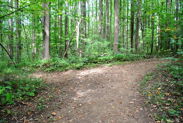
You'll cross over the West Branch Brandywine Creek and from there, you have a few choices of what direction you can go. If you head to the west, it'll bring you to the main part of Hibernia County Park and a number of different trails, and if you continue heading north, it'll take you to the Rim Trail. I continued heading north on the Rim Trail. Whichever direction you decide to go, you'll be crossing over Wagontown Road.


The Rim Trail is a continuation of the old railroad which runs along the eastern side of the West Branch Brandywine Creek, now heading in a northeast direction.
There are a number of side trails scattered throughout the park, some of which I checked out and others that I didn't bother with. The above trail is one that I skipped over since is was heading in the direction of another section of the Rim Trail.
 |
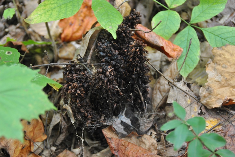
| Remnants of an old well perhaps? |

I was lucky to have spotted the remains of whatever this structure was at one time since it was about 30-40 feet into the woods and shrouded by leaves. Pretty cool find though!

The Rim Trail gradually makes a turn to the east.

 |
| There are a lot of rocks at Hibernia County Park! |

Alongside the Rim Trail are also the remnants of what used to be ice houses. This section of the park has some pretty interesting ruins, you just have to look for them!


At this sign, the Rim Trail takes a turn to the southeast but for the time being, I continued along the old railroad to see what I would find.

I was unable to get a picture since there was a bank in the way but on the opposite side of where the above gate is, there's a small pond.

I took a side trail off the old railroad trail to find out where it would bring me.

Unfortunately, it brought me to private property and I had to turn back. Instead of backtracking, I found a small path that brought me back to the old rail trail and attempted to continue to the east.

Not much further up the trail, some fallen trees were blocking the path and this was where I turned back to return to the park. I'm sure I could have continued along this trail for a good distance but I was more interested in exploring the rest of the park. Perhaps I'll return there sometime to see how far this old rail trail will take me. I have to wonder if I could make it all the way to Birdsboro!

It doesn't look like much and it wasn't a tough challenge but this was the first hill of the day that I climbed. By this point, I had returned back to sign stating that I was leaving Hibernia County Park and was headed in a southeast direction. Somewhere along this climb, the Rim Trail takes another turn to the west with another trail that continues to the southeast.


I reached the top of the hill and spotted what looks like an old home. It turns out this is the Hibernia Methodist Church which was built in 1841.
 |
| Graveyard behind Hibernia Methodist Church |
 |
| Map of the graveyard with an old water pump. |


I passed this contraption on my way up the hill to check out the church and didn't know what it was. I believe it's an old outhouse but I was unable to get much closer since it was overgrown and surrounded by thorn bushes.
 |
| Back to where the Rim Trail turns to the west. |


This hill of rocks reminded me of Haycock Mountain a little bit, exception being the boulders at Haycock are much larger!


Alongside the hill of rocks was another side trail that headed in a southeasterly direction that I decided to check out. It eventually led to private property.


Back to the Rim Trail again. There were enough trail markers to keep you aware of what trail you were on, at least in this area.


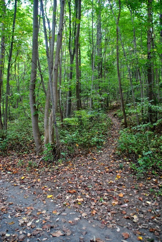
This was probably the toughest stretch of trail at Hibernia Park. The hill wasn't too steep but there were a lot of small rocks that one could easily trip on if you're not watching your step.


Almost back to Wagontown Road by this point. You can see a little bit of it to the left side of the picture.

Once you return to Wagontown Road, you have to cross over the West Branch Brandywine Creek and follow it northwest for a short distance before you get to the main part of the park. This is the view of the creek looking upstream from the bridge.

 |
| Entrance to Hibernia County Park at Lyons Head Drive, one of a few different entrances |


Once you get to Lyons Head Drive, follow it for a very short distance and to your left, you'll see the Birch Run Trail heading northward. If you continue down Lyons Head Road, there are a few other trails further down.

With a few exceptions, (more on this later) most of the trails at Hibernia County Park are in pretty good condition.


Gradually, the Birch Run Trail takes a turn to the northeast. As I reached the dirt road you see above, I turned off and continued heading northwest.
 |
| My first view of Chambers Lake |
 |
| Alongside the lake is this plaque |

Although it's not that large, Chambers Lake is pretty scenic. In total, Chambers Lake is 94 acres and is approximately 48 feet at its deepest point.
I saw what I believe to be a bald eagle at the far end of the lake but it was too far away to identify. What was pretty cool was watching it swoop down to the lake, likely in search of a bite to eat.


Gradually making my way back to the southeast, I continued taking a few more shots of the lake. I didn't take a picture of it but to my right (east) is the Hibernia Dam which was built in 1994 in order to help with flood prevention, for recreational uses, and to provide water to the Coatesville area. In all, it's a total of 64.5 feet tall and 700 feet wide.

I'm pretty sure this is a great blue heron. What I found to be pretty cool about this is that it didn't seem to be afraid of me and didn't take off as I approached like would normally happen. I kept my distance and was able to get a few decent shots.
 |
| One last picture of Chambers Lake...for now |

I eventually made my way back to the dirt road, then made another turn to the north to locate the Birch Run Trail again.

I'm not sure why but I didn't take any pictures within this stretch of the Birch Run Trail. The small creek that runs alongside the trail is Birch Run and is the one that Hibernia Dam is blocking.

The Birch Run Trail then leads you back to Lyons Head Road and from there, I made a turn to the northeast. The above pond has bluegills, largemouth bass and is also stocked with trout. It's open only to children and disabled individuals for the opening of trout season and opens to the public after Memorial Day.


The next trail I took was the Forge Trail heading to the northwest along the opposite side of Chambers Lake.

 |
| Small path leading down to Chambers Lake |


Camping at Hibernia County Park is also permitted from the first weekend of May through to the last weekend of October. Somewhere in this area is where one of the two campsites are.


This was a side trail that was supposed to lead to Chambers Lake but it was blocked off by a fallen tree. I didn't want to walk around it so I turned back towards the campsite. At this point, I was now at the northwest corner of the campsite, now headed in a northeasterly direction.

Once you get to the northernmost corner of the campsite, the Cedar Hollow Trail continues to the north.

The Cedar Hollow Trail then takes a turn to the east and an unnamed trail intersects with it heading west to the northeastern side side of Chambers Lake. For the time being, I took the unnamed trail to investigate.

Once you cross over this small creek, the trail turns to the south. As you approach the lake, you'll see the remnants of what used to be Birdell Road which leads directly into the lake.

Alongside Chambers Lake was another heron, this time a white one. It hung out for a short while but eventually flew to a different part of the lake.
 |
| Looking south towards the boat launch area of Chambers Lake |


 |
| View of Chambers Lake looking to the west. |
 |
| I have no idea what kind of plant this is! |

I didn't take any pictures of the unnamed trail on the way back to the Cedar Hollow Trail. I was now heading to the east.


I turned off the Cedar Hollow Trail onto another unnamed trail heading to the north but once again, the trail was blocked off by a fallen tree. This trail was supposed to lead to what's called the Nursery Field on the trail map. Once again, I turned around and headed back to the Cedar Hollow Trail.


Once out of the woods, I turned to the south and through a few open fields. Just to the south of these fields is the location of another of Hibernia's campsites.

Thinking I was on a trail, I took this dirt road for a short distance. After checking my GPS app, I realized I had missed the trail I had intended to take so I turned back.


After doubling back from the dirt road, I found the trail I was looking for (Forest Hill Trail).


Unfortunately, I either lost the trail or it just wasn't being maintained. Instead of turning back, I just bushwhacked through this section of the woods. There was a stream bed heading to the southeast so I followed it until I found an opening out to Park Road.

Once I made my way out of the woods, I ended up alongside the Hibernia Mansion. While there's no date for when the mansion was built, the first owner was a man by the name of George Harrison who had lived there from as early as 1744 until he sold it to Samuel Downing in 1790.
From 1808 through to 1821, ownership of the mansion and adjoining property along with the iron works passed through a number of hands until it was purchased by Charles Brooke in 1822. Brooke then passed the land on to his sons in 1862.
In the 1880's up until 1894, the property was owned by Thomas Costigan where it was then purchased by Colonel Franklin Swayne. Swayne owned the mansion until his death in 1924 where it was willed to his cousin, Mary Skerrett Matteson who primarily used the home for vacationing up until 1963 where she sold the property to Chester County.

Most of what you'll see of the mansion today was due to the work done by Colonel Franklin Swayne. If you are interested in taking a tour, the mansion is open from May until August*. Candlelight tours are also offered in the first weekend of December*. For more information, call the Chester County Department of Facilities and Parks at 610-383-3812.
* This information is provided on the Chester County website and is from 2014.


After checking out the mansion, I took a turn to the east down a dirt road towards the West Branch Brandywine Creek. The dirt road eventually makes a turn to the southeast where it meets up with the Forest Hill Trail which heads in a northeast direction. You can also continue down the dirt road to the Forge Trail and the creek.


These ruins are known as the Flat Top Cottage Ruins but other than that, I couldn't find any additional information about it.

Following the Forest Hill Trail, I eventually realized I was heading back toward trails I had already been on so I turned around again. I probably could have kept going for quite a distance before overlapping but I was more interested in checking out this section of the West Branch Brandywine Creek.


I found a side trail leading south towards the creek. The trail eventually made another turn to the east.
 |
| I have no idea what this is or why it was on a trail in the middle of the woods |
 |
| Approaching the West Branch Brandywine Creek |


I've been fishing in this area before and if you're a fisherman, there are a few small pockets of water to check out but for the most part, they're few and far between in this section of the creek.


As stated on the sign, these are the ruins of undershot water wheels. If these water wheels were used for processing iron, I'm not sure. While the land around Hibernia was in use during the iron industry, there were a number of different mills in operation at the same time.

Heading east on the Forge Trail. Along this trail, there are a few other areas where there were remains of what used to be structures but nothing that was worthy of taking pictures as only signs describing what they were existed.


I made my way back to Lyons Head Road and was starting my return back to the car, now heading to the southeast. This spot is pretty popular for fishing.

 |
| I don't think I've ever seen a hiker crossing sign before! |

Now back on Wagontown Road, this is looking downstream from the bridge on the West Branch Brandywine Creek.

I took one last shot of the creek on my return back to the car, I took quite a few of them that day!
 |
| One last shot of the trail leading back to the car |
That was is for my exploration of Hibernia County Park. For the most part, it was a pretty fun adventure and another that took me back to the days of the iron industry. My only gripe about this park is that there were a number of trails that had been blocked off by fallen trees or that seemingly disappeared in the middle of the woods (Forest Hill Trail). Otherwise, the trails were in good condition and there was a lot more distance to hike than I had anticipated. I'd definitely like to return here during the winter to see if there are other structures in the woods that couldn't been seen while being shrouded by leaves from the trees.
Until next time, happy exploring and happy hiking!
Please give my Facebook page a like!
Nice job. My neighborhood.
ReplyDeleteThanks! It's a beautiful park, I look forward to returning!
Delete