Date of Hike: Saturday, May 28, 2016
Total Distance: 10.4 Miles
Avg speed: 2.3 MPH
Total Time: 4:35:50
Conditions: Sunny, 86 Degrees
Difficulty: Easy, Moderate
On Saturday the 28th, I hiked another section of the Horse-Shoe Trail starting at Scott's Run Lake which is in French Creek State Park, and hiked to a small parking lot located on Furnace Road in Morgantown, PA (according to Google Maps). It was a hot day and the first time hiking in the heat for longer than a few miles. Combined with the terrain which wasn't too bad but there were some hills to ascend and climb, it made for a slightly challenging day and the toughest hike I've been on since before I pinched the nerve in my neck in December 2015.
The weather here in southeast PA has been nothing short of crazy recently. A few weeks ago, the temperatures weren't getting much above 60-65 degrees and within the short span of a few weeks, they shot up to 90. In mid-May, some places in Pennsylvania were seeing snow and freezing rain and now, we're have summer like temperatures. Don't get me wrong, I don't mind the heat but when temperatures change by almost 30 degrees in a short span of time, it doesn't give your body much time to adjust to the temperature change.
Ok, back to hiking! For this adventure, I parked at the Scott's Run Lake parking lot. There is no street address so once you get into the park, keep your eyes open for Scott's Run Road and follow the signs for Scott's Run Lake. If you use Google Maps as your GPS device, drop a marker on the parking lot and you can set up your driving directions from there.
For a copy of the trail maps (there are 10 in total), you'll need to purchase them from the Horse-Shoe Trail Conservancy.

Before jumping on the Horse-Shoe Trail, I took a short walk around the lake area and shot off a few pictures of the lake. I also ran into a group of people who asked if I could take a few pictures of them.


After shooting a few pictures of the group, I was on my way. For the most part, the Horse-Shoe Trail runs in a east/west direction in this section of the trail and to start out, I was heading northwest.


I'm not sure what this might have been at one time but a short distance up the trail, you'll find the remnants of what's left of a building of sorts. All that was left of it was the foundation and it was relatively small, too small to be a home.

Right after you cross over the above remnants, you'll get to this opening alongside Scott's Run Road.

Another short walk along the Horse-Shoe Trail and you'll be crossing over Scott's Run Road.


After another short walk through the woods, the Horse-Shoe Trail will lead you to Fire Tower Road and another unnamed dirt road that will eventually lead you to one of the group camping sites within the park. After another hundred yards or so, you'll see the Horse-Shoe Trail on the left side leading back into the woods.

This area is where the first challenge of the day began. Once you jump on the trail from the dirt road, you'll be climbing up a hill. It's not too tough but on a hot day, it'll definitely get you sweating!

I've been through this section of French Creek State Park on a few occasions. The first time was when I discovered the remnants of what used to be the Six Penny Day Use Area and the second time was when I returned to explore it in more depth in hopes I would find some additional ruins.

The Horse-Shoe and Six Penny Trails intersect in this area with the Six Penny Trail heading to the east. It also merges with the Horse-Shoe Trail continuing in a northwest direction.


Once you pass the intersecting Six Penny Trail, the merged Horse-Shoe and Six Penny Trails head down a pretty long hill. Somewhere along the descent, you'll also pass the Kalima Trail which heads off in a easterly direction.

When you reach the bottom of the hill, the Horse-Shoe and Six Penny Trails split with the Six Penny Trail heading northeast and the Horse-Shoe Trail continuing northwest.


The Horse-Shoe Trail will take you over the Six Penny Creek. Not to worry, the water isn't deep and there are rocks you can step on if you don't want to get your feet wet.


The next crossing will be on Geigertown Road and from there, onto the property of the South Birdsboro Archery Rod and Gun Club.


For now, the Horse-Shoe Trail cuts through the property of the gun club and relatively close to a shooting range. Eventually, and although there hasn't been much word on when, the Horse-Shoe Trail will be re-routed away from the gun club thanks to the folks at the Natural Lands Trust who purchased a 54 acre parcel of land in June 2015 and donated it to French Creek State Park.

Alongside the trail while walking through the shooting range property, you'll see these signs for a distance.


After another short distance, you'll be entering the property of Birdsboro Preserve & Waters. A little more than a year ago, I explored some of this preserve during a weekend camping trip at French Creek State Park. Very nice place to hike!

Shortly after entering into the property of the preserve, you'll get to an intersection where you can turn to the east or west. To follow the Horse-Shoe Trail, turn to the west.


Note that as you're walking through the Birdsboro Preserve and Waters, you'll see different colored trail markers (in this section, they were green). The Horse-Shoe Trail markers are yellow which I believe to be consistent throughout the entire distance of the trail which you will also find on this same trail.


I'm not exactly sure what this is supposed to be. Perhaps it was put there as a shelter or maybe a bird watch along the trail. Although I'm not exactly sure where, this is close to private property and outside the boundaries of the preserve.


This picture didn't come out like how I had seen it. This rock is alongside the trail and had a pretty funky shape to it.


One of the few road crossings in this section of the Horse-Shoe Trail on Mullen Hollow Road.

After a very short walk on Mullen Hollow Road, it was back into the woods.

Along the trail, I spotted a number of rocks that gave the appearance of sweating. It was a hot day and my guess is that with the relatively quick change from cool temperatures to being in the high 80's to low 90's, there was condensation on them.


As I was walking along the Horse-Shoe Trail, I came across this bridge. It turns out this is the remnants of the Wilmington Division of the Philadelphia and Reading Railroad which was built in 1868. At one time, it ran from Wilmington, DE to Birdsboro, PA and in 1972, Hurricane Agnes (it was actually a tropical storm by the time it reached PA) struck Pennsylvania resulting in major flooding and forced the closing of the northern half of this railroad.
The southern half is still in service today and runs from Coatesville, PA to Wilmington, DE. Looking at the track from the above link, I've hiked a portion of this abandoned rail at Hibernia County Park.

View from the bridge looking at the remnants of what used to be the railroad. I'm curious to know if this is a current rail trail as it's the same abandoned rail that runs through Birdsboro Preserve and Waters. If so, one could make a pretty nice loop out of this by combining the Horse-Shoe Trail with the trails that run through the preserve.


This section of the trail was one of the few areas where I was walking along a road known as Sparrow Lane.


Alongside Sparrow Lane is Hay Creek which is also the same creek that runs through Birdsboro Preserve and Waters, but a bit smaller!

Crossing over Hay Creek, this is the view looking upstream.


Once you reach the beginning of Sparrow Lane, the next road crossing is at the intersection of Hay Creek and Furnace Roads. At this point, I was almost at my destination.


The Horse-Shoe Trail runs directly alongside Furnace Road for a short distance.

I ended up walking a little further than my planned turnaround point (a parking area), but there was a reason for this.

This was the reason I kept going. On the map of the Horse-Shoe Trail, this spot is marked as a place to park to hike the trail. At first, I wasn't sure if this was it because usually when you see something like this, parking by non-employees of whatever company owns/operates these things don't allow parking.


After turning around and heading back to Scott's Run Lake, I took some random shots along the way.


Back to the gun club, I spotted this snake swimming across the pond that's on the property but unfortunately, I wasn't close enough to get a decent shot. I walked over to the area where it was headed to but no luck finding it.


The last few shots of the flowers from a tulip poplar tree. It's not often you get to see them as they're usually too high up or already on the ground.


That was it for my adventure on the Horse-Shoe Trail for the day. I still have a long way to go and little by little, I'm completing small sections at a time. In all, this was a pretty good adventure, better than the others I've taken on the trail since there were more woods and less roads to travel on.
For some reason, I decided to wear shorts for this hike and although the trail was in very good condition throughout, I don't think I'll be doing it again unless it's on a more well traveled trail. On almost every adventure, walking through spider webs is a given but to have them constantly run across your legs when you're not used to it was a bit of an annoyance. It's my own fault for wearing the shorts and a small lesson learned!
Until next time, happy exploring and happy hiking!
On Saturday the 28th, I hiked another section of the Horse-Shoe Trail starting at Scott's Run Lake which is in French Creek State Park, and hiked to a small parking lot located on Furnace Road in Morgantown, PA (according to Google Maps). It was a hot day and the first time hiking in the heat for longer than a few miles. Combined with the terrain which wasn't too bad but there were some hills to ascend and climb, it made for a slightly challenging day and the toughest hike I've been on since before I pinched the nerve in my neck in December 2015.
The weather here in southeast PA has been nothing short of crazy recently. A few weeks ago, the temperatures weren't getting much above 60-65 degrees and within the short span of a few weeks, they shot up to 90. In mid-May, some places in Pennsylvania were seeing snow and freezing rain and now, we're have summer like temperatures. Don't get me wrong, I don't mind the heat but when temperatures change by almost 30 degrees in a short span of time, it doesn't give your body much time to adjust to the temperature change.
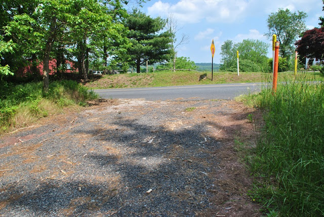
Ok, back to hiking! For this adventure, I parked at the Scott's Run Lake parking lot. There is no street address so once you get into the park, keep your eyes open for Scott's Run Road and follow the signs for Scott's Run Lake. If you use Google Maps as your GPS device, drop a marker on the parking lot and you can set up your driving directions from there.
For a copy of the trail maps (there are 10 in total), you'll need to purchase them from the Horse-Shoe Trail Conservancy.

Before jumping on the Horse-Shoe Trail, I took a short walk around the lake area and shot off a few pictures of the lake. I also ran into a group of people who asked if I could take a few pictures of them.


 |
| Looking downstream on Scott's Run |

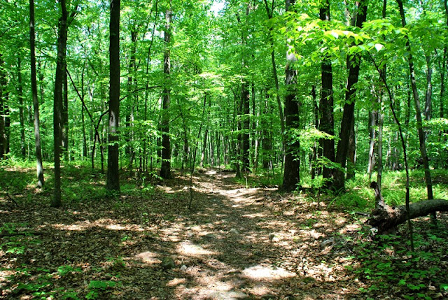
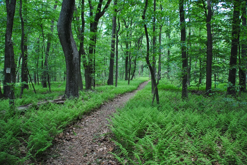
After shooting a few pictures of the group, I was on my way. For the most part, the Horse-Shoe Trail runs in a east/west direction in this section of the trail and to start out, I was heading northwest.


I'm not sure what this might have been at one time but a short distance up the trail, you'll find the remnants of what's left of a building of sorts. All that was left of it was the foundation and it was relatively small, too small to be a home.

Right after you cross over the above remnants, you'll get to this opening alongside Scott's Run Road.

Another short walk along the Horse-Shoe Trail and you'll be crossing over Scott's Run Road.


After another short walk through the woods, the Horse-Shoe Trail will lead you to Fire Tower Road and another unnamed dirt road that will eventually lead you to one of the group camping sites within the park. After another hundred yards or so, you'll see the Horse-Shoe Trail on the left side leading back into the woods.

This area is where the first challenge of the day began. Once you jump on the trail from the dirt road, you'll be climbing up a hill. It's not too tough but on a hot day, it'll definitely get you sweating!

I've been through this section of French Creek State Park on a few occasions. The first time was when I discovered the remnants of what used to be the Six Penny Day Use Area and the second time was when I returned to explore it in more depth in hopes I would find some additional ruins.

The Horse-Shoe and Six Penny Trails intersect in this area with the Six Penny Trail heading to the east. It also merges with the Horse-Shoe Trail continuing in a northwest direction.


Once you pass the intersecting Six Penny Trail, the merged Horse-Shoe and Six Penny Trails head down a pretty long hill. Somewhere along the descent, you'll also pass the Kalima Trail which heads off in a easterly direction.

When you reach the bottom of the hill, the Horse-Shoe and Six Penny Trails split with the Six Penny Trail heading northeast and the Horse-Shoe Trail continuing northwest.


The Horse-Shoe Trail will take you over the Six Penny Creek. Not to worry, the water isn't deep and there are rocks you can step on if you don't want to get your feet wet.


The next crossing will be on Geigertown Road and from there, onto the property of the South Birdsboro Archery Rod and Gun Club.


For now, the Horse-Shoe Trail cuts through the property of the gun club and relatively close to a shooting range. Eventually, and although there hasn't been much word on when, the Horse-Shoe Trail will be re-routed away from the gun club thanks to the folks at the Natural Lands Trust who purchased a 54 acre parcel of land in June 2015 and donated it to French Creek State Park.

Alongside the trail while walking through the shooting range property, you'll see these signs for a distance.


After another short distance, you'll be entering the property of Birdsboro Preserve & Waters. A little more than a year ago, I explored some of this preserve during a weekend camping trip at French Creek State Park. Very nice place to hike!

Shortly after entering into the property of the preserve, you'll get to an intersection where you can turn to the east or west. To follow the Horse-Shoe Trail, turn to the west.


 |
| Mountain Laurels were just starting to bloom! |
 |
| Plenty of tent caterpillars to be found as well |

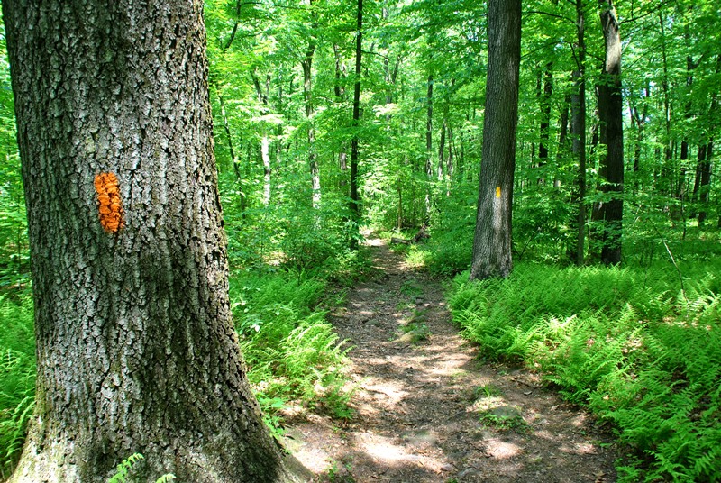
Note that as you're walking through the Birdsboro Preserve and Waters, you'll see different colored trail markers (in this section, they were green). The Horse-Shoe Trail markers are yellow which I believe to be consistent throughout the entire distance of the trail which you will also find on this same trail.


 |
| Almost stepped on this little guy! American Toad |


I'm not exactly sure what this is supposed to be. Perhaps it was put there as a shelter or maybe a bird watch along the trail. Although I'm not exactly sure where, this is close to private property and outside the boundaries of the preserve.

 |
| I took a quick peek inside and kept moving |


This picture didn't come out like how I had seen it. This rock is alongside the trail and had a pretty funky shape to it.


One of the few road crossings in this section of the Horse-Shoe Trail on Mullen Hollow Road.

 |
| Spotted a chipmunk while walking along Mullen Hollow Road. |
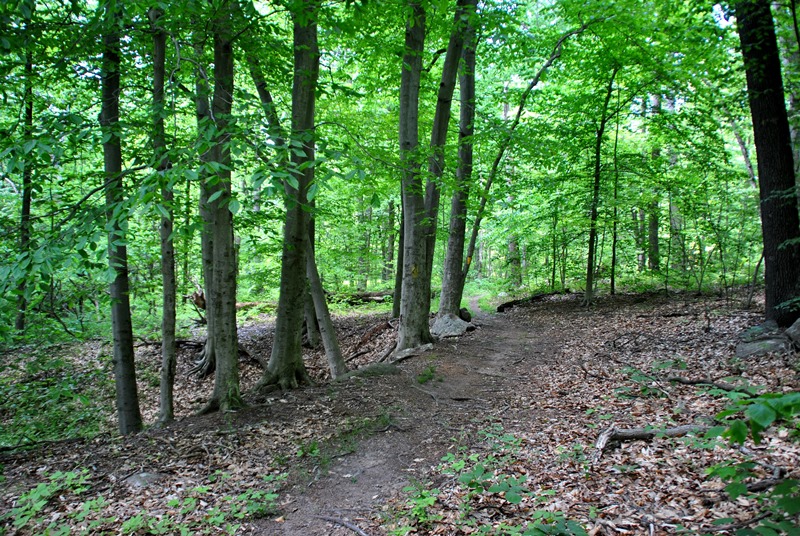
After a very short walk on Mullen Hollow Road, it was back into the woods.

Along the trail, I spotted a number of rocks that gave the appearance of sweating. It was a hot day and my guess is that with the relatively quick change from cool temperatures to being in the high 80's to low 90's, there was condensation on them.


As I was walking along the Horse-Shoe Trail, I came across this bridge. It turns out this is the remnants of the Wilmington Division of the Philadelphia and Reading Railroad which was built in 1868. At one time, it ran from Wilmington, DE to Birdsboro, PA and in 1972, Hurricane Agnes (it was actually a tropical storm by the time it reached PA) struck Pennsylvania resulting in major flooding and forced the closing of the northern half of this railroad.
The southern half is still in service today and runs from Coatesville, PA to Wilmington, DE. Looking at the track from the above link, I've hiked a portion of this abandoned rail at Hibernia County Park.

View from the bridge looking at the remnants of what used to be the railroad. I'm curious to know if this is a current rail trail as it's the same abandoned rail that runs through Birdsboro Preserve and Waters. If so, one could make a pretty nice loop out of this by combining the Horse-Shoe Trail with the trails that run through the preserve.


 |
| Looking back after crossing the bridge |
This section of the trail was one of the few areas where I was walking along a road known as Sparrow Lane.


Alongside Sparrow Lane is Hay Creek which is also the same creek that runs through Birdsboro Preserve and Waters, but a bit smaller!

Crossing over Hay Creek, this is the view looking upstream.


Once you reach the beginning of Sparrow Lane, the next road crossing is at the intersection of Hay Creek and Furnace Roads. At this point, I was almost at my destination.


The Horse-Shoe Trail runs directly alongside Furnace Road for a short distance.

I ended up walking a little further than my planned turnaround point (a parking area), but there was a reason for this.

 |
| I took a picture of this rock because this was where I stopped and turned around to head back. |
This was the reason I kept going. On the map of the Horse-Shoe Trail, this spot is marked as a place to park to hike the trail. At first, I wasn't sure if this was it because usually when you see something like this, parking by non-employees of whatever company owns/operates these things don't allow parking.


 |
| Swallowtail Butterfly |
After turning around and heading back to Scott's Run Lake, I took some random shots along the way.

 |
| Almost stepped on another American Toad! |

Back to the gun club, I spotted this snake swimming across the pond that's on the property but unfortunately, I wasn't close enough to get a decent shot. I walked over to the area where it was headed to but no luck finding it.


The last few shots of the flowers from a tulip poplar tree. It's not often you get to see them as they're usually too high up or already on the ground.


That was it for my adventure on the Horse-Shoe Trail for the day. I still have a long way to go and little by little, I'm completing small sections at a time. In all, this was a pretty good adventure, better than the others I've taken on the trail since there were more woods and less roads to travel on.
For some reason, I decided to wear shorts for this hike and although the trail was in very good condition throughout, I don't think I'll be doing it again unless it's on a more well traveled trail. On almost every adventure, walking through spider webs is a given but to have them constantly run across your legs when you're not used to it was a bit of an annoyance. It's my own fault for wearing the shorts and a small lesson learned!
Until next time, happy exploring and happy hiking!
No comments:
Post a Comment