Date of Hike: Saturday, June 6, 2015
Total Distance: 11.34 Miles
Avg speed: 2.2 MPH
Avg moving speed: 2.29 MPH
Moving Time: 4:56:41
Total Time: 5:08:54
Conditions: Partly Sunny, 77 Degrees
Difficulty: Moderate
This past Saturday, I took a ride out to Natural Lands Trust ChesLen Preserve. I had troubles deciding where to go this time around. Within the area of the preserve, there are several places to go hiking and I eventually settled on ChesLen and will be returning to the same area to check out the others that I was looking at before deciding. The preserve itself is 1,263 acres and is one of the largest private nature preserves in southeastern Pennsylvania. While I think there's more than what's stated, there are said to be 8 miles of trails. I did do some overlapping during my hike but I don't think it was 3 miles worth and I didn't hit some of the trails in the southeastern section of the preserve that are listed on the trail map.
Around the ChesLen Preserve, there are five listed places to park according to the trail map. For this adventure, I went to their main parking lot. If you want to locate the other four parking lots, they can be found on the trail map. The address where I parked is:
1199 Cannery Road
Coatesville, PA 19320
GPS: 39.9210922,-75.7279444

If you don't bring a trail map with you, there's a kiosk with trail maps in the main parking lot directly next to the trail head.

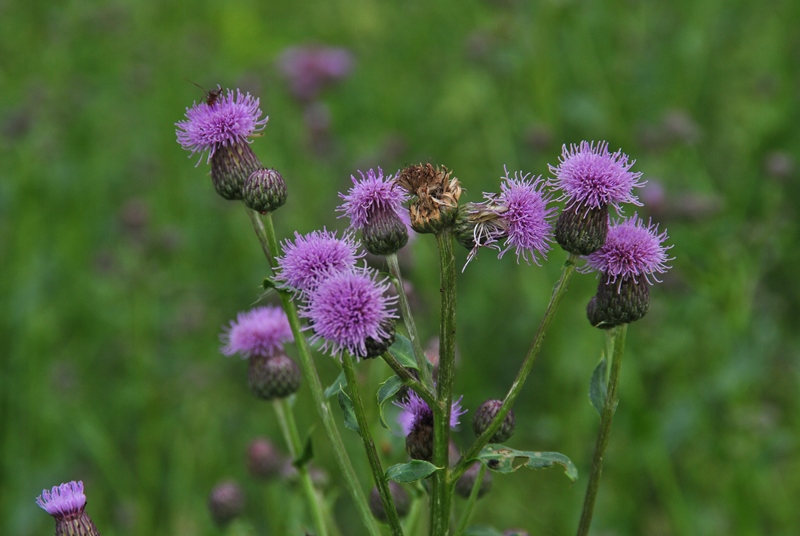
Before I even started my hike, I noticed some wildflowers directly next to the parking lot. Thistle can be quite the annoyance when you walk into it but when they're in bloom, they're absolutely beautiful flowers.


Once I was done checking out the flowers (thistle) alongside the parking lot, I headed towards the Lenfest Center. Completed in June of 2013 and named after Gerry and Marguerite Lenfest, the center is available for corporate, non-profit, and private functions and is available 7 days a week from 9AM-10PM. There's also an outdoor patio pavilion with a few fire places and restrooms.
I didn't get a chance to check out the center itself since there were people getting set up for a graduation party (congrats to the graduate!). Alongside the sidewalk leading up to the center, there are flower gardens on both sides.

 |
| Sidewalk leading up to the Lenfest Center and pavilion. |


Once I was done taking pictures around the Lenfest Center and pavilion, it was time to hit the trail. I started off heading southward on the Peter O. Hausmann Trail (Red Trail). Peter Hausmann has/had been a member of the Natural Lands Trust since 1987 and recently (or soon to be) retired. According to the information from the above link, it states he's retiring in June but the year isn't listed.

As you head up a distance on the trail, you have the choice to go east (left) or south (straight). As stated already, I headed south.

 |
| A little bit on the blurry side, I had my lens zoomed out all the way and didn't get the best shot. |


I have to eat a little bit of crow here. In previous blog posts, I've mentioned that I don't particularly care to hike in open spaces. However, this time around, I have to admit that some of what I saw was pretty darn cool. Alongside the trail, you manage to spot some little things that catch your attention, mainly the different types of wildflowers. On top of that, the lines from the wheat and corn fields added some dimension to the open space and since it was windy, you could see the wheat waving around with the wind off in the distance.


The trail in this area slowly starts to turn towards the west but is still mostly pushing in a southward direction.


 |
| Gradually made my way to the top of the hill, this view is looking back towards the Lenfest Center |

I then turned to the southeast and as I gradually made my way further down the trail, I turned again more towards the east while still going in a southerly direction.


The trail then turns back to the south as you approach Lost Trail Road and what I originally thought was a small parking lot. It turns out that wasn't the case.

It's hard to see in the picture but just ahead, there's a trail marker (almost dead center) showing that the trail splits off in two different directions. The Peter O. Hausmann Trail turns to the southwest (right) and an unnamed trail continues to the south (left). I continued south on the unnamed trail which there are a few different ones throughout the preserve and are listed as "other trails" on the trail map.


This was an unmarked trail that cut through a small wooded area alongside Lost Trail Road. The unnamed trail continues around this wooded area alongside the open space and was the one I stayed on. My curiosity kills me sometimes and as much as I wanted to check it out, I followed the designated trail.

 |
| Walking alongside the small wooded area next to Lost Trail Road |

This is an example as to why I rated this hike to be a moderate challenge and not easy. The hills at the preserve aren't much of a challenge and there are places where you're walking on "level" ground but as seen below, the trails are also angled in one direction or another which tends to put pressure on your knees, ankles, and feet. There are a lot of areas throughout the preserve where this is the type of trail you'll be walking on.


Still heading south but now turning slightly to the southwest, Lost Trail Road comes to an end (or beginning depending on how you look at it) and the unnamed trail then runs alongside Kelsall Road.


The trail then takes a turn to the northwest away from Kelsall Road and somewhat parallel with PA State Route 162 (Embreeville Road).

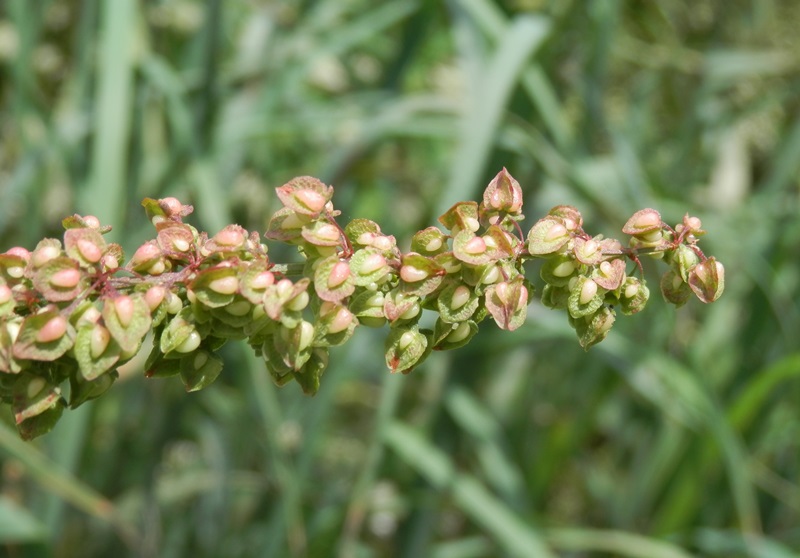
I have no idea what this plant is but it wasn't a dandelion, it was about three to four times the size of that.


These are what I believe to be tree swallows which I found out during this hike that they can be pretty aggressive when they're protecting their young. On two separate occasions, they dive bombed me in attempt to chase me away from their nests. When they dive bomb you, they make a weird clicking type sound as they get close and let out a chirp. Of all the times I've been hiking, not once have I ever had a swallow dive bomb me. Chased by geese? Yes, but never chased by a swallow. As you can see from the pictures, the nests are right next to the trails so avoiding them wasn't possible. I just kept moving and eventually they stopped dive bombing as I got further from their nests.

 |
| Small pond alongside the unnamed trail. |
As you get past the pond and start heading up this small hill, you'll see one of the parking lots that are off PA State Route 162 (Embreeville Road). If you want to park here and don't have a trail map, there's a kiosk in the lot.

The Peter O. Hausmann and unnamed trails merge for a very short distance at the parking lot. As the fence cuts to the right, the Peter O. Hausmann Trail turns to the northeast (right) and the unnamed trail continues to the north (straight) alongside Embreeville Road for a short distance. I continued to the north.

The unnamed trail then begins its turn to the northeast as well, then to the east meeting up with the Peter O. Hausmann Trail.


 |
| I've never seen a thistle plant like this before! |


 |
| Intersection of the unnamed and Peter O. Hausmann trails. |

Once I was back on the Peter O. Hausmann Trail, it turned around the above bend and down a small hill where I spotted this side trail which I decided to check out.


The side trail went down a small hill and over this stream. Once I headed back up the opposite hill, the trail became overgrown so I decided to turn back. By the looks of it, this is an unmarked connecting trail that will bring you back to the Peter O. Hausmann trail on the opposite side of the stream and wooded area.


 |
| This was as far as I went, I wasn't interested in walking though this! |

After checking out the trail and stream area, I returned to the Peter O. Hausmann trail and continued my journey to the east.

Once the trail cut back to the northwest, I was back on a section that I had been on earlier in the day. I took a few more shots but not many since I had already taken pictures of this area.


I made my way back to the area where the Lenfest Center is located. The parking lot is directly to the left of this picture, the building to the left is the center and the one on the right is the pavilion. At this point, I turned to the east and continued following the Peter O. Hausmann Trail.


The trail crosses over Cannery Road where you'll see another parking lot. From there, the Peter O. Hausmann Trail heads to the northeast (more north than east) and the Yellow Trail cuts to the south. I followed the Yellow Trail.

The Yellow Trail splits off in two different directions, one of which is not marked on the map (south). I turned to the east (left). I'm not entirely sure but I believe had I gone straight, it would have brought me to some of the other unnamed trails within the preserve.


The Yellow Trail cuts to the north alongside the treeline you see in the below picture. By this time and after being in the open for quite a distance, I was ready for some woodlands.


The trail then cuts back to the east again and finally into some woodlands although it was still out in the open. At this time, it was still a bit cloudy so the sun wasn't too bad.


This is where I think I missed a turn. Instead of turning to the south, I continued in an eastward direction and ended up missing the entire southeastern section of the preserve, an area that was mostly wooded and could have been a welcome respite from being in open fields. Like I said earlier, I had to eat a little crow but after a while, walking out in the open was starting to wear on me a bit.


Small stream crossing on one of the unnamed trails. The water was shallow enough to walk across but for some reason, I turned back instead of following it. Had I decided to follow it, this would have been my second chance to explore the southeastern section of the preserve. I should have paid better attention to my location and the trail map!


Back to the Yellow Trail, and I even took a picture of the trail marker indicating I could have gone that way. Maybe next time...


This also threw me off. On the Yellow Trail shortly after it turns to the north, there's another connecting trail that states it's leading out of the preserve. Had I been paying closer attention, I would have known I was already past the trails I wanted to turn on earlier. I forgot to mention this earlier but a good part of the ChesLen Preserve is open to equestrian use although I didn't see any horseback riders during my hike.


Perhaps sometime in the future, I'll return to this preserve to find out where this trail leads. It doesn't say anything about not trespassing and while I couldn't see them, I heard a few people talking further down this trail.


According to the trail map, the trail cuts through the woods in this area but it doesn't. It's only for a short distance but the trail is in an open field, then returns to the woods.


This caught my attention...along this section of the trail, there were the remains of a number of what looked to be fences on either side, but only in small sections. I'm curious to know what this area was used for previous to it being a preserve.

The Yellow Trail loops back to the south somewhere in this area, then cuts to the west.


Back out in the open and for the most part, it would remain this way for the rest of the hike. There are a few small spots but the majority of the time from here on out, you're either walking through the middle of a field or skirting along the edge of one. Make sure to bring your sunscreen!

The Yellow Trail meets up with the Peter O. Hausmann trail heading north. For a very short distance, I followed the Hausmann trail until it intersected with the Green Trail heading in a northeasterly direction.


 |
| Veering to the right on the Green Trail |


The Green Trail is a small loop where one direction continues to the north and the other turns to the east. I turned to the east which eventually turns to the north on the opposite side of the field, then loops back to the south meeting up with the trail I had originally taken to the east.


Opposite of where the Green Trail loop meets is an unnamed trail that cuts to the northwest and was where I turned off the Green Trail. I don't like overlapping when I hike so when I planned out my route, I did my best to limit the number of times I was on the same trail more than once. At this preserve, it's not possible to hike the entire area without overlapping.

 |
| The unnamed trail cuts through a small grove of trees. |
The unnamed trail then turns to the southwest and follows these power lines for a distance.


The unnamed trail meets up with the Peter O. Hausmann Trail shortly after crossing over the steam in the above picture. From here, I was heading north towards the West Branch Brandywine Creek.

Here's a small piece of history within the preserve. Known as Potter's Field, this small cemetery contains 204 gravestones and are remnants of the Chester County Poorhouse that was located nearby. Built in 1798, the poorhouse was a refuge for orphans and adult indigents. All of the gravestones that are marked were only given a number and unfortunately, any records associated with the gravestones were lost making identification of those who are buried at this site impossible. If you're interested in learning more about the Chester County Poorhouse, click here.
Eventually, the poorhouse was torn down and the Embreeville State Hospital was built in its place in 1938 and remained in operation until 1980. While I can't seem to find much historical information about the state hospital, there are quite a few pictures on the web of the site once it was abandoned. If you'd like to take a look, check out this Facebook page called "Subject Matters Photography" Imagery By Daryl W. Moran. If you're interested in abandoned places, you should also check out all of the photo albums on his page. Awesome stuff!
Apparently, within the vicinity of this cemetery, there's another one located not far from where the poorhouse was standing at one time. Where it's located is not mentioned on this site. Take note that this website is hard to read due to the black background and blue lettering. It makes my eyes go nuts!


Once I was done checking out Potter's Field, I continued northward over these railroad tracks. Take note that these tracks are still in operation. While it doesn't seem to be a busy railway, use caution when crossing over the tracks.

 |
| Train off in the distance but it wasn't moving |
Once I crossed over the tracks, this trail (Purple Trail) was to my right heading northeast but for the moment, I continued going north on the Red Trail.

The Purple Trail is another loop around this large meadow/marshland and on the second turn which was to the west, I followed it around the edge.

 |
| The Purple Trail then turns to the north, then turns again to the east on the other side of the meadow. |


There are some side trails off the Purple Trail that run alongside the West Branch Brandywine Creek and any chance I had to check them out, I got out of the sun (by this time, it was pretty toasty in the open) to check out the creek.


 |
| These two trees were enormous! |


Eventually, the trails alongside the West Branch Brandywine Creek came to an end and I had to head back out alongside the meadow.

Corcoran's Bridge, built in 1908 by Patrick H. Corcoran and his construction company, is also known as the "Bridge to Nowhere". It seems quite a few of these types of bridges were built in 1908 and now I wonder how many of them may have been built by the same company.


I crossed over Corcoran's Bridge, then crossed Embreeville Road where you'll find yet another parking lot (I stopped here first on my way to the main parking lot).
 |
| View from Corcoran's Bridge looking I believe upstream |
To the west of the parking lot is this fenced in field and according to the trail map, a trail that will lead to the Star Gazer's Stone, more on this in a moment.

However, after following it for a distance, I discovered that this wasn't the right trail and had to turn back.

Back to the parking lot area, I then walked north alongside the fenced in field. As you walk along this field, ahead of you will be a very nice looking home that looks to be currently empty. If it's not, the residents have allowed the grass in the area to grow pretty tall and only maintain a small portion of the property leaving the rest to nature. Above the field, the trail will again lead to the west and this time, it wasn't blocked off.

Once you get to Star Gazer Road, turn to the north and a short distance up, you'll find the Star Gazer's Stone to your right. I'll admit, at first I was a bit disappointed when I saw it because of how small it is. Little did I know the historical significance it has and why it was there. Once I read the plaque though, I realized that this is a piece of history dating back to the Colonial period.
For more than 80 years between the 1680's and 1760's, the William Penn and Charles Calvert families were in a dispute over land they both felt they had a legitimate claim to, sometimes turning violent (Cresap's War). In late 1763 after a number of unsuccessful attempts to resolve the dispute, Charles Mason (astronomer) and Jeremiah Dixon (surveyor) were sent from England to put the dispute to rest. Over the next five years, Mason and Dixon surveyed the land using the stars as a guide to create the east-west boundary between Pennsylvania and Maryland, known as the Mason-Dixon Line. The Star Gazer's Stone was a reference point that was placed where it is now to mark the astronomical meridian line north of an observatory that was set up with permission from a local farmer by the name of John Harlan where the calculations to set the boundary were made.
The Mason-Dixon Line was also known as the unofficial boundary between the North and South as a line of freedom for blacks who had escaped slavery in the South before the Civil War.
There's far more history to this than what I've described here. If you're interested in learning more about the history surrounding the Star Gazer's Stone and the Mason-Dixon Line, check out the websites referenced in the above links.


Once I was done at the Star Gazer's Stone, it was time to return to the trail and preserve. Heading east, I was on my way back to Corcoran's Bridge.
 |
| I think it's time to replace the wood on this fence! |
You may be wondering why I took a picture of a hole in the ground. As you're walking alongside the fence to or from the Star Gazer's Stone, there are a few of these holes smack in the middle of the trail that you can easily step in if you're not watching where you're walking. Your feet may not sink into the holes, but you may end up twisting an ankle or taking a spill. Be sure to keep your eyes out for them.

 |
| Crossing back over the West Branch Brandywine Creek and looking I believe downstream |

Back into the ChesLen Preserve, I continued to follow the Purple Trail east, then turning to the southeast alongside the West Branch Brandywine Creek.


The Purple Trail then turns to the southwest and up this short hill back to the Peter O. Hausmann Trail. From here, I was on my way south back to the main parking lot and my car.


This sign is next to the parking lot alongside Cannery Road.

 |
| Almost back to the parking lot! |
That was it for my adventure at the ChesLen Preserve but unfortunately, it wasn't the end of my adventures for the day. When I returned to my car to head home, the ignition broke and I was unable to start the engine (my car is old). Being stranded is no fun but thankfully, I have AAA and was able to call for assistance. After hanging out about an hour for the tow truck (actually, it was a flatbed), my car and I were rescued.
On the ride back to having my car dropped off, the driver of the flatbed truck (his name is Ken) and I had a conversation where I told him about my expeditions hiking and he told me he was a photographer and that he had a Facebook page. After checking out his Facebook page, I have to say that he's an excellent photographer, far better than what I can do, that's for sure. I love taking pictures but I only do so as a hobby. If you happen to be looking for someone to shoot pictures for you, give him a call. Here's a link to his Facebook page where you'll find his contact information.
Ken's photography
Thanks again for your assistance Ken!
In all, the ChesLen Preserve is a beautiful place and I hope to return someday to explore some of the trails I missed. As I previously noted, if you decide to check this preserve out, make sure to bring your sunscreen, most of the trails are out in the open and there's little cover from the sun.
Until next time, happy adventures and happy hiking!
Please give my Facebook page a like!
No comments:
Post a Comment