Date of Hike: Sunday, July 5, 2015
Total Distance: 10.48 Miles
Avg speed: 2.31 MPH
Avg moving speed: 2.59 MPH
Moving Time: 4:02:36
Total Time: 4:31:56
Conditions: Mostly Sunny, 86 Degrees
Difficulty: Easy, Moderate
On July 5th, I took a ride out to the Pennypack Park in Philadelphia to explore. I had been there once before but it was several years ago and I believe I had my fishing gear with me so I wasn't looking for an adventure. What hiking I did was to find fishing spots and quite honestly, I don't remember much of my last trip out there. I had just moved to Bucks County at the time and was looking for new places to go.
Approximate address:
8750 Pine Road
Philadelphia, PA 19115
GPS: 40.089849, -75.070009
There are more parking lots scattered throughout the park but you're on your own with finding them. Unfortunately, the trail map of the park is low quality and difficult to read. I took a picture of a trail map encased in plexiglass at a kiosk at the Pine Road entrance (below) and hopefully I can attempt to enhance it a bit to make a map available to anyone who may need it.

Before I started my adventure on the trails, I walked up to the Pine Road entrance to get a shot of the flower gardens. There are a few next to the restrooms as well as alongside Pine Road where the below sign is.

By ordinance of the City of Philadelphia in order to protect the Pennypack Creek and surrounding land, Pennypack Park was established in 1905. The park is approximately 1,600 acres of woodlands, meadows, wetlands and fields and of course the Pennypack Creek. In 1683, William Penn acquired the land from the Lenni-Lenape Indians who used the Pennypack Creek and surrounding land for hunting and fishing.


Here's the trail map I was referring to. Hopefully I can enhance this some and once it's completed, I can post a link to it so that there's a better quality map for exploring the park.

Right next to the parking lot, there's an opening to Pennypack Creek so before I went looking for the trails, I walked alongside the creek.
Some of the birds within the park seem to be relatively domesticated (geese, ducks, pigeons). They didn't seem to be afraid when humans got too close unlike most other places I've been to. I didn't include the picture since it was blurry but there were several geese upstream that swam in my direction when they saw me. I guess they're used to being fed by humans.


This pigeon didn't even move when I got close, it just continued about it's business looking for food.


Heading southward and before getting to the trails, there's a large open field and the below pavilion. When I was last at Pennypack Park, the roof of this pavilion was falling apart. I believe sometime in 2013, the roof of the pavilion was replaced and is now looking very nice.

Once again walking alongside the Pennypack Creek. To the the right of this picture was the field and pavilion along with a few side trails leading back up to the field.


Once I was done exploring along the Pennypack Creek (for now), I skirted along the edge of the field and looked for a different trail head. The Pennypack Trail is in the area but I was looking more for natural surfaced trails.


As I was skirting along the edge of the field, I spotted this trail and decided to check it out.


After a distance, it turned into a natural surface trail. I thought this was the beginning of my hike.


After a short distance, the trail dead ended in this area. I probably could have continued alongside the creek but the hill on the opposite side of the bushes was somewhat steep and muddy. There's been quite a bit of rain in recent weeks and I wasn't about to put myself in a position to be slipping and falling in mud. From here, I doubled back towards the field on a different trail that ran alongside the creek.


Once back out to the edge of the field, I turned to the west and jumped on the Pennypack Trail for the time being.

After turning back to the south on the Pennypack Trail, there's a natural surfaced trail that cuts to the right side and was where I turned off the pavement.

Horseback riding is permitted at the Pennypack Creek. Throughout my hike, I only ran into one horseback rider but there were plenty of tracks and droppings on the trails.


This is a good reason to have a trail map. Throughout the hike, there are trails that turn in all different directions. While I doubt anyone would get lost (follow the creek if you do, or look for the Pennypack Trail), it would be nice to have something to refer to when you're out in the middle of the woods. Somewhere in this area, the trail I took looped back to the east.


When I arrived at this spot alongside the Pennypack Trail, I could hear running water so I decided to check it out and headed north for a short distance, just to beyond the trees in the below picture.

This is the first of a few different dams/waterfalls within the confines of the Pennypack Park. Throughout the nineteenth and early twentieth centuries, the Pennypack Creek had a number of mills and factories along its banks. Although I was unable to spot any, there are said to be ruins throughout the park from that era.

I followed the Pennypack Trail until I was beyond the bridge. Throughout the park and once you approach any road crossings, the natural surfaced trails will gradually lead you back to the Pennypack Trail allowing you to cross under any of the bridges in the area.

Once I crossed under the Verree Road bridge, I turned off the Pennypack Trail and back to the natural surfaces, now heading southward.

Another intersecting trail turning to the southwest (right) and this time, I decided to investigate. With a trail map, I usually plot my course before heading to wherever I may be going but since I didn't have one, I was deciding on the fly.

Most of the trails that I was on throughout the park were in good condition but this one was a bit on the overgrown side. It wasn't bad though, and it was still relatively easy to work around the overgrown spots and was worth checking out.


The trail eventually turns back to the east heading towards the Pennypack Creek and Trail


Back on the more well maintained trails, it then turns to the southwest again.


Once again, I made my way back to the Pennypack Trail. Just next to the trail is this small stream ad a bridge that crosses over it. In this area, the trail turns back to the east.


Approaching Krewstown Road, this is a railroad bridge crossing over the Pennypack Creek.


Just beyond the railroad bridge is the Krewstown Road bridge.

Like my last crossing, once I was beyond the bridge, I turned off the paved Pennypack Trail and hit the natural surface trails again heading southeast, then turning to the northeast (more east than north).

This was probably the most boring part of my hike. For a long stretch, the trail is straight and flat.


Once you get beyond the long straight section of trail, it then turns to the south and shortly after the turn, you'll be back on the Pennypack Trail and crossing under Bustleton Avenue.


Just beyond Bustleton Avenue, the Pennypack Trail crosses over the Pennypack Creek. I wasn't aware of this at the time but there are natural surface trails that continue along the western side of the Pennypack Creek (the side I was currently on at the time).

As soon as I had the chance, I took the first side trail I could find which ended up heading back towards the bridge I had just crossed over so i turned back.


I tried to find out some more information about this memorial but was unable to.

Now heading south, the trail I was on was within view of the Pennypack Trail.


Another pedestrian bridge crossing over the Pennypack Creek.

Once I crossed over, I spotted this tree overhanging the creek. I have to wonder if at one time, there might have been a rope swing hanging from this tree.

A little further downstream is another dam/waterfall with the trail crossing under Roosevelt Boulevard. At this point, I turned around to head back to the car. I'm not sure how true it is but from the reviews I've read about the Pennypack Park, it's said that the people aren't too friendly once you get south of the boulevard so this was where I turned back. I didn't run into anyone who seemed like they were shady so I can't confirm this to be truth.


Instead of crossing the pedestrian bridge and staying on the Pennypack Trail, I stayed on the western side of the creek and started my return to the car, now heading north.


Once I made my way back to the Pennypack Trail, I decided to follow it all the way back to the parking lot. I'm not fond of paved trails but this time around, I just wanted to get back to the car. From here on out, I only took a few pictures of the trail and whatever else I found to be interesting.


Just about back to the parking lot, I spotted these two logs sitting next to the Pennypack Trail. How I missed them when I first started my hike, I have no idea, they're enormous.

Apparently, someone took the time out to count all of the rings on this tree...190 years old!

That was it for my adventure at the Pennypack Park. In all, the trails are in pretty good condition and for the most part, they were clean. I did run into one spot close to private property that looked like it was used for a party (or ten) with beer bottles and trash scattered about but otherwise, it was a good hike. Giving the number of trails, I'd definitely like to return to check this place out some more and hopefully map it out a little better than it is now.
Until next time, happy hiking and happy adventures!
Please give my Facebook page a like!
On July 5th, I took a ride out to the Pennypack Park in Philadelphia to explore. I had been there once before but it was several years ago and I believe I had my fishing gear with me so I wasn't looking for an adventure. What hiking I did was to find fishing spots and quite honestly, I don't remember much of my last trip out there. I had just moved to Bucks County at the time and was looking for new places to go.
Approximate address:
8750 Pine Road
Philadelphia, PA 19115
GPS: 40.089849, -75.070009
There are more parking lots scattered throughout the park but you're on your own with finding them. Unfortunately, the trail map of the park is low quality and difficult to read. I took a picture of a trail map encased in plexiglass at a kiosk at the Pine Road entrance (below) and hopefully I can attempt to enhance it a bit to make a map available to anyone who may need it.

Before I started my adventure on the trails, I walked up to the Pine Road entrance to get a shot of the flower gardens. There are a few next to the restrooms as well as alongside Pine Road where the below sign is.

By ordinance of the City of Philadelphia in order to protect the Pennypack Creek and surrounding land, Pennypack Park was established in 1905. The park is approximately 1,600 acres of woodlands, meadows, wetlands and fields and of course the Pennypack Creek. In 1683, William Penn acquired the land from the Lenni-Lenape Indians who used the Pennypack Creek and surrounding land for hunting and fishing.


Here's the trail map I was referring to. Hopefully I can enhance this some and once it's completed, I can post a link to it so that there's a better quality map for exploring the park.

Right next to the parking lot, there's an opening to Pennypack Creek so before I went looking for the trails, I walked alongside the creek.
 |
| Pine Road Bridge over the Pennypack Creek |
Some of the birds within the park seem to be relatively domesticated (geese, ducks, pigeons). They didn't seem to be afraid when humans got too close unlike most other places I've been to. I didn't include the picture since it was blurry but there were several geese upstream that swam in my direction when they saw me. I guess they're used to being fed by humans.


This pigeon didn't even move when I got close, it just continued about it's business looking for food.

 |
| This little guy was sitting on a picnic table |

Heading southward and before getting to the trails, there's a large open field and the below pavilion. When I was last at Pennypack Park, the roof of this pavilion was falling apart. I believe sometime in 2013, the roof of the pavilion was replaced and is now looking very nice.

Once again walking alongside the Pennypack Creek. To the the right of this picture was the field and pavilion along with a few side trails leading back up to the field.


Once I was done exploring along the Pennypack Creek (for now), I skirted along the edge of the field and looked for a different trail head. The Pennypack Trail is in the area but I was looking more for natural surfaced trails.


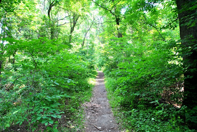
As I was skirting along the edge of the field, I spotted this trail and decided to check it out.


After a distance, it turned into a natural surface trail. I thought this was the beginning of my hike.


After a short distance, the trail dead ended in this area. I probably could have continued alongside the creek but the hill on the opposite side of the bushes was somewhat steep and muddy. There's been quite a bit of rain in recent weeks and I wasn't about to put myself in a position to be slipping and falling in mud. From here, I doubled back towards the field on a different trail that ran alongside the creek.

 |
| Catbird with a dragonfly in its mouth. |

 |
| These trails aren't used as often |


Once back out to the edge of the field, I turned to the west and jumped on the Pennypack Trail for the time being.

After turning back to the south on the Pennypack Trail, there's a natural surfaced trail that cuts to the right side and was where I turned off the pavement.

Horseback riding is permitted at the Pennypack Creek. Throughout my hike, I only ran into one horseback rider but there were plenty of tracks and droppings on the trails.


This is a good reason to have a trail map. Throughout the hike, there are trails that turn in all different directions. While I doubt anyone would get lost (follow the creek if you do, or look for the Pennypack Trail), it would be nice to have something to refer to when you're out in the middle of the woods. Somewhere in this area, the trail I took looped back to the east.

 |
| The trails were a bit muddy from the recent rains. |


 |
| Another intersecting trail |

 |
| Pennypack Trail in the background |
When I arrived at this spot alongside the Pennypack Trail, I could hear running water so I decided to check it out and headed north for a short distance, just to beyond the trees in the below picture.

This is the first of a few different dams/waterfalls within the confines of the Pennypack Park. Throughout the nineteenth and early twentieth centuries, the Pennypack Creek had a number of mills and factories along its banks. Although I was unable to spot any, there are said to be ruins throughout the park from that era.

 |
| Looking downstream to the bridge on Verree Road |
I followed the Pennypack Trail until I was beyond the bridge. Throughout the park and once you approach any road crossings, the natural surfaced trails will gradually lead you back to the Pennypack Trail allowing you to cross under any of the bridges in the area.

Once I crossed under the Verree Road bridge, I turned off the Pennypack Trail and back to the natural surfaces, now heading southward.

Another intersecting trail turning to the southwest (right) and this time, I decided to investigate. With a trail map, I usually plot my course before heading to wherever I may be going but since I didn't have one, I was deciding on the fly.

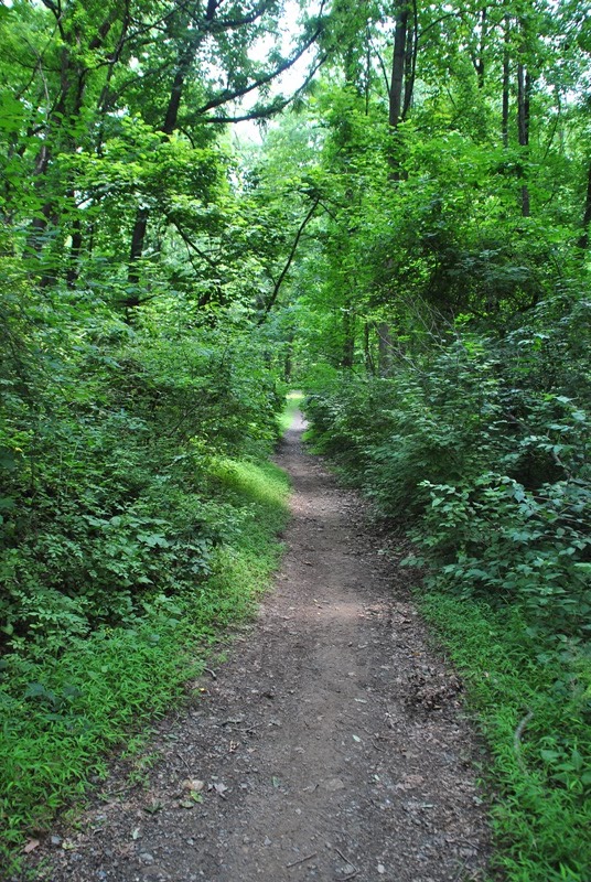
Most of the trails that I was on throughout the park were in good condition but this one was a bit on the overgrown side. It wasn't bad though, and it was still relatively easy to work around the overgrown spots and was worth checking out.


The trail eventually turns back to the east heading towards the Pennypack Creek and Trail


Back on the more well maintained trails, it then turns to the southwest again.

 |
| Wineberries looking tasty! |


Once again, I made my way back to the Pennypack Trail. Just next to the trail is this small stream ad a bridge that crosses over it. In this area, the trail turns back to the east.


Approaching Krewstown Road, this is a railroad bridge crossing over the Pennypack Creek.


Just beyond the railroad bridge is the Krewstown Road bridge.

Like my last crossing, once I was beyond the bridge, I turned off the paved Pennypack Trail and hit the natural surface trails again heading southeast, then turning to the northeast (more east than north).

This was probably the most boring part of my hike. For a long stretch, the trail is straight and flat.


Once you get beyond the long straight section of trail, it then turns to the south and shortly after the turn, you'll be back on the Pennypack Trail and crossing under Bustleton Avenue.


Just beyond Bustleton Avenue, the Pennypack Trail crosses over the Pennypack Creek. I wasn't aware of this at the time but there are natural surface trails that continue along the western side of the Pennypack Creek (the side I was currently on at the time).

 |
| Looking downstream on the Pennypack Creek |
 |
| Looking upstream on the Pennypack Creek |
As soon as I had the chance, I took the first side trail I could find which ended up heading back towards the bridge I had just crossed over so i turned back.


I tried to find out some more information about this memorial but was unable to.

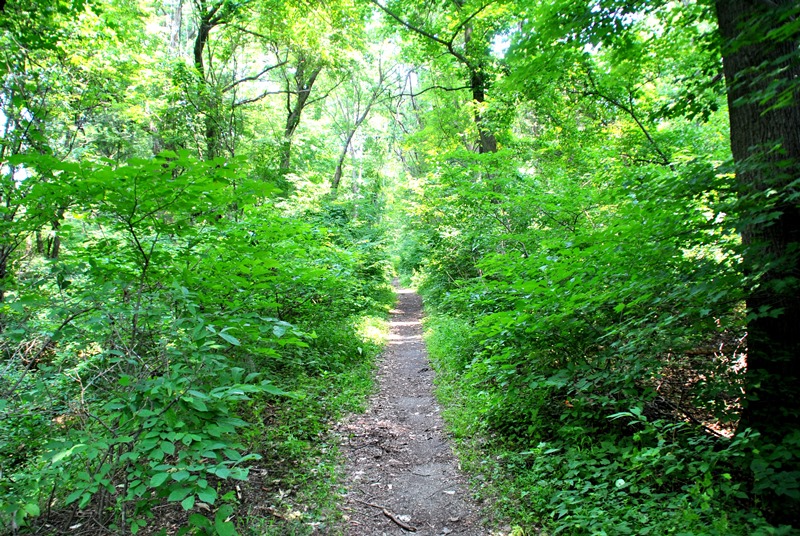
Now heading south, the trail I was on was within view of the Pennypack Trail.


Another pedestrian bridge crossing over the Pennypack Creek.

Once I crossed over, I spotted this tree overhanging the creek. I have to wonder if at one time, there might have been a rope swing hanging from this tree.

A little further downstream is another dam/waterfall with the trail crossing under Roosevelt Boulevard. At this point, I turned around to head back to the car. I'm not sure how true it is but from the reviews I've read about the Pennypack Park, it's said that the people aren't too friendly once you get south of the boulevard so this was where I turned back. I didn't run into anyone who seemed like they were shady so I can't confirm this to be truth.


Instead of crossing the pedestrian bridge and staying on the Pennypack Trail, I stayed on the western side of the creek and started my return to the car, now heading north.

 |
| Small stream crossing along the trail |


Once I made my way back to the Pennypack Trail, I decided to follow it all the way back to the parking lot. I'm not fond of paved trails but this time around, I just wanted to get back to the car. From here on out, I only took a few pictures of the trail and whatever else I found to be interesting.


 |
| Remnants of a stone wall on the opposite bank |


Just about back to the parking lot, I spotted these two logs sitting next to the Pennypack Trail. How I missed them when I first started my hike, I have no idea, they're enormous.

Apparently, someone took the time out to count all of the rings on this tree...190 years old!

That was it for my adventure at the Pennypack Park. In all, the trails are in pretty good condition and for the most part, they were clean. I did run into one spot close to private property that looked like it was used for a party (or ten) with beer bottles and trash scattered about but otherwise, it was a good hike. Giving the number of trails, I'd definitely like to return to check this place out some more and hopefully map it out a little better than it is now.
Until next time, happy hiking and happy adventures!
Please give my Facebook page a like!
No comments:
Post a Comment