Date of Hike: June 23, 2015
Total Distance: 4.60 Miles
Avg speed: 1.66 MPH
Avg moving speed: 1.99 MPH
Moving Time: 2:18:26
Total Time: 2:45:36
Conditions: Sunny, 92 Degrees
Difficulty: Easy
I'm a bit late with getting this post up. These last few weeks have been busy and I was in Boston last weekend on business and didn't have the time to update my blog. I had intentions of going hiking when I was up in the Boston area but unfortunately, when I arrived it was raining...rats! Normally, I wouldn't let that stop me but since I took a flight to get there, it would have meant more belongings to drag along with me and likely having to check in my luggage instead of carrying it on the plane with me. I decided to forgo the hiking. Hopefully, I can head up there again someday.
A few weeks ago, my car was in the shop being repaired and since I had the day off and another vehicle at my disposal, I took a ride out to the Phoenixville/Kimberton area and checked out the French Creek Trail (also known as the French Creek Heritage Park). It was an easy hike which was good for such a hot and humid day.
Approximate address:
1134 Rapps Dam Rd
Phoenixville, PA 19460
GPS: 40.138151, -75.552971
There are parking lots on both sides of Rapps Dam Road which you won't be able to miss upon your arrival. Make sure to approach the parking lots from the south. The covered bridge over French Creek is currently closed to traffic, more on this in a bit. Although you won't need it, you can get a copy of the trail map from East Pikeland Township's website in the Township Trails section, or by clicking here.
Update: As of October 8, 2015, Rapps Bridge has since been re-opened.

This section of Phoenixville has quite a bit of history packed into a small place dating back to the Revolutionary War. In this area, there used to be a grist mill owned by Thomas Snyder, then sold to George Washington Rapp in 1878. Rapp built a successful milling business selling Gold Medal and Rapps Mill Flour and "Lay or Bust" chicken feed to customers as far away as Philadelphia.
The mill remained in the Rapp family for two more generations until it was sold to Henry Supoit in 1920. In 1935, the grist mill burned to the ground and its stones were sold putting an end to industry on French Creek.

I started out heading to the southeast and a short hike down the trail is this sign giving credit to a young man by the name of Jacob Miller who blazed the trail in 2011. In this section, the trail splits off in two different directions, both heading southeast with one of them staying directly alongside French Creek. I took the trail leading away from the creek for the time being.

The Continental Powder Works was built in 1776 after a shortage of gun powder due to a proclamation by King George III which stopped exports of the powder to America. It was the only powder mill and gun factory commissioned by the Continental Congress and supplied George Washington's army with gun powder and musketry in the early part of the Revolutionary War.


The Continental Powder Works didn't last long. Only in operation for less than a year (since June of 1776), in March of 1777, an explosion destroyed the powder works and on September 22, 1777, Hessian troops burned the gun factory to the ground destroying several thousand weapons meant for Washington's army.
In 2012, archaeologists excavated a building foundation close to where this sign is located and found clues that this area was part of the Powder Works. While no artifacts were found, indicators such as a thick layer of stone rubble, hand-wrought rails, burned soil, melted glass and measurements that conformed to a period description of the Works' graining mill were located.


This threw me off. Once you reach the above signs with the arrow pointing to the archaeological dig site, just across a small field at this opening is a sign stating that no one is permitted. I'm not sure what one is supposed to see with a sign pointing in the direction of a dig site where no one allowed to be. Perhaps there are plans to open the area in the future but for the time being, once you see the above signs, there's nothing else to explore (unless you want to be cited for trespassing) and you have to turn back towards French Creek. It's safe to say that I was a little bit disappointed with this.


I turned back to check out the trail that runs alongside French Creek, then turned to the southeast again.


Along the trail, there are a number of small paths that will lead you directly alongside French Creek. This area is pretty popular for fishing and is also one of my favorite places to go fish as well.


Shortly after spotting the above trail marker, the trail came to an end on the opposite side of this small bridge. I walked around for a bit looking for another opening but unfortunately, I had to turn back as the trail was overgrown and not maintained.


Now heading back to the northwest, I returned to the parking lot to continue my adventure on the opposite side of Rapps Dam Road.

This covered bridge is known as Rapps Bridge which was built in 1866 by Benjamin Hartman at a cost of $3,600. It's one of the largest covered bridges in Chester County spanning a total of 105 feet. It was reconstructed again in 1978 and in 2011, it underwent additional restorations at a cost of $1.5 million. As you can see from the orange fencing, the bridge is currently closed. On April 29, 2014, a man driving a tractor trailer carrying potted plants attempted to cross the bridge which caused a substantial amount of damage closing it once again.
As of June 15, 2015 and according to East Pikeland Township's website, the process for repairs are now underway. Since the bridge is made of wood, it has to be cut and the wood has to cure before the actual repairs can be done which is slated to begin in August. On June 23, 2015, the driver of the tractor trailer who damaged the bridge pleaded guilty to a count of failure to prevent a catastrophe and will have to pay a restitution of $450,000.
As stated above, Rapps Bridge has been re-opened to traffic.


Across Rapps Dam Road and a short distance from Rapps Bridge is this small kiosk station which provides a little bit of history surrounding the French Creek Heritage Park.

Next to the above sign is a picture of this trail map, the same one you'll find on the East Pikeland Township website. Take note that the eastern side of the trail is the area that was not being maintained. From what it looks like, I should have been able to hike a distance further than what I was able to.

Close to where the kiosk is, you'll find the first of two trail heads. One of which is a natural surface as noted below and the other is an 8-10 foot wide paved trail.

Next to the natural surface trail head is the Mill Works on French Creek. While the Continental Powder Works was ruined, the land was still of value and was purchased by Casper Snyder, Jr. in 1792 and used for farming. His sons, Henry and Thomas operated the mill processing flax seed into linseed oil and also built a grist mill, sawmill and a mill to hull and clean clover seed in the vicinity. There is no information on when this mill ceased operation although it is stated that any industry that was along French Creek came to an end in 1935.


Below is an explanation on how the gun powder was made back when the Continental Power Works was still in operation. It seems the process is still relatively similar to how it was done back then.

On the opposite side of the mill is the paved section of the French Creek Trail which only runs for 1/3 mile and is handicap accessible.


I didn't want to hike on the paved trail so once I shot the above picture, it was back down to the natural surface trail and for the moment, heading in a northwesterly direction.


Somewhere in this area, the trail turns to the southwest. In this section of the French Creek Trail, you won't be able to see French Creek.

While out on the trail, I see this quite frequently. Known as spittlebugs, the nymphs which feed on the juices of the host plant cover themselves with this protective material resembling human spittle.


This stretch of water is one of many areas in this section of French Creek that I like to fish. The water looks shallow but on the opposite side, it's relatively deep.


Once you cross over the first bridge, the trail runs directly alongside private property. To your right if you're hiking in a southwest direction, you'll be able to see the homes that are next to the trail.


Along the trail are a number of side trails that lead to French Creek, likely created by local fishermen.


As the trail gradually turns to the west, then northwest, there's a side trail that will take you alongside French Creek (left) and was the one I chose to explore.

Taking the side trail turned out to be a pretty good choice. I had never been to this section of French Creek and after exploring it, I think I've found a few more fishing spots, not to mention how nice it is in this section of the creek!


Eventually, the trail I was on led back to the main French Creek Trail, still heading in a northwest direction.


Once you cross over the second pedestrian bridge, the trail then turns into gravel and widens up quite a bit.


Shortly after crossing over the second pedestrian bridge is where the French Creek Trail comes to an end (for now) and it opens up into a small parking lot. If you'd like to park in this lot instead of the one on Rapps Dam Road, the address is approximately 547 Hares Hill Road, Phoenixville, PA, 19460. Technically, this address is in East Pikeland Township even though it's listed as Phoenixville.


It seems careless drivers and bridges don't get along too well in this area lately. To the left side of this picture, the road leading up to the bridge is on a pretty sharp turn. I think someone was driving too fast and missed their turn.


After taking a short break at the picnic table, it was time to head back to the car. On my return, I didn't take many pictures since I had already been there. What pictures I took were from anything I could find that was interesting to me.


Next to the first pedestrian bridge is a small area with picnic tables if you'd like to grab a lunch and hang out close to French Creek.

French Creek was first dammed in 1776 to assist with the operation of the mills in the area. Once mill operations ceased in 1935, the Township created a picnic and swimming area in 1938 which existed until the polio epidemic put an end to swimming in 1950's.


While this hike was slowly coming to an end, I still had another objective in mind. The below trail is a connector to the fishing trails that run alongside French Creek. The French Creek Trail is nice but in some areas, there's no view of the creek.

Take note that the fishing trails are not maintained like the French Creek Trail is. If you choose to check out these trails, be prepared to walk through areas that are overgrown. As I made my way to the creek, I turned to the northwest again, heading in the direction of the pedestrian bridge.


Heading back to the southeast and back to the parking lot and vehicle. Even though it was hot outside, I was glad I kept the long pants on!


That was it for my adventure at the French Creek Trail and Heritage Park. As many times as I've been fishing in this area, I never researched the history which was pretty interesting. I never knew there was a gun powder mill and weapons factory used to supply Washington's army during the beginning stages of the Revolutionary War. Pretty cool stuff if you ask me!
In all, it was a good hike due to the weather which was hot and humid with all flat terrain. For once, I was happy that there wasn't a challenge to this hike. The icing on the cake was learning about the history surrounding the area!
Until next time, happy hiking and happy exploring!
Please give my Facebook page a like!
I'm a bit late with getting this post up. These last few weeks have been busy and I was in Boston last weekend on business and didn't have the time to update my blog. I had intentions of going hiking when I was up in the Boston area but unfortunately, when I arrived it was raining...rats! Normally, I wouldn't let that stop me but since I took a flight to get there, it would have meant more belongings to drag along with me and likely having to check in my luggage instead of carrying it on the plane with me. I decided to forgo the hiking. Hopefully, I can head up there again someday.
A few weeks ago, my car was in the shop being repaired and since I had the day off and another vehicle at my disposal, I took a ride out to the Phoenixville/Kimberton area and checked out the French Creek Trail (also known as the French Creek Heritage Park). It was an easy hike which was good for such a hot and humid day.
Approximate address:
1134 Rapps Dam Rd
Phoenixville, PA 19460
GPS: 40.138151, -75.552971
There are parking lots on both sides of Rapps Dam Road which you won't be able to miss upon your arrival. Make sure to approach the parking lots from the south. The covered bridge over French Creek is currently closed to traffic, more on this in a bit. Although you won't need it, you can get a copy of the trail map from East Pikeland Township's website in the Township Trails section, or by clicking here.
Update: As of October 8, 2015, Rapps Bridge has since been re-opened.

This section of Phoenixville has quite a bit of history packed into a small place dating back to the Revolutionary War. In this area, there used to be a grist mill owned by Thomas Snyder, then sold to George Washington Rapp in 1878. Rapp built a successful milling business selling Gold Medal and Rapps Mill Flour and "Lay or Bust" chicken feed to customers as far away as Philadelphia.
The mill remained in the Rapp family for two more generations until it was sold to Henry Supoit in 1920. In 1935, the grist mill burned to the ground and its stones were sold putting an end to industry on French Creek.

I started out heading to the southeast and a short hike down the trail is this sign giving credit to a young man by the name of Jacob Miller who blazed the trail in 2011. In this section, the trail splits off in two different directions, both heading southeast with one of them staying directly alongside French Creek. I took the trail leading away from the creek for the time being.

The Continental Powder Works was built in 1776 after a shortage of gun powder due to a proclamation by King George III which stopped exports of the powder to America. It was the only powder mill and gun factory commissioned by the Continental Congress and supplied George Washington's army with gun powder and musketry in the early part of the Revolutionary War.

 |
| Looking back on the trail leading to the remnants of the Continental Powder Works |

The Continental Powder Works didn't last long. Only in operation for less than a year (since June of 1776), in March of 1777, an explosion destroyed the powder works and on September 22, 1777, Hessian troops burned the gun factory to the ground destroying several thousand weapons meant for Washington's army.
In 2012, archaeologists excavated a building foundation close to where this sign is located and found clues that this area was part of the Powder Works. While no artifacts were found, indicators such as a thick layer of stone rubble, hand-wrought rails, burned soil, melted glass and measurements that conformed to a period description of the Works' graining mill were located.


This threw me off. Once you reach the above signs with the arrow pointing to the archaeological dig site, just across a small field at this opening is a sign stating that no one is permitted. I'm not sure what one is supposed to see with a sign pointing in the direction of a dig site where no one allowed to be. Perhaps there are plans to open the area in the future but for the time being, once you see the above signs, there's nothing else to explore (unless you want to be cited for trespassing) and you have to turn back towards French Creek. It's safe to say that I was a little bit disappointed with this.


I turned back to check out the trail that runs alongside French Creek, then turned to the southeast again.

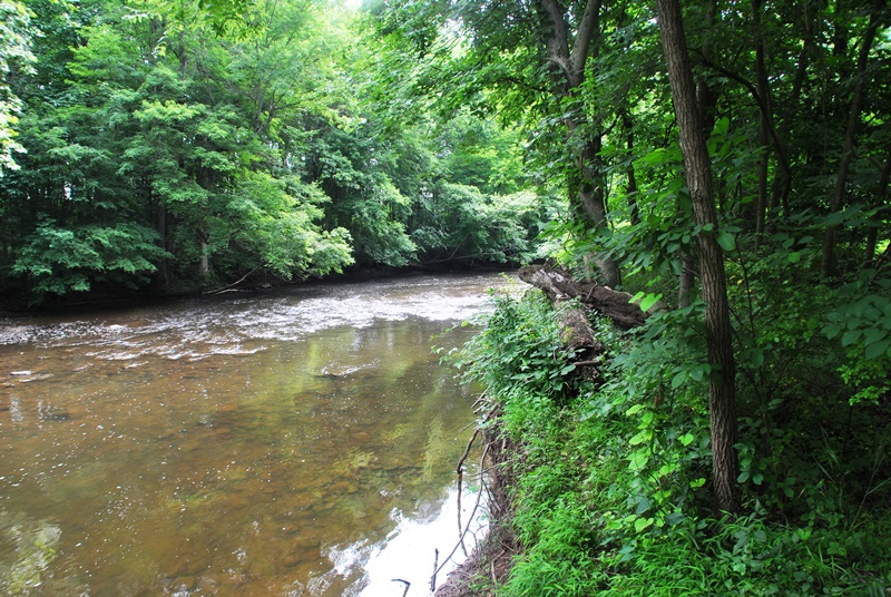
 |
| Heading southeast alongside French Creek |

Along the trail, there are a number of small paths that will lead you directly alongside French Creek. This area is pretty popular for fishing and is also one of my favorite places to go fish as well.


 |
| This was the only trail marker that I spotted on the trail |
Shortly after spotting the above trail marker, the trail came to an end on the opposite side of this small bridge. I walked around for a bit looking for another opening but unfortunately, I had to turn back as the trail was overgrown and not maintained.


Now heading back to the northwest, I returned to the parking lot to continue my adventure on the opposite side of Rapps Dam Road.

This covered bridge is known as Rapps Bridge which was built in 1866 by Benjamin Hartman at a cost of $3,600. It's one of the largest covered bridges in Chester County spanning a total of 105 feet. It was reconstructed again in 1978 and in 2011, it underwent additional restorations at a cost of $1.5 million. As you can see from the orange fencing, the bridge is currently closed. On April 29, 2014, a man driving a tractor trailer carrying potted plants attempted to cross the bridge which caused a substantial amount of damage closing it once again.
As of June 15, 2015 and according to East Pikeland Township's website, the process for repairs are now underway. Since the bridge is made of wood, it has to be cut and the wood has to cure before the actual repairs can be done which is slated to begin in August. On June 23, 2015, the driver of the tractor trailer who damaged the bridge pleaded guilty to a count of failure to prevent a catastrophe and will have to pay a restitution of $450,000.
As stated above, Rapps Bridge has been re-opened to traffic.


Across Rapps Dam Road and a short distance from Rapps Bridge is this small kiosk station which provides a little bit of history surrounding the French Creek Heritage Park.

Next to the above sign is a picture of this trail map, the same one you'll find on the East Pikeland Township website. Take note that the eastern side of the trail is the area that was not being maintained. From what it looks like, I should have been able to hike a distance further than what I was able to.

Close to where the kiosk is, you'll find the first of two trail heads. One of which is a natural surface as noted below and the other is an 8-10 foot wide paved trail.

Next to the natural surface trail head is the Mill Works on French Creek. While the Continental Powder Works was ruined, the land was still of value and was purchased by Casper Snyder, Jr. in 1792 and used for farming. His sons, Henry and Thomas operated the mill processing flax seed into linseed oil and also built a grist mill, sawmill and a mill to hull and clean clover seed in the vicinity. There is no information on when this mill ceased operation although it is stated that any industry that was along French Creek came to an end in 1935.


Below is an explanation on how the gun powder was made back when the Continental Power Works was still in operation. It seems the process is still relatively similar to how it was done back then.

On the opposite side of the mill is the paved section of the French Creek Trail which only runs for 1/3 mile and is handicap accessible.


I didn't want to hike on the paved trail so once I shot the above picture, it was back down to the natural surface trail and for the moment, heading in a northwesterly direction.


 |
| Side trail leading to the fishing trails alongside French Creek |
Somewhere in this area, the trail turns to the southwest. In this section of the French Creek Trail, you won't be able to see French Creek.

While out on the trail, I see this quite frequently. Known as spittlebugs, the nymphs which feed on the juices of the host plant cover themselves with this protective material resembling human spittle.


This stretch of water is one of many areas in this section of French Creek that I like to fish. The water looks shallow but on the opposite side, it's relatively deep.


 |
| One of two pedestrian bridges along the trail that cross over French Creek |
 |
| View looking downstream from the bridge. |
 |
| Looking upstream from the bridge |


Once you cross over the first bridge, the trail runs directly alongside private property. To your right if you're hiking in a southwest direction, you'll be able to see the homes that are next to the trail.


Along the trail are a number of side trails that lead to French Creek, likely created by local fishermen.


As the trail gradually turns to the west, then northwest, there's a side trail that will take you alongside French Creek (left) and was the one I chose to explore.

Taking the side trail turned out to be a pretty good choice. I had never been to this section of French Creek and after exploring it, I think I've found a few more fishing spots, not to mention how nice it is in this section of the creek!


 |
| Vernal pool on the opposite side of the trail from French Creek |


Eventually, the trail I was on led back to the main French Creek Trail, still heading in a northwest direction.
 |
| One of the few trail markers I spotted on the trail |


 |
| The second of the two pedestrian bridges crossing over French Creek |

 |
| View looking downstream from the bridge |
 |
| View looking upstream |
Once you cross over the second pedestrian bridge, the trail then turns into gravel and widens up quite a bit.


Shortly after crossing over the second pedestrian bridge is where the French Creek Trail comes to an end (for now) and it opens up into a small parking lot. If you'd like to park in this lot instead of the one on Rapps Dam Road, the address is approximately 547 Hares Hill Road, Phoenixville, PA, 19460. Technically, this address is in East Pikeland Township even though it's listed as Phoenixville.


It seems careless drivers and bridges don't get along too well in this area lately. To the left side of this picture, the road leading up to the bridge is on a pretty sharp turn. I think someone was driving too fast and missed their turn.


 |
| Picture from a picnic table in the back of the parking lot. |
 |
| Some sort of fungus growing through the mulch next to the picnic table |
After taking a short break at the picnic table, it was time to head back to the car. On my return, I didn't take many pictures since I had already been there. What pictures I took were from anything I could find that was interesting to me.


 |
| Back to the first pedestrian bridge |
Next to the first pedestrian bridge is a small area with picnic tables if you'd like to grab a lunch and hang out close to French Creek.

French Creek was first dammed in 1776 to assist with the operation of the mills in the area. Once mill operations ceased in 1935, the Township created a picnic and swimming area in 1938 which existed until the polio epidemic put an end to swimming in 1950's.

 |
| Remnants of Rapps Dam |
 |
| One last shot of the pedestrian bridge before heading back to the car |

While this hike was slowly coming to an end, I still had another objective in mind. The below trail is a connector to the fishing trails that run alongside French Creek. The French Creek Trail is nice but in some areas, there's no view of the creek.

Take note that the fishing trails are not maintained like the French Creek Trail is. If you choose to check out these trails, be prepared to walk through areas that are overgrown. As I made my way to the creek, I turned to the northwest again, heading in the direction of the pedestrian bridge.

 |
| Nicely landscaped property on the opposite bank |

Heading back to the southeast and back to the parking lot and vehicle. Even though it was hot outside, I was glad I kept the long pants on!


 |
| Almost back to the car, Rapps Bridge is in the background |
 |
| One last shot of Rapps Bridge |
That was it for my adventure at the French Creek Trail and Heritage Park. As many times as I've been fishing in this area, I never researched the history which was pretty interesting. I never knew there was a gun powder mill and weapons factory used to supply Washington's army during the beginning stages of the Revolutionary War. Pretty cool stuff if you ask me!
In all, it was a good hike due to the weather which was hot and humid with all flat terrain. For once, I was happy that there wasn't a challenge to this hike. The icing on the cake was learning about the history surrounding the area!
Until next time, happy hiking and happy exploring!
Please give my Facebook page a like!
Very interesting
ReplyDeletethanks
You're welcome, thanks for stopping in!
Delete