Date of Hike: Sunday, September 13, 2015
Total Distance: 9.56 Miles
Avg speed: 2.2 MPH
Total Time: 4:24:40
Conditions: Partly Sunny, 68 degrees
Difficulty: Easy, Moderate
I'm a little late with getting this post up but better late than never! On Sunday the 13th of September, I took another ride out to Marsh Creek State Park to explore some of the trails on the western and northwestern side of the park. The last time I was there, I explored the southern end of the park. Like the southern end, most of the trails are in very good condition and well worth checking out.
Approximate address:
802 N. Reeds Road
Downingtown, PA 19335
GPS: 40.061552, -75.733969
Take note that if you use Google Maps as your GPS, you can set your driving directions for the Marsh Creek State Park Boat Launch and it'll bring you directly to the parking lot. If you don't use Google Maps, the entrance to the parking lot off Reeds Road is a very short distance from the above address, you won't be able to miss it. As you enter the state park, there's a fantastic view of Marsh Creek Reservoir. For a copy of the trail map, click here. You can also obtain one upon your arrival at the park.


Technically. the trail heads in a northerly direction for a short distance. Once you enter into the woods, the trail splits to the west and the north and was where I made my turn to the west on the Blue Trail.

Hunting is permitted at Marsh Creek State Park. Now that hunting season has begun, be sure to wear some safety gear if you head out unless you go on a Sunday.

Once heading west, the Blue Trail is a long but gradual uphill hike.


Somewhere in this area, the Blue Trail split off to the north with an unmarked trail that continued west down a steep hill. Throughout the hike, I noted there were a number of unmarked trails leading in different directions. Instead of following the Blue Trail, I continued west down the steep hill to find out where it was going to lead to.


Once you get to the bottom of the hill, the trail turns to the north and looks to be the remnants of the East Brandywine Railroad. Started in 1854, the rail was intended to connect the farms and villages along the rural portions of the Brandywine River with the larger cities and commerce in the area.
Between 1854 and 1903, the railway changed hands a number of times before it was taken over by the Pennsylvania Railroad in 1903 and renamed to the New Holland Branch. Service declined over the decades as automobiles became more prevalent with passenger service ending in 1930. Freight service ended in 1960 with the eastern majority of the rail being abandoned by Penn Central in 1972.

I'm not fond of trails that are long, flat and straight so I eventually found another unmarked side trail leading back up a hill but didn't get far before it circled back to the old rail trail.

The side trail I took brought me back to the old rail trail (and back to the Blue Trail) which also runs alongside the East Branch Brandywine Creek. This is the view looking downstream.

The rail trail (Blue Trail) continues alongside the East Branch Brandywine Creek for a good distance.


At this point, the Blue Trail takes a turn to the northeast (right) and the old rail trail continues to the north alongside the East Branch Brandywine Creek. Technically, this is the property border of Marsh Creek State Park and continuing to the north brings you into private property (notice the yellow sign that might be stating "no trespassing" and that I might have kept going north along the rail trail).

I had an objective in mind but unfortunately, a big fence was blocking my access which is no surprise. To the east of the rail trail is an old quarry that I wanted to check out. Known as the Cornog Quarry and from what little information I could find, it's currently owned by Aqua and that operations began at the quarry in 1907. Who owned it while it was in operation and when it closed is a mystery to me for now. All I could find was a website that shows pictures of some of the minerals that were mined out of it.
According to some of the websites I touched on, there's supposedly a hole somewhere in the fence but I decided it would be best not to take a chance and turned back. Last April, two teenagers had to be rescued from the quarry after attempting to climb the cliff and getting stuck with one of them sustaining injuries after falling a distance. Luckily, the injuries weren't fatal but the two teenagers who got stuck and two others who were with them ended up being fined by the Pennsylvania State Police for trespassing.


I eventually made my way back to the park and turned to the northeast along the Blue Trail.

The Blue Trail leads to an open field with the trail running along the treeline on the northern side, then makes a turn to the southeast.


Now heading southeast, this is the view looking back to the opposite side of the field I had been on.

There's a trail entrance alongside Chalfont Road.

The Blue Trail (left) intersects with the Green Trail (right) which turns to the west. For the time being, I stayed on the Blue Trail which gradually makes a turn to the south.

There had been some rain the night before but not enough to make the trails soggy. This was one of the only areas throughout the hike where I had seen any puddles on the trails.

To the east of the trail is another field that had some farming equipment and the tractor to the left side. I took a picture of the tractor so I could do some research on it but unfortunately, it came out way overexposed.

Although I won't go into much depth, the Osage orange tree has a pretty interesting history including the use of the wood to make fences, bows, wagon wheels, and a number of other uses due to its durability and strength.


My intention was to figure out what each of these pieces of farm equipment did but unfortunately, I'm not really sure where to start. My guess with this one would be that it's a seeder of sorts which looks to be an obvious choice with the bins on top of it.

I was able to at least find some information about this piece of equipment. This is known as a Claas Liner 470t hay rake and is used to make the rectangular hay bails that you see in the above pictures (and below, what's left of that pile). Once cut down, the rake pushes the hay to one side or another creating a small pile for the bailer to pick up.


Once I was done checking out the farm equipment, it was back to the trail still heading south.

There are numerous trails in this section of the park and my objective was to get as much distance in as possible so I took a few turns, first heading back to the west and eventually heading southwest.


Along the way, I found the ruins of a home and as usual, I went a little nuts taking pictures of it. I love finding old ruins!


Once I was done checking out the ruins, the trail then made another turn back to the southeast. My only gripe about the trails at Marsh Creek State Park is that there aren't many trail markers which made it difficult to determine where in the park I was. It wasn't a real big deal but I had to use my phone more than I normally do so I could keep my bearings.


Other than the beginning of the hike, this was one of the few trail markers I had spotted but there's no Yellow Trail shown on the map! The above trail marker was broken and was leaning over almost touching the ground.


Throughout this area, I changed directions a number of times depending on which trail I had in mind to take.


Again in this area, I changed directions a number of times, first to the south, then turning east, then back to the north again.


My second view of the reservoir. By this time, I was gradually making my way to the east and getting closer to the boat launch and parking lot where I started my hike.


As you get close to the reservoir, you'll run into these ruins which are the remnants of a town by the name of Milford Mills that once used to be where the reservoir is now. In the 1970's, the State of Pennsylvania claimed eminent domain over the homes in the area and by March of 1972, all roads leading into Milford Mills were closed for good, the homes razed, and the F. Huston McIlvain Dam was built. By 1974, the reservoir was full, stocked with walleye, bass and tiger muskies, and Marsh Creek State Park was opened to the public.


Once I was done checking out the ruins, I headed north on the White Trail alongside the reservoir.


As you're following the White Trail to the north, you eventually make your way to this parking lot which is at the end of Chalfont Road.

It's hard to tell but the tree stump in this picture is enormous.


The White Trail runs along Chalfont Road for a distance before making a turn to the northeast back into the woods.


This is a small side trail that leads to the edge of the lake but it didn't go very far.


Once you turn off Chalfont Road, the trail runs through an open field.


Across the reservoir was this lookout point and if you look closely, there seems to be a waste basket there as well. I'm not sure what this may be but there's nothing on the trail map although there is a road (Milford Road) in the vicinity.


The White Trail in the area isn't as well maintained as the other trails in the park but they're still easily passable.


Unfortunately, it's impossible to see in this picture but there's a chipmunk poking its head out.


Getting close to Little Conestoga Road and the "end" of the White Trail (or beginning depending on which way you're traveling).


When the White Trail reaches Little Conestoga Road, you'll find a small parking lot and a trail marker signifying a turn to the east but this was where I turned around to head back to the car. I'm planning on returning to see if there's a trail on the opposite side of the bridge that leads to the lookout point I had seen earlier.


Almost back to the parking lot, this outlet is just next to the boat launch area.


I'm a little late with getting this post up but better late than never! On Sunday the 13th of September, I took another ride out to Marsh Creek State Park to explore some of the trails on the western and northwestern side of the park. The last time I was there, I explored the southern end of the park. Like the southern end, most of the trails are in very good condition and well worth checking out.
Approximate address:
802 N. Reeds Road
Downingtown, PA 19335
GPS: 40.061552, -75.733969
Take note that if you use Google Maps as your GPS, you can set your driving directions for the Marsh Creek State Park Boat Launch and it'll bring you directly to the parking lot. If you don't use Google Maps, the entrance to the parking lot off Reeds Road is a very short distance from the above address, you won't be able to miss it. As you enter the state park, there's a fantastic view of Marsh Creek Reservoir. For a copy of the trail map, click here. You can also obtain one upon your arrival at the park.

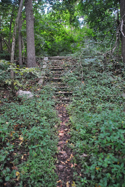
There are a few different trail heads to choose from which can be found behind the restrooms. For this adventure, I started out heading west.

 |
| One of a few trail heads opposite the restrooms at the park |

Technically. the trail heads in a northerly direction for a short distance. Once you enter into the woods, the trail splits to the west and the north and was where I made my turn to the west on the Blue Trail.

Hunting is permitted at Marsh Creek State Park. Now that hunting season has begun, be sure to wear some safety gear if you head out unless you go on a Sunday.

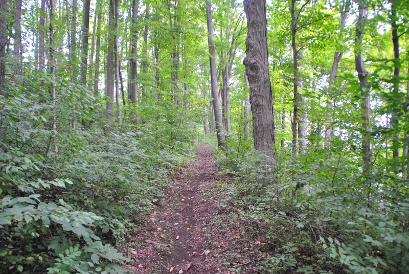
Once heading west, the Blue Trail is a long but gradual uphill hike.


Somewhere in this area, the Blue Trail split off to the north with an unmarked trail that continued west down a steep hill. Throughout the hike, I noted there were a number of unmarked trails leading in different directions. Instead of following the Blue Trail, I continued west down the steep hill to find out where it was going to lead to.


Once you get to the bottom of the hill, the trail turns to the north and looks to be the remnants of the East Brandywine Railroad. Started in 1854, the rail was intended to connect the farms and villages along the rural portions of the Brandywine River with the larger cities and commerce in the area.
Between 1854 and 1903, the railway changed hands a number of times before it was taken over by the Pennsylvania Railroad in 1903 and renamed to the New Holland Branch. Service declined over the decades as automobiles became more prevalent with passenger service ending in 1930. Freight service ended in 1960 with the eastern majority of the rail being abandoned by Penn Central in 1972.

I'm not fond of trails that are long, flat and straight so I eventually found another unmarked side trail leading back up a hill but didn't get far before it circled back to the old rail trail.

The side trail I took brought me back to the old rail trail (and back to the Blue Trail) which also runs alongside the East Branch Brandywine Creek. This is the view looking downstream.
 |
| Looking upstream on the East Branch Brandywine Creek |

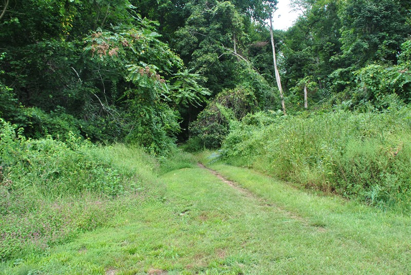
The rail trail (Blue Trail) continues alongside the East Branch Brandywine Creek for a good distance.

 |
| Remnants of old railroad ties |

At this point, the Blue Trail takes a turn to the northeast (right) and the old rail trail continues to the north alongside the East Branch Brandywine Creek. Technically, this is the property border of Marsh Creek State Park and continuing to the north brings you into private property (notice the yellow sign that might be stating "no trespassing" and that I might have kept going north along the rail trail).

I had an objective in mind but unfortunately, a big fence was blocking my access which is no surprise. To the east of the rail trail is an old quarry that I wanted to check out. Known as the Cornog Quarry and from what little information I could find, it's currently owned by Aqua and that operations began at the quarry in 1907. Who owned it while it was in operation and when it closed is a mystery to me for now. All I could find was a website that shows pictures of some of the minerals that were mined out of it.
According to some of the websites I touched on, there's supposedly a hole somewhere in the fence but I decided it would be best not to take a chance and turned back. Last April, two teenagers had to be rescued from the quarry after attempting to climb the cliff and getting stuck with one of them sustaining injuries after falling a distance. Luckily, the injuries weren't fatal but the two teenagers who got stuck and two others who were with them ended up being fined by the Pennsylvania State Police for trespassing.


I eventually made my way back to the park and turned to the northeast along the Blue Trail.

The Blue Trail leads to an open field with the trail running along the treeline on the northern side, then makes a turn to the southeast.


Now heading southeast, this is the view looking back to the opposite side of the field I had been on.

There's a trail entrance alongside Chalfont Road.

The Blue Trail (left) intersects with the Green Trail (right) which turns to the west. For the time being, I stayed on the Blue Trail which gradually makes a turn to the south.

There had been some rain the night before but not enough to make the trails soggy. This was one of the only areas throughout the hike where I had seen any puddles on the trails.

To the east of the trail is another field that had some farming equipment and the tractor to the left side. I took a picture of the tractor so I could do some research on it but unfortunately, it came out way overexposed.

Although I won't go into much depth, the Osage orange tree has a pretty interesting history including the use of the wood to make fences, bows, wagon wheels, and a number of other uses due to its durability and strength.


My intention was to figure out what each of these pieces of farm equipment did but unfortunately, I'm not really sure where to start. My guess with this one would be that it's a seeder of sorts which looks to be an obvious choice with the bins on top of it.
 |
| Another entrance to the park off Chalfont Road |
 |
| I have no idea what this one does! |

I was able to at least find some information about this piece of equipment. This is known as a Claas Liner 470t hay rake and is used to make the rectangular hay bails that you see in the above pictures (and below, what's left of that pile). Once cut down, the rake pushes the hay to one side or another creating a small pile for the bailer to pick up.


Once I was done checking out the farm equipment, it was back to the trail still heading south.

There are numerous trails in this section of the park and my objective was to get as much distance in as possible so I took a few turns, first heading back to the west and eventually heading southwest.


Along the way, I found the ruins of a home and as usual, I went a little nuts taking pictures of it. I love finding old ruins!


Once I was done checking out the ruins, the trail then made another turn back to the southeast. My only gripe about the trails at Marsh Creek State Park is that there aren't many trail markers which made it difficult to determine where in the park I was. It wasn't a real big deal but I had to use my phone more than I normally do so I could keep my bearings.


Other than the beginning of the hike, this was one of the few trail markers I had spotted but there's no Yellow Trail shown on the map! The above trail marker was broken and was leaning over almost touching the ground.


Throughout this area, I changed directions a number of times depending on which trail I had in mind to take.


 |
| My first view of the Marsh Creek Reservoir |


Again in this area, I changed directions a number of times, first to the south, then turning east, then back to the north again.


My second view of the reservoir. By this time, I was gradually making my way to the east and getting closer to the boat launch and parking lot where I started my hike.


As you get close to the reservoir, you'll run into these ruins which are the remnants of a town by the name of Milford Mills that once used to be where the reservoir is now. In the 1970's, the State of Pennsylvania claimed eminent domain over the homes in the area and by March of 1972, all roads leading into Milford Mills were closed for good, the homes razed, and the F. Huston McIlvain Dam was built. By 1974, the reservoir was full, stocked with walleye, bass and tiger muskies, and Marsh Creek State Park was opened to the public.


Once I was done checking out the ruins, I headed north on the White Trail alongside the reservoir.


As you're following the White Trail to the north, you eventually make your way to this parking lot which is at the end of Chalfont Road.

It's hard to tell but the tree stump in this picture is enormous.


The White Trail runs along Chalfont Road for a distance before making a turn to the northeast back into the woods.


This is a small side trail that leads to the edge of the lake but it didn't go very far.


Once you turn off Chalfont Road, the trail runs through an open field.


Across the reservoir was this lookout point and if you look closely, there seems to be a waste basket there as well. I'm not sure what this may be but there's nothing on the trail map although there is a road (Milford Road) in the vicinity.
 |
| Leaves are slowly starting to change color |


The White Trail in the area isn't as well maintained as the other trails in the park but they're still easily passable.


Unfortunately, it's impossible to see in this picture but there's a chipmunk poking its head out.


Getting close to Little Conestoga Road and the "end" of the White Trail (or beginning depending on which way you're traveling).


When the White Trail reaches Little Conestoga Road, you'll find a small parking lot and a trail marker signifying a turn to the east but this was where I turned around to head back to the car. I'm planning on returning to see if there's a trail on the opposite side of the bridge that leads to the lookout point I had seen earlier.


 |
| A view of the dam from the area close to the ruins of the homes. |

 |
| Back to the ruins |


Almost back to the parking lot, this outlet is just next to the boat launch area.


That was the end of my adventure for the day. On my way out, I stopped close to the entrance to the park to shoot the above picture. The view is much better in person!
In all, this is an excellent place to hike. The trails are pretty well maintained, they're clean, there's a varied amount of terrain with nothing too difficult and plenty of miles to explore. It's definitely well worth the drive to check out.
Until next time, happy adventures and happy hiking!
Please give my Facebook page a like!
Very nice, thank you for sharing!
ReplyDeleteThanks!
Delete