Date of Hike: Tuesday, July 12, 2016
Total Distance: 11.08 Miles
Avg speed: 2.2 MPH
Total Time: 4:59:37
Conditions: Sunny, 87 Degrees
Difficulty: Easy, Moderate, Difficult
It's been a while since I posted on my blog and as usual, it's not dead! I've been hiking a number of times since my last post but have been to places that I've already explored and written about. To write about them again seems to be a little on the redundant side in my opinion, especially if they're short hikes. There are a few local ones that I return to frequently when I get the urge to head out and to top this off, I've hiked quite a few places in the area and am running out of new destinations that are within a reasonable driving distance. Eventually, I'll be expanding the distances I drive to explore but for personal reasons, I don't go too far from home. If you'd like to see the pictures from some of my recent adventures, check out the photo albums on my Facebook page.
With that being said, my adventure on July 12 brought me to Welkinweir to explore a section of the Horse-Shoe Trail that I hadn't yet hiked and it turned out to be a pretty good adventure.
Address:
1368 Prizer Road
Pottstown, PA 19465
GPS: 40.154892, -75.685117
For a copy of the trail maps and guidebook, you can contact the Horseshoe Trail Conservancy ($15). You can also obtain the maps and guidebook at Eastern Mountain Sports ($22.95). If you have patience, I'd order directly from the conservancy, more than a 50% markup at EMS? Wow...

To start out my adventure, I decided to walk around some of the grounds to check out the gardens of Welkinweir before heading to the Horse-Shoe Trail. Note that Welkinweir is open to members only during the weekends. If you're not a member, you can go during the week. Although I didn't check it out, there's an estate you can take a tour of as well.

I noted above that the temperature was 87 degrees. I arrived there early so at the time, the temperature was around 74-75 degrees so it was quite comfortable to start the adventure. Of course as the day progressed, it got pretty toasty.


View of "The Great Pond" looking toward the Horse-Shoe Trail. Once you cross over the bridge on the far end, the connecting trail is along the tree line. I caught sight of a bald eagle along that tree line but unfortunately, no pictures as it took off pretty quickly. Rats! One day, I'll get a picture of one!


As you cross over the bridge on the far end of the pond, you'll find the remnants of a fireplace of sorts. Right next to it is where you'll find the connecting trail that will lead you to the Horse-Shoe Trail.


Once on the connecting trail (heading south), you'll find this map of Welkinweir for those who have hiked the Horse-Shoe Trail and are making their way to the estate. The red arrow on the left center side of the map is where I was.

Once you get to the Horse-Shoe Trail, you'll find the below marker. Going left (east) will take you to Warwick County Park and going right (west) will take you to Valley Forge and was the direction I went.


Once you get to the Horse-Shoe Trail, you immediately start with a nice, long, and in some parts, steep uphill climb and a good way to begin an adventure! This section of the trail was the most difficult.


The trail levels off for a distance and as it turns to the south, you also begin a descent back down the hill.


As expected, some of the Horse-Shoe Trail is slightly overgrown but it wasn't difficult to get through. This is one reason I almost always wear long pants on the trail regardless of the temperature!

As you start making your way down the opposite side of the hill, you'll end up next to private property and walking down a dirt driveway. It's hard to tell from the picture but this hill was somewhat steep. Not so bad on the way down but on the way back up after hiking several miles took some effort!


The dirt driveway eventually lets you out on Fairview Road (or Nantmeal Village Road, it's listed as both on Google Maps) and across Route 100. Be careful crossing, this is a busy road!


The second challenge of the day! Once you cross over Route 100, you'll be climbing another hill. Like the first hill, it's a good workout to climb and is pretty steep in some parts.

Just to give you an idea on how steep the hills in this section of the Horse-Shoe Trail are, here's a screenshot from a different topographical map. If you're not familiar on how to read a topographical map, each line on this map represents 10 feet of elevation gain and the closer the lines are to each other, the more steep the hill is.
Granted, these hills weren't huge by any means but as of recently, my hikes have been on relatively easy terrain so for this to be the beginning (and end) of my hike, my legs were pretty tired by the time my adventure had ended.

Be forewarned...once you reach the top of this hill, the Horse-Shoe Trail will bring you directly alongside private property. No big deal, right? Usually, the answer to this would be "yes" but in this case, there's a dog on the property that wasn't entirely friendly, not on a leash, and was easily within a few feet of me barking while it followed me along the property line next to the trail.
It never set foot on the trail itself and looked to have some sort of shock collar on it but if you're not dog friendly, this could easily make one quite uncomfortable. It was annoying enough that the dog didn't stop barking until I got away from the property, I couldn't imagine what it would be like to someone who gets freaked out by dogs.
The funny part was, because of the dog barking at me and getting so close, I totally forgot about how tired I was from climbing the hill that led up to that property! Fortunately, the dog must have been inside the home on my return to Welkinweir so I didn't have to deal with it.

Once you get to the top of the hill and past the barking dog (ha!), the trail turns to the east with a very gradual uphill climb. Take note that in this area, you should pay attention to the trail markers to make sure you stay on the Horse-Shoe Trail, there are numerous side trails scattered throughout this section.

In this section of the trail, it bounces between going southeast to northeast and back again.

The next road the Horse-Shoe Trail will lead you to is Green Lane. Once you get to this dirt road, the trail takes a turn to the south.


After following Green Lane for a short distance, the trail takes a turn to the west on Bartlett Lane.


After following Bartlett Lane for a short distance, the Horse-Shoe Trail takes another turn off the road to the south and back into the woods.


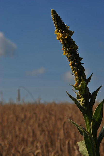
After heading south for a distance, the Horse-Shoe Trail takes another turn to the west and alongside some wheat fields.


As the trail skirts along the perimeter of the wheat fields, it changes directions from west to south a few times.


As you get beyond the wheat fields, the trail then turns to the east. Like the other section of the Horse-Shoe Trail I had passed through, there are a few side trails so be sure to keep an eye on the trail markers.

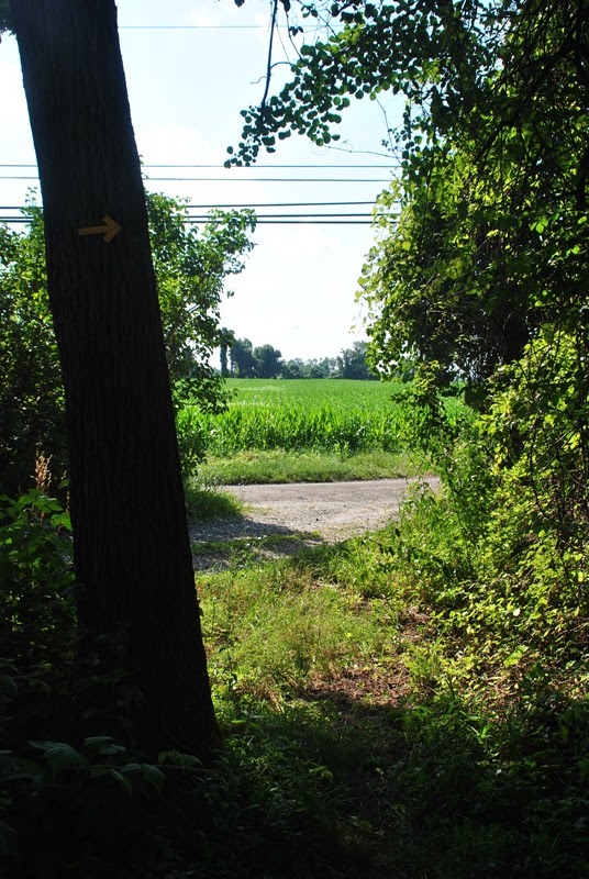
This is one of the side trails I'm talking about. It's in very good shape which tells me it's still in use so if you happen to miss the trail marker, you likely wouldn't know you're on the wrong trail until you run into private property. The Horse-Shoe Trail made a turn to the left.


As the trail takes another turn to the south, you'll end up alongside private property and on this dirt driveway.


Once you get to the end (or beginning really) of the driveway, you'll be alongside the Horseshoe Trail road and turning to the southeast.

The fortunate part of this is that at least for a short distance, you can avoid walking on the road. It's not a busy road by any means but if you don't like road walking, you can stay in the grass alongside it. At this point, the trail passes the intersection of the Horseshoe Trail (road) and Birchrun Road.

Although it wasn't necessary, I crossed over the Horseshoe Trail road so that I could continue walking in the grass. On the way back, I just walked along the road.

A little something I wasn't aware of. The Horse-Shoe Trail has been re-routed in this section of the trail. On my trail map, it has me continuing down the Horseshoe Trail road for a while longer before turning off. There was nothing on the the Horse-Shoe Trail Conservancy's website about the re-route and I'm not sure if it's temporary or permanent. The trail is frequently re-routed, sometimes to get it back into the woods instead of a roadside so it's no surprise.

The re-route will take you northeast along Jaine Lane which runs for a decent distance before entering back into the woods. This was probably the longest section of road walking for this adventure.


Jaine Lane gradually turns to the east and once it heads back to the woods, it turns to the south.

This is where things got a bit interesting for me. Although I did my best to follow the directions posted on the re-route notice, I still ended up walking in circles for a short time. In the above note, it stated to enter the woods in the back of the property. Well, I took that literally and ended up walking around the perimeter of someone's yard looking for the trail leading into the woods. I couldn't find it until after I looped back around to Jaine Lane and back on the trail. The second time around, I spotted the trail marker (which I should have seen the first time!) and made my way into the woods.
The below bear statue is on the property of the home I ended up walking around. If you own this property and somehow manage to read my blog post, my apologies for walking around on your property, it wasn't intentional!

After getting temporarily "lost" I spotted the yellow trail marker leading into the woods (the one I should have seen) and was on my way. This wasn't the end of my screwing up though. As I was hiking through this section of the woods, I made a wrong turn on a side trail. Remember how I said you should keep an eye on the trail markers? Well, this is why. After doubling back, the marker signifying a turn in the trail was well defined and I completely missed it!
I normally have no problems taking wrong turns or getting "lost" but when you're hiking the Horse-Shoe Trail, you're also hiking alongside or through private property in places. The last thing I want to do is anger a resident who doesn't want people on their property and/or creating an issue with those who help to maintain the trail (the conservancy).


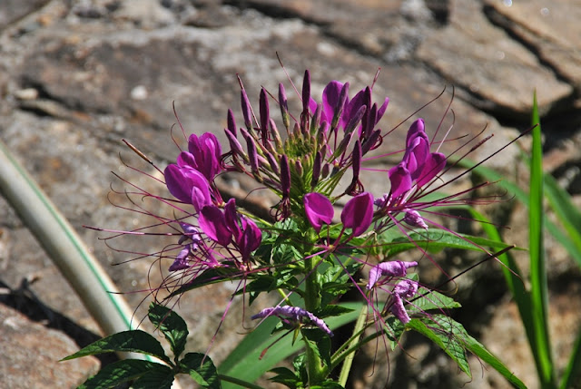
Almost at the end of my adventure for the day (my turn around point), this was just about the final stretch of trail. This was another section that was a bit overgrown with the plants that have the above burrs on them. It wasn't too difficult to get around them though.


Once I reached Davis Lane, this was where I turned around to head back to Welkinweir. The below picture is of what I believe to be the embankment that was referred to in the re-route notice before reaching Jaine Lane.

Like I usually do when returning, I took some shots of whatever I could find.


On my return to Jaine Lane, I took a closer look at where I had walked in a circle around the property I had been on and noticed my mistake. The pines trees you see on the left side are some of several that border the property I had been on. When I reached this point the first time, I headed toward the pines which I shouldn't have done. Although the trail marker was in plain sight, I didn't see it until I looped around a second time. The trail into the woods is right about where the line between the sun and shade are.


On the way back, I stopped to take a break and to switch out of my sweaty socks and right beneath my feet, I spotted this plant/fungus. I have no idea what it is but it looked pretty cool to me!


Back to Welkinweir, I took a number of pictures in the gardens before calling it a day.


That was it for my adventure on this section of the Horse-Shoe Trail. In all, it was a pretty good hike with less road walking than I had originally anticipated. For the most part, the trail is in good condition throughout this section and the terrain is various enough to keep you interested and give you a good workout. My only gripe was the barking dog after climbing the hill by route 100!
With this adventure, I have less than three miles to hike to complete trail map #2 out of the 10 that make up the 140+ miles of the Horse-Shoe Trail. Map #1 has already been completed and a good part of map #3 is also done. What this means for me is driving longer distances to complete my adventures on the Horse-Shoe Trail. My plans are to complete the entire trail and in time, I eventually will!
Sadly, it may be a while before I can post another adventure. Similar to what happened to me more than a year ago with plantar fasciitis in my left foot, I now have it in my right foot and its been nagging me for months. It's not any worse than it was but it's also not getting better. With that being said, I may have to hang up my hiking boots for a while until it heals. I'm reluctant to stop hiking but it seems it has to be done in order to keep going.
Until next time, happy adventures and happy hiking!
It's been a while since I posted on my blog and as usual, it's not dead! I've been hiking a number of times since my last post but have been to places that I've already explored and written about. To write about them again seems to be a little on the redundant side in my opinion, especially if they're short hikes. There are a few local ones that I return to frequently when I get the urge to head out and to top this off, I've hiked quite a few places in the area and am running out of new destinations that are within a reasonable driving distance. Eventually, I'll be expanding the distances I drive to explore but for personal reasons, I don't go too far from home. If you'd like to see the pictures from some of my recent adventures, check out the photo albums on my Facebook page.
With that being said, my adventure on July 12 brought me to Welkinweir to explore a section of the Horse-Shoe Trail that I hadn't yet hiked and it turned out to be a pretty good adventure.
Address:
1368 Prizer Road
Pottstown, PA 19465
GPS: 40.154892, -75.685117
For a copy of the trail maps and guidebook, you can contact the Horseshoe Trail Conservancy ($15). You can also obtain the maps and guidebook at Eastern Mountain Sports ($22.95). If you have patience, I'd order directly from the conservancy, more than a 50% markup at EMS? Wow...

To start out my adventure, I decided to walk around some of the grounds to check out the gardens of Welkinweir before heading to the Horse-Shoe Trail. Note that Welkinweir is open to members only during the weekends. If you're not a member, you can go during the week. Although I didn't check it out, there's an estate you can take a tour of as well.

I noted above that the temperature was 87 degrees. I arrived there early so at the time, the temperature was around 74-75 degrees so it was quite comfortable to start the adventure. Of course as the day progressed, it got pretty toasty.

 |
| Crushed stone path leading to the gardens |


View of "The Great Pond" looking toward the Horse-Shoe Trail. Once you cross over the bridge on the far end, the connecting trail is along the tree line. I caught sight of a bald eagle along that tree line but unfortunately, no pictures as it took off pretty quickly. Rats! One day, I'll get a picture of one!

 |
| Spring house next to "The Great Pond" |
 |
| Eastern Tiger Swallowtail |

As you cross over the bridge on the far end of the pond, you'll find the remnants of a fireplace of sorts. Right next to it is where you'll find the connecting trail that will lead you to the Horse-Shoe Trail.


Once on the connecting trail (heading south), you'll find this map of Welkinweir for those who have hiked the Horse-Shoe Trail and are making their way to the estate. The red arrow on the left center side of the map is where I was.

Once you get to the Horse-Shoe Trail, you'll find the below marker. Going left (east) will take you to Warwick County Park and going right (west) will take you to Valley Forge and was the direction I went.


Once you get to the Horse-Shoe Trail, you immediately start with a nice, long, and in some parts, steep uphill climb and a good way to begin an adventure! This section of the trail was the most difficult.


The trail levels off for a distance and as it turns to the south, you also begin a descent back down the hill.


As expected, some of the Horse-Shoe Trail is slightly overgrown but it wasn't difficult to get through. This is one reason I almost always wear long pants on the trail regardless of the temperature!

As you start making your way down the opposite side of the hill, you'll end up next to private property and walking down a dirt driveway. It's hard to tell from the picture but this hill was somewhat steep. Not so bad on the way down but on the way back up after hiking several miles took some effort!


The dirt driveway eventually lets you out on Fairview Road (or Nantmeal Village Road, it's listed as both on Google Maps) and across Route 100. Be careful crossing, this is a busy road!


The second challenge of the day! Once you cross over Route 100, you'll be climbing another hill. Like the first hill, it's a good workout to climb and is pretty steep in some parts.

Just to give you an idea on how steep the hills in this section of the Horse-Shoe Trail are, here's a screenshot from a different topographical map. If you're not familiar on how to read a topographical map, each line on this map represents 10 feet of elevation gain and the closer the lines are to each other, the more steep the hill is.
Granted, these hills weren't huge by any means but as of recently, my hikes have been on relatively easy terrain so for this to be the beginning (and end) of my hike, my legs were pretty tired by the time my adventure had ended.

Be forewarned...once you reach the top of this hill, the Horse-Shoe Trail will bring you directly alongside private property. No big deal, right? Usually, the answer to this would be "yes" but in this case, there's a dog on the property that wasn't entirely friendly, not on a leash, and was easily within a few feet of me barking while it followed me along the property line next to the trail.
It never set foot on the trail itself and looked to have some sort of shock collar on it but if you're not dog friendly, this could easily make one quite uncomfortable. It was annoying enough that the dog didn't stop barking until I got away from the property, I couldn't imagine what it would be like to someone who gets freaked out by dogs.
The funny part was, because of the dog barking at me and getting so close, I totally forgot about how tired I was from climbing the hill that led up to that property! Fortunately, the dog must have been inside the home on my return to Welkinweir so I didn't have to deal with it.

Once you get to the top of the hill and past the barking dog (ha!), the trail turns to the east with a very gradual uphill climb. Take note that in this area, you should pay attention to the trail markers to make sure you stay on the Horse-Shoe Trail, there are numerous side trails scattered throughout this section.

In this section of the trail, it bounces between going southeast to northeast and back again.

 |
| Low bridge! |
The next road the Horse-Shoe Trail will lead you to is Green Lane. Once you get to this dirt road, the trail takes a turn to the south.


After following Green Lane for a short distance, the trail takes a turn to the west on Bartlett Lane.


After following Bartlett Lane for a short distance, the Horse-Shoe Trail takes another turn off the road to the south and back into the woods.

 |
| Trail sign alongside Bartlett Road |


After heading south for a distance, the Horse-Shoe Trail takes another turn to the west and alongside some wheat fields.


As the trail skirts along the perimeter of the wheat fields, it changes directions from west to south a few times.


As you get beyond the wheat fields, the trail then turns to the east. Like the other section of the Horse-Shoe Trail I had passed through, there are a few side trails so be sure to keep an eye on the trail markers.

 |
| This tree was enormous! |
This is one of the side trails I'm talking about. It's in very good shape which tells me it's still in use so if you happen to miss the trail marker, you likely wouldn't know you're on the wrong trail until you run into private property. The Horse-Shoe Trail made a turn to the left.


As the trail takes another turn to the south, you'll end up alongside private property and on this dirt driveway.


Once you get to the end (or beginning really) of the driveway, you'll be alongside the Horseshoe Trail road and turning to the southeast.

The fortunate part of this is that at least for a short distance, you can avoid walking on the road. It's not a busy road by any means but if you don't like road walking, you can stay in the grass alongside it. At this point, the trail passes the intersection of the Horseshoe Trail (road) and Birchrun Road.

Although it wasn't necessary, I crossed over the Horseshoe Trail road so that I could continue walking in the grass. On the way back, I just walked along the road.

A little something I wasn't aware of. The Horse-Shoe Trail has been re-routed in this section of the trail. On my trail map, it has me continuing down the Horseshoe Trail road for a while longer before turning off. There was nothing on the the Horse-Shoe Trail Conservancy's website about the re-route and I'm not sure if it's temporary or permanent. The trail is frequently re-routed, sometimes to get it back into the woods instead of a roadside so it's no surprise.

The re-route will take you northeast along Jaine Lane which runs for a decent distance before entering back into the woods. This was probably the longest section of road walking for this adventure.


Jaine Lane gradually turns to the east and once it heads back to the woods, it turns to the south.

This is where things got a bit interesting for me. Although I did my best to follow the directions posted on the re-route notice, I still ended up walking in circles for a short time. In the above note, it stated to enter the woods in the back of the property. Well, I took that literally and ended up walking around the perimeter of someone's yard looking for the trail leading into the woods. I couldn't find it until after I looped back around to Jaine Lane and back on the trail. The second time around, I spotted the trail marker (which I should have seen the first time!) and made my way into the woods.
The below bear statue is on the property of the home I ended up walking around. If you own this property and somehow manage to read my blog post, my apologies for walking around on your property, it wasn't intentional!

After getting temporarily "lost" I spotted the yellow trail marker leading into the woods (the one I should have seen) and was on my way. This wasn't the end of my screwing up though. As I was hiking through this section of the woods, I made a wrong turn on a side trail. Remember how I said you should keep an eye on the trail markers? Well, this is why. After doubling back, the marker signifying a turn in the trail was well defined and I completely missed it!
I normally have no problems taking wrong turns or getting "lost" but when you're hiking the Horse-Shoe Trail, you're also hiking alongside or through private property in places. The last thing I want to do is anger a resident who doesn't want people on their property and/or creating an issue with those who help to maintain the trail (the conservancy).


Almost at the end of my adventure for the day (my turn around point), this was just about the final stretch of trail. This was another section that was a bit overgrown with the plants that have the above burrs on them. It wasn't too difficult to get around them though.


Once I reached Davis Lane, this was where I turned around to head back to Welkinweir. The below picture is of what I believe to be the embankment that was referred to in the re-route notice before reaching Jaine Lane.

 |
| Looking back to Davis Lane |
Like I usually do when returning, I took some shots of whatever I could find.


On my return to Jaine Lane, I took a closer look at where I had walked in a circle around the property I had been on and noticed my mistake. The pines trees you see on the left side are some of several that border the property I had been on. When I reached this point the first time, I headed toward the pines which I shouldn't have done. Although the trail marker was in plain sight, I didn't see it until I looped around a second time. The trail into the woods is right about where the line between the sun and shade are.

 |
| Back to Jaine Lane |

 |
| Small stream crossing along the trail |


On the way back, I stopped to take a break and to switch out of my sweaty socks and right beneath my feet, I spotted this plant/fungus. I have no idea what it is but it looked pretty cool to me!


 |
| Almost back to Welkinweir, crossing back over Route 100 |
Back to Welkinweir, I took a number of pictures in the gardens before calling it a day.


That was it for my adventure on this section of the Horse-Shoe Trail. In all, it was a pretty good hike with less road walking than I had originally anticipated. For the most part, the trail is in good condition throughout this section and the terrain is various enough to keep you interested and give you a good workout. My only gripe was the barking dog after climbing the hill by route 100!
With this adventure, I have less than three miles to hike to complete trail map #2 out of the 10 that make up the 140+ miles of the Horse-Shoe Trail. Map #1 has already been completed and a good part of map #3 is also done. What this means for me is driving longer distances to complete my adventures on the Horse-Shoe Trail. My plans are to complete the entire trail and in time, I eventually will!
Sadly, it may be a while before I can post another adventure. Similar to what happened to me more than a year ago with plantar fasciitis in my left foot, I now have it in my right foot and its been nagging me for months. It's not any worse than it was but it's also not getting better. With that being said, I may have to hang up my hiking boots for a while until it heals. I'm reluctant to stop hiking but it seems it has to be done in order to keep going.
Until next time, happy adventures and happy hiking!