Date of Hike: Monday, May 25, 2015
Total Distance: 10.41 Miles
Avg speed: 2.28 MPH
Avg moving speed: 2.47 MPH
Moving Time: 4:12:41
Total Time: 4:33:57
Conditions: Sunny, 86 Degrees
Difficulty: Easy, Moderate
Before I started my blog last year, I hiked the Old Mill Trail at Nockamixon State Park but at the time, I was new to (serious) hiking and discovered the harsh lesson of purchasing improper fitting footwear and had to limp back to the vehicle with blisters on both of my feet without completing the hike. I had intentions of eventually posting the pictures from that hike but instead, this past Monday (Memorial Day), I made an impulse decision to complete the hike I wasn't able to last year. I didn't have any intentions of hiking on Monday but the itch got to me and off I went...I have no regrets.
I parked in parking lot #1 after pulling into the main entrance of the park. There's a paved trail that you can hop on from there but if you want to hike the entire paved section, follow the road all the way to the end where the marina is and park there. There are numerous other parking lots within the vicinity as well so if one is full, try to find another. For a copy of the trail map and to locate the other parking lots, you can stop at the ranger station by the front entrance or you can get one here.
Address is:
1542 Mountain View Dr.
Quakertown, PA 18951-5732
GPS: 40.4524088,-75.2272074

As mentioned, I started out on the paved section which runs for about one and a half miles before turning into a natural trail. I didn't take many pictures in this area.


This milling stone has some historical significance but unfortunately, the sign that used to be posted next to it was broken off at the base. I have another picture of it from my last hike and will update when I dig it up. At this point, you're also as the end of the paved section of trail.

Alongside the mill wheel you see above is this small stream and also where the trail splits off in a few different directions. From here, you can cross over the stream or hike alongside it for a distance where it'll lead you to another parking lot.
At one point in time, the water used to be dammed in this spot for the mill that was in the area.


There was someone at the site of the former dam taking pictures while I was there so I headed upstream for a distance in hopes they'd be done by the time I got back.

Remnants of the old mill pond that used to exist while the mill was in operation.

By the time I returned back to where the dam was, the person who was taking pictures wasn't done yet so I decided to keep moving and snap pictures on my return. Directly across from the ruins of the dam is a trail leading in a westward direction. You'll actually be walking on top of the dam and the above pond will be to your right.

This section of trail isn't as well maintained as the others.

A short distance before you get to the remains of this stone wall, the trail opens up and is much easier to navigate.


This area threw me off a bit. There are a few side trails that lead to the opposite side of the stone wall you see on the left. I thought they were part of what's shown on the trail map but after attempting to find my way on the few that I found, they basically came to an end.

This sign is what threw me off but after looking a bit closer, it's directing you to stay on the trail going in either direction and not to the trails I was on. Funny enough, I believe I did the same thing last year when I hiked the Old Mill Trail.


You won't be anywhere near Lake Nockamixon for a distance as the trail cuts to the north then finally circles back towards the east. In this area though, the trails are in pretty decent shape.


I finally reached a clearing alongside the lake. The small sailboat you see is a remote control one that was being navigated by a guy who was in a boat to the left side of where I shot the picture.


From here and for a good distance, the trail runs directly alongside Lake Nockamixon. However, the trail is above the lake by about 50-60 feet with a steep drop and you really can't see much of it.


The trail wraps around a small inlet and on the opposite side, you'll find a picnic table and what looks like the remnants of an old boat launch. I'm not sure what the logs in the water were there for but it isn't the only place where I spotted them.
I stopped and took a break at this picnic table when I was there last year. This time, I stuck around long enough to snap off a few shots and kept moving.


It's hard to see but on the right side of the picture is another trail intersecting with the one I was on. Last year, this was where I turned around to head back to the car. Not only did my feet have blisters but in the spring last year, we were having rain frequently and the trail was soggy.


I've mentioned this before but in a way, I'm actually glad we haven't had much rain recently. Like the trails on the other side of Lake Nockamixon (Elephant, Church and Mink), these trails are open to equestrian use and in areas, the ground is pretty badly rutted due to the horses. If it had been wet, it would have made hiking some sections of this trail somewhat difficult.


Once you cross over Old Bethlehem Road, it turns into the Quarry Trail. This is also one of the only areas where there's a hill that will give you a decent workout. On the DCNR's website, it states that both the Old Mill and Quarry trails are a "more difficult challenge". Other than the distance and the one hill on the Quarry Trail, I'm inclined to disagree with this. In my opinion, the only real challenges of hiking at Nockamixon State Park are a few hills and walking through the ruts in the ground caused by the horses, especially when it's wet and the ruts turn into a slurry of deep mud and water.

The Quarry Trail is a loop trail that leads back to Old Bethlehem Road. Once you cross over, you can go either south or northwest. I chose the northwest trail that lead up the hill.


According to the trail map, this is Kahagon Road and the area where a summer camp used to exist at one point in time.


I'm not sure what kind of caterpillar this is. If anyone happens to know, I'm all ears. I searched the internet attempting to identify it but was unable to (for now).


Once I got to the water's edge, I turned to the northwest alongside Lake Nockamixon


If you can believe this, these flowers are actually from a poison ivy plant. I don't think I've ever seen these before. Of course, I don't go looking for them either!

At this point, you're pretty much within an inlet that will bring you upstream on the Tohickon Creek.

There were trails scattered all over the place in this area but none of them are really well maintained. According to the trail map, the trail in this area pushed further west than I made it before deciding to turn back.


Instead of following the primary trail, I found another one that skirted directly next to the lake and followed it to see where it would bring me.


Looking back to the bridge on PA State Route 563 (Mountain View Drive).

In this spot, there's a rock to the left of this picture that overlooks the lake but unfortunately, there was a group of people hanging on it out so I wasn't able to get a picture.


Once you're done at the rock overlooking Lake Nockamixon, the trail circles around to the north, then gradually turning to the east around a body of water and what I believe are the remnants of an old quarry that provided building materials for local structures (according to the DCNR, I'm not sure if this body of water are the remnants of the quarry).


The trail then circles back to the southwest and will bring you alongside Lake Nockamixon again.

As you get close to the lake again, you reach a trail that states there's no outlet. Whatever you do, don't let that stop you from exploring it and don't let it fool you either. From what I found, there are a few ways to get in and out of this area.


This body of water is what I believe to be the remnants of the quarry mentioned on the DCNR's website. However, the water is very shallow in here so I'm wondering if the quarry was filled when the lake was being built or if it was ever that deep to begin with.


There was a trail leading out of this area that went up a hill and would have brought me back to the trail I had just been on.

Giving this was once a quarry, I'm wondering if this is remnants of an old gravel parking lot at one time. There was a lot of gravel in the area. Since there was nothing but open space and gravel, it was also much warmer than it was throughout the rest of my hike. The heat from the sun made it pretty toasty.


It was somewhere in here where I found another unmarked trail that ran alongside the lake and decided to check it out instead of returning to the Quarry Trail. At first, the trail was in pretty decent condition.


Slowly but surely, the condition of the side trail I was on began to deteriorate as I pushed further.


Shortly after climbing over this fallen tree was where the trail came to an abrupt end. By now, I had traveled too far to want to turn back and I also knew the marked trail was in the area. It was just a matter of finding it.

After a little bit of bushwhacking through the woods and changing direction a few times, I found the trail and was on my way back to the car. At this point, I was back to the Old Mill Trail heading to the section that runs closer to Mountain View Road (Route 563).


Hunting is permitted at Nockamixon State Park. Take note of this in case you are hiking during hunting season and be sure to wear orange safety gear that will identify you as human.


Getting close to where the remnants of the old mill dam and pond were located.


This was the trail crossing, obviously not meant for humans unless you don't mind getting your feet and legs wet and muddy. I try to avoid it if at all possible.


The stream is well below normal level so it wasn't like you couldn't find a spot to cross over.

This time around, there wasn't anyone at the dam so I was able to get the pictures I was trying to get earlier in the day.


Like my walk in, once I reached the paved area, I only took one picture. I'm not fond of taking pictures of paved trails.

That was it for my hike at Nockamixon State Park for the day. As usual, it was a good adventure but I would advise anyone who decides to hike on these trails to do so when it's dry. Giving the number of areas that I walked through that had been rutted from horses, I could only imagine the condition of these trails if they were wet. Last year when I hiked on the Old Mill Trail, it was pretty soggy and I was able to navigate but my feet were soaked by the time I had completed the hike and I did notice there were pockets of deep mud.
Don't get me wrong, I'm not trying to discourage anyone from hiking these trails, they're definitely worth checking out. The Old Mill and Quarry Trails are a far better cry than the Church and Mink Trails on the opposite side of the lake where the mud is deep and near impossible to avoid. If you decide to hike on the Old Mill and Quarry trails when it's wet, be sure to bring gaiters just in case.
Until next time, happy exploring and happy hiking!
Please give my Facebook page a like!
Before I started my blog last year, I hiked the Old Mill Trail at Nockamixon State Park but at the time, I was new to (serious) hiking and discovered the harsh lesson of purchasing improper fitting footwear and had to limp back to the vehicle with blisters on both of my feet without completing the hike. I had intentions of eventually posting the pictures from that hike but instead, this past Monday (Memorial Day), I made an impulse decision to complete the hike I wasn't able to last year. I didn't have any intentions of hiking on Monday but the itch got to me and off I went...I have no regrets.
I parked in parking lot #1 after pulling into the main entrance of the park. There's a paved trail that you can hop on from there but if you want to hike the entire paved section, follow the road all the way to the end where the marina is and park there. There are numerous other parking lots within the vicinity as well so if one is full, try to find another. For a copy of the trail map and to locate the other parking lots, you can stop at the ranger station by the front entrance or you can get one here.
Address is:
1542 Mountain View Dr.
Quakertown, PA 18951-5732
GPS: 40.4524088,-75.2272074

As mentioned, I started out on the paved section which runs for about one and a half miles before turning into a natural trail. I didn't take many pictures in this area.


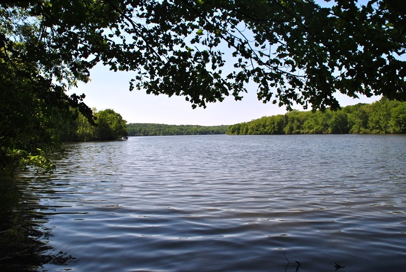 |
| Still on the paved trail, this is the first good view of Lake Nockamixon |
This milling stone has some historical significance but unfortunately, the sign that used to be posted next to it was broken off at the base. I have another picture of it from my last hike and will update when I dig it up. At this point, you're also as the end of the paved section of trail.

Alongside the mill wheel you see above is this small stream and also where the trail splits off in a few different directions. From here, you can cross over the stream or hike alongside it for a distance where it'll lead you to another parking lot.
At one point in time, the water used to be dammed in this spot for the mill that was in the area.


There was someone at the site of the former dam taking pictures while I was there so I headed upstream for a distance in hopes they'd be done by the time I got back.

Remnants of the old mill pond that used to exist while the mill was in operation.

By the time I returned back to where the dam was, the person who was taking pictures wasn't done yet so I decided to keep moving and snap pictures on my return. Directly across from the ruins of the dam is a trail leading in a westward direction. You'll actually be walking on top of the dam and the above pond will be to your right.

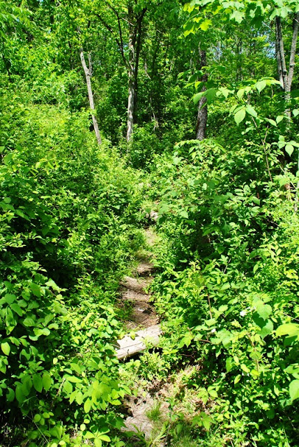
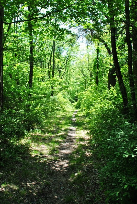
This section of trail isn't as well maintained as the others.

A short distance before you get to the remains of this stone wall, the trail opens up and is much easier to navigate.


This area threw me off a bit. There are a few side trails that lead to the opposite side of the stone wall you see on the left. I thought they were part of what's shown on the trail map but after attempting to find my way on the few that I found, they basically came to an end.

This sign is what threw me off but after looking a bit closer, it's directing you to stay on the trail going in either direction and not to the trails I was on. Funny enough, I believe I did the same thing last year when I hiked the Old Mill Trail.

 |
| You'll see red trail markers throughout the hike |


You won't be anywhere near Lake Nockamixon for a distance as the trail cuts to the north then finally circles back towards the east. In this area though, the trails are in pretty decent shape.


 |
| Small stream leading to Lake Nockamixon |

I finally reached a clearing alongside the lake. The small sailboat you see is a remote control one that was being navigated by a guy who was in a boat to the left side of where I shot the picture.


From here and for a good distance, the trail runs directly alongside Lake Nockamixon. However, the trail is above the lake by about 50-60 feet with a steep drop and you really can't see much of it.


The trail wraps around a small inlet and on the opposite side, you'll find a picnic table and what looks like the remnants of an old boat launch. I'm not sure what the logs in the water were there for but it isn't the only place where I spotted them.
I stopped and took a break at this picnic table when I was there last year. This time, I stuck around long enough to snap off a few shots and kept moving.


It's hard to see but on the right side of the picture is another trail intersecting with the one I was on. Last year, this was where I turned around to head back to the car. Not only did my feet have blisters but in the spring last year, we were having rain frequently and the trail was soggy.


I've mentioned this before but in a way, I'm actually glad we haven't had much rain recently. Like the trails on the other side of Lake Nockamixon (Elephant, Church and Mink), these trails are open to equestrian use and in areas, the ground is pretty badly rutted due to the horses. If it had been wet, it would have made hiking some sections of this trail somewhat difficult.


Once you cross over Old Bethlehem Road, it turns into the Quarry Trail. This is also one of the only areas where there's a hill that will give you a decent workout. On the DCNR's website, it states that both the Old Mill and Quarry trails are a "more difficult challenge". Other than the distance and the one hill on the Quarry Trail, I'm inclined to disagree with this. In my opinion, the only real challenges of hiking at Nockamixon State Park are a few hills and walking through the ruts in the ground caused by the horses, especially when it's wet and the ruts turn into a slurry of deep mud and water.

The Quarry Trail is a loop trail that leads back to Old Bethlehem Road. Once you cross over, you can go either south or northwest. I chose the northwest trail that lead up the hill.
 |
| Looking up the hill I was about to climb |
 |
| Looking back down the hill after climbing it |
 |
| Once you reach the top of the hill, the Quarry Trail turns to the northeast. |


 |
| The Quarry Trail then turns to the west |


According to the trail map, this is Kahagon Road and the area where a summer camp used to exist at one point in time.

 |
| Remnants of the summer camp? |


I'm not sure what kind of caterpillar this is. If anyone happens to know, I'm all ears. I searched the internet attempting to identify it but was unable to (for now).


 |
| Remnants of a building, I'm guessing one that was part of the summer camp. |
 |
| On top of the foundation of whatever building this used to be. |
 |
| Heading south towards Lake Nockamixon |


Once I got to the water's edge, I turned to the northwest alongside Lake Nockamixon


If you can believe this, these flowers are actually from a poison ivy plant. I don't think I've ever seen these before. Of course, I don't go looking for them either!

At this point, you're pretty much within an inlet that will bring you upstream on the Tohickon Creek.

There were trails scattered all over the place in this area but none of them are really well maintained. According to the trail map, the trail in this area pushed further west than I made it before deciding to turn back.


 |
| This bridge is PA State Route 563 (Mountain View Drive) |


Instead of following the primary trail, I found another one that skirted directly next to the lake and followed it to see where it would bring me.


Looking back to the bridge on PA State Route 563 (Mountain View Drive).

In this spot, there's a rock to the left of this picture that overlooks the lake but unfortunately, there was a group of people hanging on it out so I wasn't able to get a picture.


Once you're done at the rock overlooking Lake Nockamixon, the trail circles around to the north, then gradually turning to the east around a body of water and what I believe are the remnants of an old quarry that provided building materials for local structures (according to the DCNR, I'm not sure if this body of water are the remnants of the quarry).


The trail then circles back to the southwest and will bring you alongside Lake Nockamixon again.

As you get close to the lake again, you reach a trail that states there's no outlet. Whatever you do, don't let that stop you from exploring it and don't let it fool you either. From what I found, there are a few ways to get in and out of this area.


This body of water is what I believe to be the remnants of the quarry mentioned on the DCNR's website. However, the water is very shallow in here so I'm wondering if the quarry was filled when the lake was being built or if it was ever that deep to begin with.

 |
| Another view of Lake Nockamixon |


There was a trail leading out of this area that went up a hill and would have brought me back to the trail I had just been on.

Giving this was once a quarry, I'm wondering if this is remnants of an old gravel parking lot at one time. There was a lot of gravel in the area. Since there was nothing but open space and gravel, it was also much warmer than it was throughout the rest of my hike. The heat from the sun made it pretty toasty.


 |
| Back alongside Lake Nockamixon again |

 |
| End of Old Bethlehem Road |


It was somewhere in here where I found another unmarked trail that ran alongside the lake and decided to check it out instead of returning to the Quarry Trail. At first, the trail was in pretty decent condition.


Slowly but surely, the condition of the side trail I was on began to deteriorate as I pushed further.


Shortly after climbing over this fallen tree was where the trail came to an abrupt end. By now, I had traveled too far to want to turn back and I also knew the marked trail was in the area. It was just a matter of finding it.

After a little bit of bushwhacking through the woods and changing direction a few times, I found the trail and was on my way back to the car. At this point, I was back to the Old Mill Trail heading to the section that runs closer to Mountain View Road (Route 563).


Hunting is permitted at Nockamixon State Park. Take note of this in case you are hiking during hunting season and be sure to wear orange safety gear that will identify you as human.


Getting close to where the remnants of the old mill dam and pond were located.


This was the trail crossing, obviously not meant for humans unless you don't mind getting your feet and legs wet and muddy. I try to avoid it if at all possible.


The stream is well below normal level so it wasn't like you couldn't find a spot to cross over.

 |
| Trail leading back to the old mill dam and pond area |
This time around, there wasn't anyone at the dam so I was able to get the pictures I was trying to get earlier in the day.


Like my walk in, once I reached the paved area, I only took one picture. I'm not fond of taking pictures of paved trails.

That was it for my hike at Nockamixon State Park for the day. As usual, it was a good adventure but I would advise anyone who decides to hike on these trails to do so when it's dry. Giving the number of areas that I walked through that had been rutted from horses, I could only imagine the condition of these trails if they were wet. Last year when I hiked on the Old Mill Trail, it was pretty soggy and I was able to navigate but my feet were soaked by the time I had completed the hike and I did notice there were pockets of deep mud.
Don't get me wrong, I'm not trying to discourage anyone from hiking these trails, they're definitely worth checking out. The Old Mill and Quarry Trails are a far better cry than the Church and Mink Trails on the opposite side of the lake where the mud is deep and near impossible to avoid. If you decide to hike on the Old Mill and Quarry trails when it's wet, be sure to bring gaiters just in case.
Until next time, happy exploring and happy hiking!
Please give my Facebook page a like!
Nice thanks for the over view...
ReplyDelete