Date of Hike: Friday, August 28, 2015
Total Distance: 2.03 Miles
Avg speed: 1.78 MPH
Avg moving speed: 2.61 MPH
Moving Time: 46:39
Total Time: 1:08:13
Conditions: Sunny, 80 Degrees
Difficulty: Easy, Moderate
After hiking at the Sanatoga County Preserve and deciding not to hike at the Linfield County Preserve, I ended up at one of my favorite fishing spots alongside French Creek just off Cooks Glen Road.
Approximate address:
60 Cooks Glen Road
Spring City, PA 19475
GPS: 40.1547708,-75.6400639
When you arrive and if you're approaching from Pughtown Road (from the north), there's a small parking area on the western (right hand) side of Cooks Glen Road just after you cross over French Creek.

As I mentioned, this is one of my favorite spots on French Creek to go fishing so I'm familiar with some of the trails that run along both sides of French Creek in this area. Eventually, the trails on the northern side of the creek will run into private property and you'll be forced to either turn back or cross over to the trails on the opposite side of the creek. On the southern side, the trails continue a distance further, I believe to the Sheeder Mill Farm where you can rent horses for trail riding. How far they go, I don't really know. It was my intention to find out but I ended up getting turned around on the trail.

French Creek is one of the few in the area where you can fish for trout just about all year round. The below view is looking upstream from the bridge on Cooks Glen Road. Looking into the water just beneath me, there were a few nice looking trout swimming around.

You'll find a trail head almost directly across from the parking area and from there, you'll be heading east.


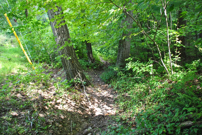
I didn't take many pictures of the trail in this area. They're in decent condition for being fishing trails with a few low spots that are usually muddy but nothing to worry about. They're easy to go around or through if necessary.


A picture of the trail! This is looking back towards the bridge on Cooks Glen Road which is a few hundred yards back.


A little further to the east, you'll begin to run into the equestrian trails which are in pretty good condition and easily passable.

An unknown stream runs into French Creek. Just upstream is this rocky spot with a few small waterfalls.

Alongside the unknown stream is this patch of rocks that stretch for a good distance.

Once I was done checking out the small stream, I turned back towards French Creek and located the horse trail again. You can see that these trails are in fairly good condition.


The horse trails also split off in different directions which was why I ended up getting turned around. At this point, both French Creek and one of the equestrian trails cut to the northeast (left) and was the direction I went.


At this spot, I was at the furthest point I had been to while fishing and had never explored beyond. If you look in the below picture, you'll see a cable crossing over the creek and the remnants of a sign hanging in the middle. This is the beginning of a fly fishing only zone on French Creek and the reason I've never gone further. I enjoy fishing but have never learned to fly fish.

Looking upstream from the area where the fly fishing only zone begins. A short distance upstream from the dock across the creek is the relative area where the trail on the opposite side runs into private property.


Somewhere in this area was where I ended up getting turned around and instead of continuing eastward along French Creek, the trail I took brought me south away from the creek.


Somewhere along the trail, I ran into private property but didn't notice until I saw this sign after passing through it. Sorry about that!

Looking into another area that was roped off and a deer that was looking back at me.


I'm not sure what these trails were at one time but a lot of them were wide enough that machinery could have driven on them. Giving the historical nature of the area with mills that were located not too far away, I have to wonder if these roads used to be traveled from one location to another during the Colonial and Industrial periods.

Some of these trails run to private property again. I ended up having to turn around a few times before eventually making my way back to French Creek.


The trail I took eventually brought me to the side of Sawmill Road. At this point, I was almost back to the car.

There are two different trail heads on Sawmill Road

Heading back to the car, on the corner of Sawmill and Cooks Glen Roads, there's another trail head entrance that I didn't check out. Eventually, I plan on returning to see where it leads.

That was it with my tour of this section of French Creek for the time being. While some of the trails in this area are private property, some of it also looks like it's public land that can be used for hiking or horseback riding. The fun part is that there are no trail maps and the trails head off in several different directions so you don't really know which one(s) will bring you to private property until you're on them. In all, it was a nice but short hike. I plan on eventually returning to see where these trails end up but there won't be any rush.
Until next time, happy adventures and happy hiking!
Please give my Facebook page a like!
After hiking at the Sanatoga County Preserve and deciding not to hike at the Linfield County Preserve, I ended up at one of my favorite fishing spots alongside French Creek just off Cooks Glen Road.
Approximate address:
60 Cooks Glen Road
Spring City, PA 19475
GPS: 40.1547708,-75.6400639
When you arrive and if you're approaching from Pughtown Road (from the north), there's a small parking area on the western (right hand) side of Cooks Glen Road just after you cross over French Creek.

As I mentioned, this is one of my favorite spots on French Creek to go fishing so I'm familiar with some of the trails that run along both sides of French Creek in this area. Eventually, the trails on the northern side of the creek will run into private property and you'll be forced to either turn back or cross over to the trails on the opposite side of the creek. On the southern side, the trails continue a distance further, I believe to the Sheeder Mill Farm where you can rent horses for trail riding. How far they go, I don't really know. It was my intention to find out but I ended up getting turned around on the trail.

French Creek is one of the few in the area where you can fish for trout just about all year round. The below view is looking upstream from the bridge on Cooks Glen Road. Looking into the water just beneath me, there were a few nice looking trout swimming around.

 |
| Looking downstream from the bridge on Cooks Glen Road |
You'll find a trail head almost directly across from the parking area and from there, you'll be heading east.
 |
| Bridge at Cooks Glen Road |

I didn't take many pictures of the trail in this area. They're in decent condition for being fishing trails with a few low spots that are usually muddy but nothing to worry about. They're easy to go around or through if necessary.


A picture of the trail! This is looking back towards the bridge on Cooks Glen Road which is a few hundred yards back.


A little further to the east, you'll begin to run into the equestrian trails which are in pretty good condition and easily passable.

An unknown stream runs into French Creek. Just upstream is this rocky spot with a few small waterfalls.

Alongside the unknown stream is this patch of rocks that stretch for a good distance.

Once I was done checking out the small stream, I turned back towards French Creek and located the horse trail again. You can see that these trails are in fairly good condition.


The horse trails also split off in different directions which was why I ended up getting turned around. At this point, both French Creek and one of the equestrian trails cut to the northeast (left) and was the direction I went.


At this spot, I was at the furthest point I had been to while fishing and had never explored beyond. If you look in the below picture, you'll see a cable crossing over the creek and the remnants of a sign hanging in the middle. This is the beginning of a fly fishing only zone on French Creek and the reason I've never gone further. I enjoy fishing but have never learned to fly fish.

Looking upstream from the area where the fly fishing only zone begins. A short distance upstream from the dock across the creek is the relative area where the trail on the opposite side runs into private property.


Somewhere in this area was where I ended up getting turned around and instead of continuing eastward along French Creek, the trail I took brought me south away from the creek.


Somewhere along the trail, I ran into private property but didn't notice until I saw this sign after passing through it. Sorry about that!

Looking into another area that was roped off and a deer that was looking back at me.


I'm not sure what these trails were at one time but a lot of them were wide enough that machinery could have driven on them. Giving the historical nature of the area with mills that were located not too far away, I have to wonder if these roads used to be traveled from one location to another during the Colonial and Industrial periods.

Some of these trails run to private property again. I ended up having to turn around a few times before eventually making my way back to French Creek.


 |
| Back to French Creek |

 |
| Concrete pillar in the middle of the woods? What for? |


The trail I took eventually brought me to the side of Sawmill Road. At this point, I was almost back to the car.

There are two different trail heads on Sawmill Road

 |
| Trail head on Sawmill Road |
Heading back to the car, on the corner of Sawmill and Cooks Glen Roads, there's another trail head entrance that I didn't check out. Eventually, I plan on returning to see where it leads.

That was it with my tour of this section of French Creek for the time being. While some of the trails in this area are private property, some of it also looks like it's public land that can be used for hiking or horseback riding. The fun part is that there are no trail maps and the trails head off in several different directions so you don't really know which one(s) will bring you to private property until you're on them. In all, it was a nice but short hike. I plan on eventually returning to see where these trails end up but there won't be any rush.
Until next time, happy adventures and happy hiking!
Please give my Facebook page a like!
This is Cooks Glen Park - website: http://www.westvincenttwp.org/cooks-glen-park/
ReplyDeleteI've loaded the park boundaries onto Openstreetmap.org