Date of Hike: Saturday, August, 22, 2015
Total Distance: 14.5 Miles*
Avg speed: 2.38 MPH*
Avg moving speed: 2.69 MPH*
Moving Time: 5:23:17*
Total Time: 6:05:56
Conditions: Sunny, 75 Degrees
Difficulty: Easy, Moderate, Difficult
*Like my last hike on the Horse-Shoe Trail, my GPS app lost its signal a few times out on the trail so the numbers are approximate. Fortunately, it wasn't nearly as bad as the last time so I'm a bit more confident on the accuracy of the statistics produced. I'm not sure if it's the phone itself or the app but either way, this almost never happens. It seems GPS apps and the Horse-Shoe Trail don't get along very well!
This time around, I chose to head out to St. Peters Village and hike to Welkinweir and back again. As of now, this is my longest hike of the season and it's safe to say I was happy to be back at my car when it was over. Perhaps it wasn't the best of choices to hike over 14 miles after a month and a half of a layoff but I went for it and came back in one piece. My previous longest hike of the season was at Ridley Creek State Park where I hiked just over 13 miles.
Approximate address for parking is:
3100 St. Peters Road
Elverson, PA 19520
GPS: 40.181211, -75.730608
Note that both the address and GPS coordinates are approximate but you won't have any troubles locating the parking lot, it's relatively large.

Once you get to the parking lot, cross the bridge over French Creek and keep going straight. The trail heads to the southwest, then turns to the south. Note that this isn't the Horse-Shoe Trail but it will lead you to it. Look for the light blue blazes.

If you look closely at the tree in the below picture, you'll see one of the light blue blazes. You'll be on this trail for at least a few minutes and it will take you away from the direction of French Creek.

When you spot the Horse-Shoe Trail (yellow blazes), turn to the left (south) to head towards Welkinweir. If you'd prefer to head west towards the Warwick Woods Campground and French Creek State Park, turn to the right.


The Horse-Shoe Trail eventually makes its way back to French Creek below the large boulders known as the Falls at French Creek. Note that if you want to follow French Creek along the rocks to get to the Horse-Shoe Trail, you can also do that as well. I chose to avoid that area this time around. If you want to see more of the Falls at French Creek, click on the above link for St. Peters Village.


The Horse-Shoe Trail stays alongside French Creek until you get to Ridge Road (State Route 23) where the creek starts to veer off to the southeast. When you get to the corner of Ridge and Hill Roads, cross over Ridge Road and keep heading south on Hill Road.

You'll pass Country Farm Lane on your way up Hill Road.

A short distance past Country Farm Lane, you'll see these trail markers. The trail cuts east through a small field between two properties. Like I mentioned in my last post about the Horse-Shoe Trail, please be mindful of the properties you're walking through and stay on the trail. I tend to push the envelope when it comes to potential trespassing but in this case, I don't want to ruin it for other hikers and it would be way too easy to get caught being somewhere you shouldn't be.

As you get through the small field, the trail drops into a small gully and back up a hill into another small field. You'll be walking alongside a wooden fence for a short distance.
The trail cuts to the north along the outskirts of the next field. Every once in a while, there's a trail marker but you may have to look for them in some areas since they're covered by tree branches, weeds, etc. When you get to the far edge of the field, the trail then turns again to the northeast.


I'm not sure if it's private property or if it's a maintenance area but as you continue on the trail heading northeast, you'll get to a point where you'll find a bench and the below trail register. From there, the trail turns again to the north.

When you get to the bottom of the above field, the trail turns again to the northeast.


From there, cross over County Park Road into Warwick County Park. Once you're in the park, follow the outskirts of the field heading to the southeast, then turning to the east. Technically, you could probably just cut straight across the field but I wanted to make sure I stayed along the trail markers.


The above picture is of the "bridge to nowhere" and is known as a Fink Truss bridge. It's the only surviving Fink Truss bridge in Pennsylvania. Patented by Albert Fink in 1854, the truss design provides the greatest strength and economy and is still the most widely used design in bridge building today. The metal frame of the bridge was built in 1870 by the Phoenix Iron Works in Phoenixville and was originally used as a pedestrian bridge over French Creek until 1990 where it was restored and now overlooks Warwick County Park.


It seems there's quite a bit of history regarding the iron industry at Warwick County Park and the local furnaces in the area which gives me a good reason to return and explore some more. I took a number of pictures but after seeing how much history is involved, I'm going to save them for a separate blog post when I return to explore the rest of the park.

Walking the Horse-Shoe Trail, I noted several more trails in the area that would have been worthy of checking out but I already had my objective in mind and wasn't going to stray off my plans.


From what I saw while hiking the Horse-Shoe Trail, the trails at Warwick County Park seem to be very well maintained.


As you get close to the eastern side of Warwick County Park, you'll be hiking alongside French Creek, or at least a small tributary of it.


Once you get to and cross over Mt. Pleasant Road, the trail turns to the southeast.


A few days ago, we had quite a bit of rain where I was at. I was surprised to see that most of the trail had very few muddy spots and those that did were easy to get through.


Once you get to the southeast corner of Warwick County Park, you'll have to cross the South Branch French Creek to continue on your way. Thankfully, all the rain we had didn't cause any problems with crossing. Just in case though, I had brought my sandals with me.

Just after you cross over the South Branch French Creek, you'll see these rocks which made for a nice place to stop and grab a quick snack.

I didn't see any but this looks to be the home of what's commonly known as a mud wasp. They're also known as organ pipe mud daubers. After breeding, the female mud dauber will build the nest which contains a number of chambers inside. In each chamber is a single egg and food for the eggs, usually spiders which the mud dauber will paralyze with a sting.


After hiking alongside the above field, the next road to cross is Coventryville Road. Once you get to this point, the trail turns to the south past the French Creek Elementary School and Warwick Furnace Road.


When Coventryville Road starts to turn to the southwest, you'll see where the Horse-Shoe Trail turns to the east back into the woods.

For the most part, hiking this section of the Horse-Shoe Trail was a breeze. This small portion of the trail (very small at that) was the only section where it was overgrown with weeds.


In this section of the Horse-Shoe Trail, it continues in a mostly eastward direction, cutting south in a few areas and back to the east again.


The trail then makes its way to Prizer Road and the below pond. From there, the trail then cuts back to the southwest (more south than west).


I didn't take any pictures but in this area as you're approaching Welkinweir, there's a long hill that brings you around a horse farm and above which will give you quite the challenge. This hill was one of the reasons I gave this hike a difficult rating. It was a big hill and somewhat steep in some areas. It felt like forever before I made it to the top!

Once you reach the top of the hill and head down the opposite side, you'll cross over this small stream. A little further down the trail is where the turn off is for Welkinweir.


I found this to be odd. When I turned onto the trail that leads to Welkinweir, most of the trees and branches in this area were dead and/or dying. I don't think it's from any type of chemical weed control since it stretched into the woods for quite a distance on both sides.


As you approach the property of Welkinweir, you'll see this pond and the estate on the top of the opposite hill. I crossed over the below bridge and checked out some of the area. I didn't go through all of the trails but I hope to return sometime to see the rest. According to their website, it's 197 acres with 55 of them being an arboretum. Welkinweir is home of Green Valleys Watershed Association.

I took a walk around the largest pond. There are a series of ponds which each being a little bit smaller than the next. If you'd like to visit Welkinweir to go hiking, you can get the trail map here.


I can't believe I was able to get so close to this great blue heron. As I was walking around the large pond, I saw it walk into the tall grass towards the water so I had an idea as to where it was. Why it didn't fly away is beyond me but it could clearly see me and was no more than about 15 feet away when I shot these pictures. Once I started moving again, it flew away but I got my pictures before it did!


Once I was done at Welkinweir, it was time to start heading back to St. Peters Village and the car. I only took a few pictures on my return hike.


I took a few shots looking upstream and downstream from the bridge on Mt. Pleasant Rd


Back on Hill Road, I saw this grater with the plow head on it when I started my hike but there were people splitting wood when I walked past. They weren't there on the way back so I was able to get a few shots. I don't think I've ever seen one of these before and it was pretty impressive.


Back at St. Peters and just about to get back to the car. I was very tired at the end of this hike but it was well worth it to me.
That was it for my hike in this section of the Horse-Shoe Trail. I may switch it up a little and hit a few local parks before heading back though. I prefer being able to hike on loop trails so I'm not overlapping and seeing areas I've already been to. This isn't a slight on the trail itself, I just like seeing new areas. In all though, it was a good workout, I topped my mileage for the season, and I got to see a beautiful section of the Horse-Shoe Trail with very little travel on roads. I look forwards to continuing my adventure!
Until next time, happy hiking and happy exploring!
Please give my Facebook page a like!
*Like my last hike on the Horse-Shoe Trail, my GPS app lost its signal a few times out on the trail so the numbers are approximate. Fortunately, it wasn't nearly as bad as the last time so I'm a bit more confident on the accuracy of the statistics produced. I'm not sure if it's the phone itself or the app but either way, this almost never happens. It seems GPS apps and the Horse-Shoe Trail don't get along very well!
This time around, I chose to head out to St. Peters Village and hike to Welkinweir and back again. As of now, this is my longest hike of the season and it's safe to say I was happy to be back at my car when it was over. Perhaps it wasn't the best of choices to hike over 14 miles after a month and a half of a layoff but I went for it and came back in one piece. My previous longest hike of the season was at Ridley Creek State Park where I hiked just over 13 miles.
Approximate address for parking is:
3100 St. Peters Road
Elverson, PA 19520
GPS: 40.181211, -75.730608
Note that both the address and GPS coordinates are approximate but you won't have any troubles locating the parking lot, it's relatively large.

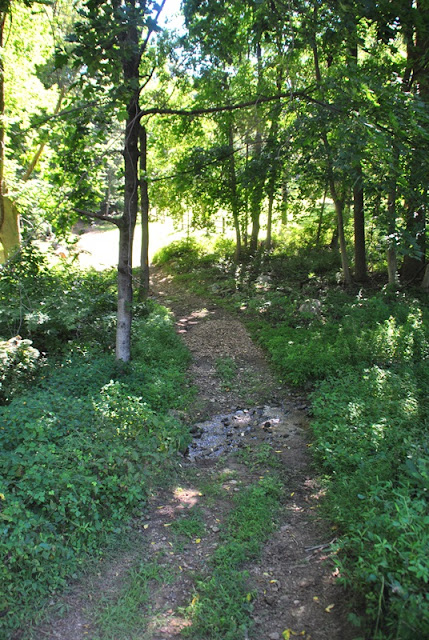
Once you get to the parking lot, cross the bridge over French Creek and keep going straight. The trail heads to the southwest, then turns to the south. Note that this isn't the Horse-Shoe Trail but it will lead you to it. Look for the light blue blazes.

If you look closely at the tree in the below picture, you'll see one of the light blue blazes. You'll be on this trail for at least a few minutes and it will take you away from the direction of French Creek.

When you spot the Horse-Shoe Trail (yellow blazes), turn to the left (south) to head towards Welkinweir. If you'd prefer to head west towards the Warwick Woods Campground and French Creek State Park, turn to the right.

 |
| The trail in this area was pretty rocky |

The Horse-Shoe Trail eventually makes its way back to French Creek below the large boulders known as the Falls at French Creek. Note that if you want to follow French Creek along the rocks to get to the Horse-Shoe Trail, you can also do that as well. I chose to avoid that area this time around. If you want to see more of the Falls at French Creek, click on the above link for St. Peters Village.


 |
| I have to wonder how this wall was built |

The Horse-Shoe Trail stays alongside French Creek until you get to Ridge Road (State Route 23) where the creek starts to veer off to the southeast. When you get to the corner of Ridge and Hill Roads, cross over Ridge Road and keep heading south on Hill Road.

You'll pass Country Farm Lane on your way up Hill Road.

A short distance past Country Farm Lane, you'll see these trail markers. The trail cuts east through a small field between two properties. Like I mentioned in my last post about the Horse-Shoe Trail, please be mindful of the properties you're walking through and stay on the trail. I tend to push the envelope when it comes to potential trespassing but in this case, I don't want to ruin it for other hikers and it would be way too easy to get caught being somewhere you shouldn't be.

As you get through the small field, the trail drops into a small gully and back up a hill into another small field. You'll be walking alongside a wooden fence for a short distance.

The trail cuts to the north along the outskirts of the next field. Every once in a while, there's a trail marker but you may have to look for them in some areas since they're covered by tree branches, weeds, etc. When you get to the far edge of the field, the trail then turns again to the northeast.

 |
| View from an opening in the trees in the above field |

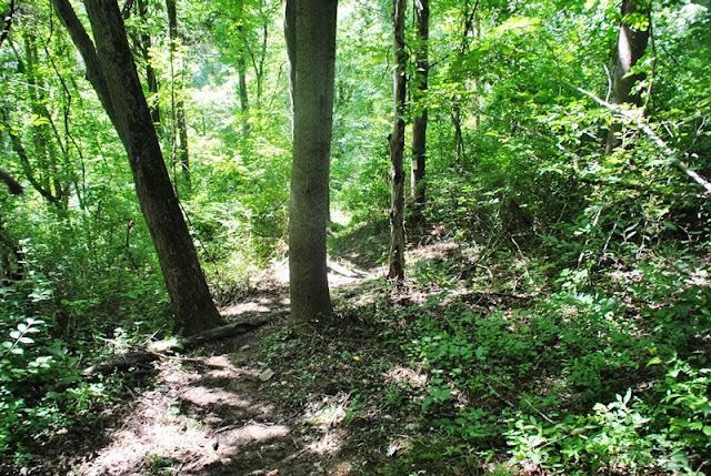
I'm not sure if it's private property or if it's a maintenance area but as you continue on the trail heading northeast, you'll get to a point where you'll find a bench and the below trail register. From there, the trail turns again to the north.

 |
| Horse-Shoe Trail looking north. |
When you get to the bottom of the above field, the trail turns again to the northeast.


From there, cross over County Park Road into Warwick County Park. Once you're in the park, follow the outskirts of the field heading to the southeast, then turning to the east. Technically, you could probably just cut straight across the field but I wanted to make sure I stayed along the trail markers.


The above picture is of the "bridge to nowhere" and is known as a Fink Truss bridge. It's the only surviving Fink Truss bridge in Pennsylvania. Patented by Albert Fink in 1854, the truss design provides the greatest strength and economy and is still the most widely used design in bridge building today. The metal frame of the bridge was built in 1870 by the Phoenix Iron Works in Phoenixville and was originally used as a pedestrian bridge over French Creek until 1990 where it was restored and now overlooks Warwick County Park.


It seems there's quite a bit of history regarding the iron industry at Warwick County Park and the local furnaces in the area which gives me a good reason to return and explore some more. I took a number of pictures but after seeing how much history is involved, I'm going to save them for a separate blog post when I return to explore the rest of the park.

Walking the Horse-Shoe Trail, I noted several more trails in the area that would have been worthy of checking out but I already had my objective in mind and wasn't going to stray off my plans.


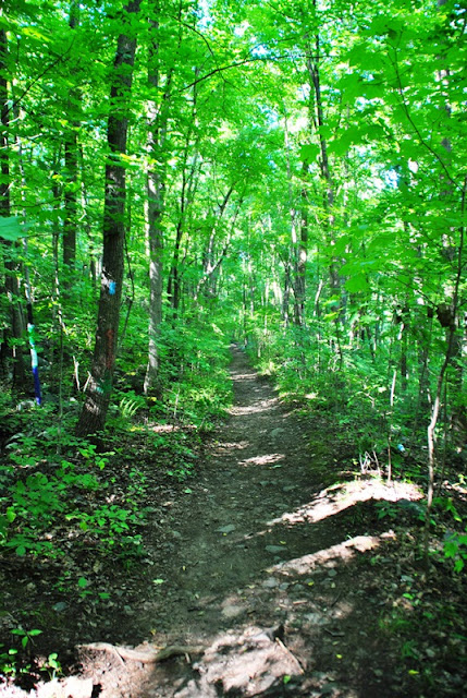
From what I saw while hiking the Horse-Shoe Trail, the trails at Warwick County Park seem to be very well maintained.

 |
| The Horse-Shoe Trail in Warwick County Park is long and relatively straight |


As you get close to the eastern side of Warwick County Park, you'll be hiking alongside French Creek, or at least a small tributary of it.


Once you get to and cross over Mt. Pleasant Road, the trail turns to the southeast.


A few days ago, we had quite a bit of rain where I was at. I was surprised to see that most of the trail had very few muddy spots and those that did were easy to get through.


 |
| Another muddy spot on the trail |
Once you get to the southeast corner of Warwick County Park, you'll have to cross the South Branch French Creek to continue on your way. Thankfully, all the rain we had didn't cause any problems with crossing. Just in case though, I had brought my sandals with me.

 |
| I took a shot looking downstream as I was crossing the creek |
Just after you cross over the South Branch French Creek, you'll see these rocks which made for a nice place to stop and grab a quick snack.

I didn't see any but this looks to be the home of what's commonly known as a mud wasp. They're also known as organ pipe mud daubers. After breeding, the female mud dauber will build the nest which contains a number of chambers inside. In each chamber is a single egg and food for the eggs, usually spiders which the mud dauber will paralyze with a sting.


After hiking alongside the above field, the next road to cross is Coventryville Road. Once you get to this point, the trail turns to the south past the French Creek Elementary School and Warwick Furnace Road.


 |
| Always sad to see a family has lost their dog. |

When Coventryville Road starts to turn to the southwest, you'll see where the Horse-Shoe Trail turns to the east back into the woods.

For the most part, hiking this section of the Horse-Shoe Trail was a breeze. This small portion of the trail (very small at that) was the only section where it was overgrown with weeds.


In this section of the Horse-Shoe Trail, it continues in a mostly eastward direction, cutting south in a few areas and back to the east again.


The trail then makes its way to Prizer Road and the below pond. From there, the trail then cuts back to the southwest (more south than west).


I didn't take any pictures but in this area as you're approaching Welkinweir, there's a long hill that brings you around a horse farm and above which will give you quite the challenge. This hill was one of the reasons I gave this hike a difficult rating. It was a big hill and somewhat steep in some areas. It felt like forever before I made it to the top!


Once you reach the top of the hill and head down the opposite side, you'll cross over this small stream. A little further down the trail is where the turn off is for Welkinweir.


I found this to be odd. When I turned onto the trail that leads to Welkinweir, most of the trees and branches in this area were dead and/or dying. I don't think it's from any type of chemical weed control since it stretched into the woods for quite a distance on both sides.

 |
| Map of Welkinweir |

As you approach the property of Welkinweir, you'll see this pond and the estate on the top of the opposite hill. I crossed over the below bridge and checked out some of the area. I didn't go through all of the trails but I hope to return sometime to see the rest. According to their website, it's 197 acres with 55 of them being an arboretum. Welkinweir is home of Green Valleys Watershed Association.

I took a walk around the largest pond. There are a series of ponds which each being a little bit smaller than the next. If you'd like to visit Welkinweir to go hiking, you can get the trail map here.


 |
| Minus all the markings, I thought this was a pretty neat looking tree |


I can't believe I was able to get so close to this great blue heron. As I was walking around the large pond, I saw it walk into the tall grass towards the water so I had an idea as to where it was. Why it didn't fly away is beyond me but it could clearly see me and was no more than about 15 feet away when I shot these pictures. Once I started moving again, it flew away but I got my pictures before it did!


 |
| Perhaps from a beaver at one time? Markings are old if it was. |
 |
| Back to where I started at Welkinweir |
 |
| I didn't see this on my way in but as I was leaving, I spotted this fireplace. I wonder what it was at one time? |
Once I was done at Welkinweir, it was time to start heading back to St. Peters Village and the car. I only took a few pictures on my return hike.


 |
| Stream crossing in the southeast corner of Warwick County Park |

I took a few shots looking upstream and downstream from the bridge on Mt. Pleasant Rd


Back on Hill Road, I saw this grater with the plow head on it when I started my hike but there were people splitting wood when I walked past. They weren't there on the way back so I was able to get a few shots. I don't think I've ever seen one of these before and it was pretty impressive.


Back at St. Peters and just about to get back to the car. I was very tired at the end of this hike but it was well worth it to me.

That was it for my hike in this section of the Horse-Shoe Trail. I may switch it up a little and hit a few local parks before heading back though. I prefer being able to hike on loop trails so I'm not overlapping and seeing areas I've already been to. This isn't a slight on the trail itself, I just like seeing new areas. In all though, it was a good workout, I topped my mileage for the season, and I got to see a beautiful section of the Horse-Shoe Trail with very little travel on roads. I look forwards to continuing my adventure!
Until next time, happy hiking and happy exploring!
Please give my Facebook page a like!
Thank you! I enjoyed your photos
ReplyDeleteYou're welcome!
DeleteAwesome pictures! Always wanted to spend a day in the are and see what there was to see. Now I have to go and see for myself. Thank you so much for the inspiration!!
ReplyDeleteThanks! I'm glad to have inspired you, you won't be disappointed. There's plenty of hiking in the St. Peter's area, enough for several days worth, enjoy your adventure(s)!
Delete