Date of Hike: Tuesday, August 18, 2015
Total Distance: 8.5-9 Miles (approximate)
Avg speed: Unknown*
Avg moving speed: Unknown*
Moving Time: Unknown*
Total Time: 4:16:52 (approximate)
Conditions: Sunny, 88 Degrees
Difficulty: Easy, Moderate
I'm back! FINALLY, after almost a month and a half without hiking, I've been able to hit the trail again. To say that it felt great to be out there would be an understatement...it was awesome! It's good to be back! With that being said, my adventure this past Tuesday took me from the Great Valley Nature Center to the Brightside Farm on the Horse-Shoe Trail. It was hot, humid, and I was sweating bullets but it was worth every step.
If you look at the below picture, you'll see a number of gaps in the track that was being recorded by my phone which is why the above numbers are either approximate or unknown. Sadly, my phone lost its GPS signal numerous times which led to inaccurate statistics. The only reason I have an idea about how far I hiked is because I purchased a map of the Horse-Shoe Trail which provides approximate distances between landmarks. There are maps of the Horse-Shoe Trail online but none that will provide you with the detail you'll get from the purchased maps (there are 10 maps in total for the trail).

As stated, I parked at the Great Valley Nature Center. The address to the center is:
4251 State Road
Devault, PA 19432
GPS: 40.09128,-75.54391
Take note that the parking lot for the Great Valley Nature Center isn't on State Road. If you're traveling on State Road (State Route 29) to get to the center, you'll want to turn onto Hollow road and the parking lot will be on your right a very short distance from State Road. That address is:
4180 Hollow Road
Malvern, PA 19355
GPS: 40.0908442,-75.5442263
Established in 1998, the Great Valley Nature Center serves as a home for permanently injured raptors that can no longer be released back into the wild. That's not their only function though, there's also an environmental education center, a summer camp for kids, scout programs, adult adventures and probably a bunch more that I'm missing. There are also a number of short trails throughout the center to explore.
Although the place is small and you won't get lost, if you want to bring a trail map with you, it can be found here.

Once I arrived at the nature center, my first objective was to walk some of the trails before jumping on the Horse-Shoe Trail. I headed north alongside a small creek that's at the center. Somewhere in the area, the Horse-Shoe Trail also heads in a northerly direction although I wasn't able to spot any of the trail markers.


At this point, I was about as far north as I could go. The bridge you see below is State Road. Once I got to this point, I turned south back towards the nature center and crossed the bridge in the above picture to explore the rest of the center. I've been there a number of times before but as usual, there's always something to take pictures of.

For the most part, I stayed along the outskirts of the nature center. There was a summer camp in session and quite a few kids enjoying their own outdoor activities which I avoided.


There's a small pond at the nature center along with a whole lot of lily pads. There were several flowers in the pond but no place alongside it where a close shot could have been taken.


As you get closer to the main area where the environmental education center is, you'll also find the Birds of Prey Center where the raptors are being cared for.

It's hard to get pictures of these birds when there's caging in the way but I took a few shots anyway. Some of them came out ok, others not so much.


Once past the Birds of Prey Center, I continued southwest to the edge of the preserve and a grove of evergreen trees. According to the map, there are supposed to be beehives in the area but I didn't see them.

In the southwestern corner of the nature center is a Lenape Native American village and a few dwellings to check out.


Once past the Lenape dwellings, I circled back to the northeast and crossed over the below bridge which will bring you back out to the parking lot.

Once I crossed the bridge, I turned to the south to find the Horse-Shoe trail. I believe this section of the trail is still part of the Great Valley nature Center.

The trail runs alongside the creek up to Hollow Road and once you cross over, you'll find a marker for the Horse-Shoe Trail. According to the Horse-Shoe Trail Conservancy, the trail which was originally 121 miles long is now 148 miles and is the longest single equestrian trail in Pennsylvania. It runs from Valley Forge to the Appalachian Trail in Dauphin County, PA. I've hiked sections of the Horse-Shoe Trail before but it was usually while hiking other trails in parks or on game lands. This was the first time where it was my objective to specifically hike the Horse-Shoe Trail.

Throughout this section of the trail, it was well marked and I had little trouble finding my way.

Just a short distance south of the Great valley nature Center is this pond although the water looks to be stagnant.

While the trail was well marked, there are sections where it's overgrown with weeds but you can still see the path. Although it was hot, I was glad to have been wearing long pants.


Continuing south, you'll be walking alongside State Road for a distance. For the most part, the trail keeps you away from the traffic so there's no need to worry about being too close. State Road is pretty busy during the morning rush but there's plenty of space to walk along the side in the areas where the trail doesn't cut through the woods. A short distance after you cross over Dickson Drive, the trail cuts to the west back into the woods.


A short distance after cutting to the west away from State Road, you'll find this mailbox. Inside the mailbox is a register for those who are hiking the trail if you choose to sign it. In this area, you'll cross over a small creek and from here, the trail begins a turn to the southwest.

In this section of woods, you'll be able to hear machinery from a local quarry. Hiking this section of the Horse-Shoe Trail isn't like hiking in the local State Parks where you can get away from civilization. In this section of the Horse-Shoe Trail, you're pretty much always relatively close to homes, or in this case, a quarry.


As you continue on the Horse-Shoe Trail, it'll eventually bring you behind the Charlestown Elementary School and loops around the outskirts of the property. If you'd like to start your hike here, the school allows hikers to park in the back left side (northwest corner) of the parking lot.


This was really the only area where I got a little bit confused with the trail. In the above picture, you'll see a mailbox and the far edge of a white house across Charlestown Road. Somewhere close to the home is a sign indicating there's a turn in the trail but it's posted about 40-50 yards away from where it actually turns. I ended up walking around for a short while looking for the trail, including on the property of the white house (I'll explain this in a bit) but it wasn't on their land...sorry about that!
If you're ever in this area, cross over Charlestown Road, walk past the white house, and as you get to the area where the woods are, look to your left and you'll find the trail. At this point, the trail turns to the west.

The trail will then lead you to the side of Pikeland Road which you'll be walking on for a distance.

As you're walking on Pikeland Road, you'll cross over Constant Spring Road and shortly after that, you'll see a driveway to a home that cuts off in about a 45 degree angle. Follow that driveway and you'll find that the trail continues through this property.
Giving the Horse-Shoe Trail is so long and cuts through many neighborhoods, some of the sections of trail are on private property which was why I ended up walking around on the property of the white home on Charlestown Road looking for the trail. Much work has been done by the Horse-Shoe Trail Conservancy to get the trail off as many roads as possible which is hard to do in such a busy area. A big thanks goes out to both the conservancy and to those property owners who have allowed for the trail to cut through their land.
With this being said, if you hike the Horse-Shoe Trail, please be considerate of those property owners, stay on the trail, and take your trash with you until you get to a waste basket.

This is a section of the trail that cuts through the property next to Pikeland Road.

Once you get to the corner of Pikeland and Hollow Roads, the trail cuts to the south on Hollow Road.

Follow Hollow Road for a distance which will turn to the west and once you get to Blackberry Lane, follow it heading south.


Keep following Blackberry Lane until you get to Oak Lane which is a sharp turn heading northwest.


You'll be on Oak Lane for a very short distance and from there, turn onto Dobbs Lane heading southwest.

Once you get to the end of Dobbs Lane which is a cul-de-sac, you'll see the below sign saying to stay on the trail between the driveways.

Once you get past the homes on Dobbs Lane, you'll be in the woods for a distance. I'm not sure why I didn't take many pictures in this area but I didn't. I think it was because I was being pestered by mosquitoes in this stretch even though I had sprayed myself with repellent. The little buggars kept buzzing my ears!


The trail will then lead you to Sidley Hill Road somewhere in this area here.

The trail then follows Yellow Springs Road to the northwest.

On the corner of Hollow and Yellow Springs Roads, you'll see a sign for the Brightside Trail.


The trail continues northwest along Yellow Springs Road, cuts to the left side of the barn in the below picture, then turns to the southwest on Valley Hill Drive. This was also where I turned off the Horse-Shoe Trail.


I believe this is a red tail hawk. I'm actually surprised I was able to get this decent of a shot, it was a pretty good distance away.


After turning off the Horse-Shoe Trail, I had reached my objective of visiting the Brightside Farm (or is it Bright Side?).

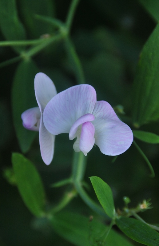
I didn't explore too much of the farm although I think I could have. The one attraction I wanted to check out is the garden which unfortunately, is for members only. There were some beautiful flowers in the garden I would have loved to have taken some pictures of but the area is fenced off.

The fence on the top of the hill is the garden I am referring to. I followed the above sign and stopped to take a rest and grab a snack in a shady spot on the trail.


Once I was done at the Bright Side Farm, it was time to head back to the Great Valley Nature Center. With the exception of the two pictures below, I didn't take any more pictures on the way back.


That was it for my adventure on the Horse-Shoe Trail for the day. As already stated, the Horse-Shoe Trail is 148 miles long so there's a lot more of it to explore. This was just the first of many (I hope) adventures along this trail. I actually went hiking on the trail again today (it's currently Saturday, August 22) so I should have another upcoming post within the next few days.
In all, it was a good day of hiking as always. I don't particularly care for walking on the sides of roads but I've always wanted to hike the Horse-Shoe Trail so in this case, I have to suck it up and deal with it. It was my first time out in over a month so it was well worth the hike.
Until next time, happy adventures and happy hiking!
Please give my Facebook page a like!
I'm back! FINALLY, after almost a month and a half without hiking, I've been able to hit the trail again. To say that it felt great to be out there would be an understatement...it was awesome! It's good to be back! With that being said, my adventure this past Tuesday took me from the Great Valley Nature Center to the Brightside Farm on the Horse-Shoe Trail. It was hot, humid, and I was sweating bullets but it was worth every step.
If you look at the below picture, you'll see a number of gaps in the track that was being recorded by my phone which is why the above numbers are either approximate or unknown. Sadly, my phone lost its GPS signal numerous times which led to inaccurate statistics. The only reason I have an idea about how far I hiked is because I purchased a map of the Horse-Shoe Trail which provides approximate distances between landmarks. There are maps of the Horse-Shoe Trail online but none that will provide you with the detail you'll get from the purchased maps (there are 10 maps in total for the trail).

As stated, I parked at the Great Valley Nature Center. The address to the center is:
4251 State Road
Devault, PA 19432
GPS: 40.09128,-75.54391
Take note that the parking lot for the Great Valley Nature Center isn't on State Road. If you're traveling on State Road (State Route 29) to get to the center, you'll want to turn onto Hollow road and the parking lot will be on your right a very short distance from State Road. That address is:
4180 Hollow Road
Malvern, PA 19355
GPS: 40.0908442,-75.5442263
Established in 1998, the Great Valley Nature Center serves as a home for permanently injured raptors that can no longer be released back into the wild. That's not their only function though, there's also an environmental education center, a summer camp for kids, scout programs, adult adventures and probably a bunch more that I'm missing. There are also a number of short trails throughout the center to explore.
Although the place is small and you won't get lost, if you want to bring a trail map with you, it can be found here.

Once I arrived at the nature center, my first objective was to walk some of the trails before jumping on the Horse-Shoe Trail. I headed north alongside a small creek that's at the center. Somewhere in the area, the Horse-Shoe Trail also heads in a northerly direction although I wasn't able to spot any of the trail markers.


 |
| Unnamed creek that runs through the nature center |

At this point, I was about as far north as I could go. The bridge you see below is State Road. Once I got to this point, I turned south back towards the nature center and crossed the bridge in the above picture to explore the rest of the center. I've been there a number of times before but as usual, there's always something to take pictures of.

For the most part, I stayed along the outskirts of the nature center. There was a summer camp in session and quite a few kids enjoying their own outdoor activities which I avoided.


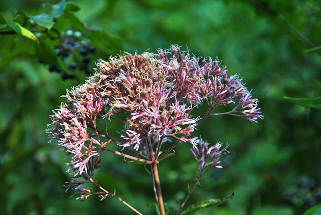
There's a small pond at the nature center along with a whole lot of lily pads. There were several flowers in the pond but no place alongside it where a close shot could have been taken.


 |
| I'm not really sure what this is, perhaps for woodpeckers? |
As you get closer to the main area where the environmental education center is, you'll also find the Birds of Prey Center where the raptors are being cared for.

It's hard to get pictures of these birds when there's caging in the way but I took a few shots anyway. Some of them came out ok, others not so much.


Once past the Birds of Prey Center, I continued southwest to the edge of the preserve and a grove of evergreen trees. According to the map, there are supposed to be beehives in the area but I didn't see them.

In the southwestern corner of the nature center is a Lenape Native American village and a few dwellings to check out.


Once past the Lenape dwellings, I circled back to the northeast and crossed over the below bridge which will bring you back out to the parking lot.

Once I crossed the bridge, I turned to the south to find the Horse-Shoe trail. I believe this section of the trail is still part of the Great Valley nature Center.

 |
| Small bridge crossing over Hollow Road |
The trail runs alongside the creek up to Hollow Road and once you cross over, you'll find a marker for the Horse-Shoe Trail. According to the Horse-Shoe Trail Conservancy, the trail which was originally 121 miles long is now 148 miles and is the longest single equestrian trail in Pennsylvania. It runs from Valley Forge to the Appalachian Trail in Dauphin County, PA. I've hiked sections of the Horse-Shoe Trail before but it was usually while hiking other trails in parks or on game lands. This was the first time where it was my objective to specifically hike the Horse-Shoe Trail.

Throughout this section of the trail, it was well marked and I had little trouble finding my way.

Just a short distance south of the Great valley nature Center is this pond although the water looks to be stagnant.

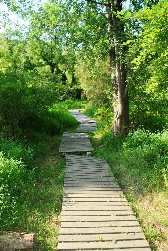
While the trail was well marked, there are sections where it's overgrown with weeds but you can still see the path. Although it was hot, I was glad to have been wearing long pants.


Continuing south, you'll be walking alongside State Road for a distance. For the most part, the trail keeps you away from the traffic so there's no need to worry about being too close. State Road is pretty busy during the morning rush but there's plenty of space to walk along the side in the areas where the trail doesn't cut through the woods. A short distance after you cross over Dickson Drive, the trail cuts to the west back into the woods.


 |
| Another section of the trail that was overgrown |

A short distance after cutting to the west away from State Road, you'll find this mailbox. Inside the mailbox is a register for those who are hiking the trail if you choose to sign it. In this area, you'll cross over a small creek and from here, the trail begins a turn to the southwest.

In this section of woods, you'll be able to hear machinery from a local quarry. Hiking this section of the Horse-Shoe Trail isn't like hiking in the local State Parks where you can get away from civilization. In this section of the Horse-Shoe Trail, you're pretty much always relatively close to homes, or in this case, a quarry.


As you continue on the Horse-Shoe Trail, it'll eventually bring you behind the Charlestown Elementary School and loops around the outskirts of the property. If you'd like to start your hike here, the school allows hikers to park in the back left side (northwest corner) of the parking lot.


This was really the only area where I got a little bit confused with the trail. In the above picture, you'll see a mailbox and the far edge of a white house across Charlestown Road. Somewhere close to the home is a sign indicating there's a turn in the trail but it's posted about 40-50 yards away from where it actually turns. I ended up walking around for a short while looking for the trail, including on the property of the white house (I'll explain this in a bit) but it wasn't on their land...sorry about that!
If you're ever in this area, cross over Charlestown Road, walk past the white house, and as you get to the area where the woods are, look to your left and you'll find the trail. At this point, the trail turns to the west.

The trail will then lead you to the side of Pikeland Road which you'll be walking on for a distance.

As you're walking on Pikeland Road, you'll cross over Constant Spring Road and shortly after that, you'll see a driveway to a home that cuts off in about a 45 degree angle. Follow that driveway and you'll find that the trail continues through this property.
Giving the Horse-Shoe Trail is so long and cuts through many neighborhoods, some of the sections of trail are on private property which was why I ended up walking around on the property of the white home on Charlestown Road looking for the trail. Much work has been done by the Horse-Shoe Trail Conservancy to get the trail off as many roads as possible which is hard to do in such a busy area. A big thanks goes out to both the conservancy and to those property owners who have allowed for the trail to cut through their land.
With this being said, if you hike the Horse-Shoe Trail, please be considerate of those property owners, stay on the trail, and take your trash with you until you get to a waste basket.

This is a section of the trail that cuts through the property next to Pikeland Road.

Once you get to the corner of Pikeland and Hollow Roads, the trail cuts to the south on Hollow Road.

Follow Hollow Road for a distance which will turn to the west and once you get to Blackberry Lane, follow it heading south.

 |
| Although not steep, there's a pretty long hill to climb on Blackberry Lane. |
 |
| Spider web in a wooden fence with the spider waiting for its next meal. Creepy looking! |

Keep following Blackberry Lane until you get to Oak Lane which is a sharp turn heading northwest.


You'll be on Oak Lane for a very short distance and from there, turn onto Dobbs Lane heading southwest.

Once you get to the end of Dobbs Lane which is a cul-de-sac, you'll see the below sign saying to stay on the trail between the driveways.

 |
| Another register box on the trail |
Once you get past the homes on Dobbs Lane, you'll be in the woods for a distance. I'm not sure why I didn't take many pictures in this area but I didn't. I think it was because I was being pestered by mosquitoes in this stretch even though I had sprayed myself with repellent. The little buggars kept buzzing my ears!


The trail will then lead you to Sidley Hill Road somewhere in this area here.

 |
| Intersection of Sidley Hill and Yellow Springs Roads |
The trail then follows Yellow Springs Road to the northwest.

On the corner of Hollow and Yellow Springs Roads, you'll see a sign for the Brightside Trail.


 |
| Opposite of the sign for the Brightside Farm, you see this sign for the Deerfield Estates (and Horse-Shoe Trail) |

The trail continues northwest along Yellow Springs Road, cuts to the left side of the barn in the below picture, then turns to the southwest on Valley Hill Drive. This was also where I turned off the Horse-Shoe Trail.


I believe this is a red tail hawk. I'm actually surprised I was able to get this decent of a shot, it was a pretty good distance away.


After turning off the Horse-Shoe Trail, I had reached my objective of visiting the Brightside Farm (or is it Bright Side?).

 |
| A little bit of history about the Bright Side Farm |
I didn't explore too much of the farm although I think I could have. The one attraction I wanted to check out is the garden which unfortunately, is for members only. There were some beautiful flowers in the garden I would have loved to have taken some pictures of but the area is fenced off.

The fence on the top of the hill is the garden I am referring to. I followed the above sign and stopped to take a rest and grab a snack in a shady spot on the trail.


Once I was done at the Bright Side Farm, it was time to head back to the Great Valley Nature Center. With the exception of the two pictures below, I didn't take any more pictures on the way back.


That was it for my adventure on the Horse-Shoe Trail for the day. As already stated, the Horse-Shoe Trail is 148 miles long so there's a lot more of it to explore. This was just the first of many (I hope) adventures along this trail. I actually went hiking on the trail again today (it's currently Saturday, August 22) so I should have another upcoming post within the next few days.
In all, it was a good day of hiking as always. I don't particularly care for walking on the sides of roads but I've always wanted to hike the Horse-Shoe Trail so in this case, I have to suck it up and deal with it. It was my first time out in over a month so it was well worth the hike.
Until next time, happy adventures and happy hiking!
Please give my Facebook page a like!
No comments:
Post a Comment