Date of Hike: Monday, May 16, 2016
Total Distance: 9.24 Miles
Avg speed: 2.4 MPH
Total Time: 3:48:49
Conditions: Sunny, 62 Degrees
Difficulty: Easy, Moderate
On Monday the 16th of May, I took a ride back out to Green Lane Park to explore the Orange and Hemlock Point Trails. With the exploration of these trails, this also completed the final section of the Perkiomen Trail that I hadn't yet explored.
Starting out the day, it was chilly and windy, less than the 62 degrees mentioned but once I got moving, there wasn't much of a problem staying warm even though I had forgotten my jacket.
Address:
2144 Snyder Road
Perkiomenville, PA 18074
GPS: 40.330134,-75.485952
Note that this is the main address to Green Lane Park. There are two parking lots in the vicinity, one of which is on Deep Creek Road and the other at the above address. I parked in the lot on Deep Creek Road since that's where the trail head is for the Orange Trail. For a copy of the trail map, click here.
I had a rough day picture-wise. A number of the pictures I took ended up being either overexposed or blurry. I usually like to mix things up and not just have pictures of trails but in this case, quite a few of the pictures I took of flowers, insects, etc. sadly didn't make the final cut so this won't be the most thrilling of tours.

The trail head for the Orange Trail is in back left side of the parking lot (southwestern corner). You won't be able to miss the kiosk or signs.

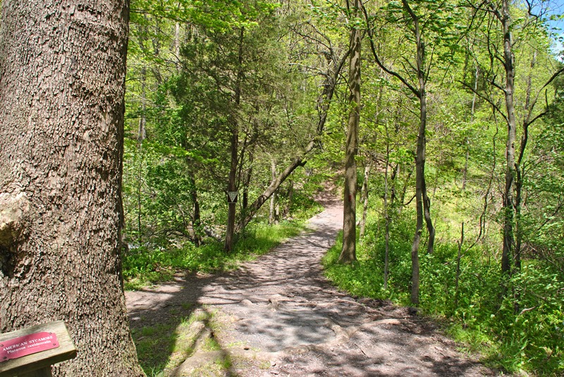
To start out, the trails are in pretty good condition. What I wasn't expecting were the number of intersecting trails throughout the Orange Trail, several of which aren't shown on the trail map. If and/or when you go, make sure you're aware of this and don't expect to just find the loop trail that you'll see on the trail map. For the time being, I was headed in a southerly direction.


Normally, in effort to try to indicate where on the trail I am, I'll take pictures of the intersections but after running into far more than I had anticipated, I finally gave up and stopped taking pictures of a number of them. You can see below that a turn is indicated but there were areas where trees were marked orange on the multiple trails which didn't help with figuring out which direction to go and only added to the confusion, especially since it was supposed to be a loop trail. There were also a number of other trails that had black markers which I'm not sure if they were connecting trails or were supposed to be blotted out. Regardless, there are a lot more trails than what's indicated and it basically made the trail map useless.


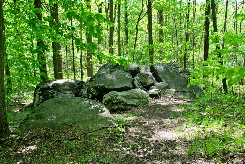
Throughout the hike on the Orange Trail, there were stone walls in a number of places as well. Somewhere in this area, I made a turn back to the north.


There were also a number of spots that were muddy along the Orange Trail but nothing that you couldn't walk through or around. Those you might have had to walk through weren't too deep or difficult to deal with.


This also added a little bit to the confusion. Just up the trail from where I took this picture is another intersecting trail but to the right, there's also a private property sign. There are homes in the area but on such well beaten trails, I wasn't sure what part of the land was supposed to be private.

The first of a few road crossings was on Snyder Road.


By now, I had gone from north to west and was looping back to the south where I ran into this large stone wall, much larger then the others I had seen throughout the Orange Trail.

Opposite the large stone wall, I found my answer as to how it got there. It looks to be a gas line where the rocks had been moved from. It's hard to tell in the pictures but these rocks were large enough to where it likely would have taken machinery to move them.


Still heading south, the Orange Trail led out to the clearing where the gas line was running through.


After a short distance, it was back into the woods. slowly turning to the southeast, then to the east.


I crossed over a section of the Orange Trail I had already been on and kept heading to the east.


Making my way out of the woods, I found these abandoned buildings. They look to be old outhouses but I really didn't go out of my way to figure it out.


At this point, I had made my way to the Perkiomen Trail. Alongside Deep Creek Road, I found an azalea bush/tree (at least I think that's what this is). At least a few of my flower pictures came out ok!


Once I was on the Perkiomen Trail, I was on my way north to the Hemlock Point Trail which is on the opposite side of Deep Creek and Knight Lakes.

In this area, the Perkiomen Trail turns to the west


Small bridge crossing over Deep Creek...the water wasn't that deep!

I couldn't find much history about this bridge, only a note about a bid to repair it in 2014.

Once you cross over Deep Creek, the Perkiomen Trail turns to the east alongside Deep Creek Lake and Green Lane Road.

This crosswalk is for the connecting trail that will bring you to the Blue Trail which I explored back in February.


After passing the above sign for the Blue Trail, I didn't take pictures for a distance since it runs past another parking lot. Once beyond the parking lot, it was back into the woods alongside Knight Lake.


Remnants of an old railroad bridge. As you approach the bridge, there's a small trail leading up to it which I followed in hopes of getting a closer shot but unfortunately, it's fenced off and pretty much overgrown with trees and bushes.


Shortly after crossing over the Perkiomen Creek, the Perkiomen Trail takes a turn to the north.
The Perkiomen Trail crosses under Hill Road and makes a turn to the west, running along side Gravel Pike (State Route 29) for a distance.

The Perkiomen Trail then takes a turn to the north and up a moderate but somewhat long hill. If you look at the fence to the left, it looks like you can see right through it but that was only on an angle. If you're standing right next to it, there are small slats with very little space to see through them. Peeking through the small openings, there's a pretty far drop on the other side as well a dam.

Turning back to the west, the Perkiomen Trail then takes you past the Marlborough Elementary School.


Now heading north, I'm not sure what this building is or if it's still open but it looks to be abandoned.


At this point, I had reached the end of the Perkiomen Trail and past the Hemlock Point Day Use Area. There were some cars in the parking lot but to me, it looks like it's not as well maintained as the other parking lots throughout Green Lane Park.

As you approach the Green Lane Reservoir, this is also where you can find the Red Trail which continues to the northwest and the Hemlock Point Trail which heads to the south and was the direction I went. There are two different entrances to the Hemlock Point Trail, the other is off the Perkiomen Trail alongside Marlborough Elementary School.


Although the Hemlock Point Trail runs alongside the Green Lane Reservoir, there weren't many spots where you can get a good view of the water.

Somewhere in this area, the Hemlock Point Trail turns to the east.


On the way back down the hill alongside Gravel Pike, I was able to find an opening in the fence and get somewhat of a picture of the spillway. Aqua owns the property and apparently, it seems they don't want anyone looking down there! It's a shame because even though it's man made, it's a pretty nice view.

On my return to the car, I only took a few more shots. For some reason, I just wasn't feeling the mojo I usually do when taking pictures on the trail which might explain how they came out. Instead of following the Perkiomen Trail, I hiked alongside Deep Creek Lake for a distance which eventually brought me back to the Perkiomen Trail but at least it was a change of scenery instead of walking along the side of a road.


That was it for my adventure at Green Lane Park for the day and for the most part, it was a pretty good one. Both the Orange and Hemlock Point Trails are definitely worth checking out. Giving the number of trails I saw on what was supposed to be the Orange Trail loop, I think I'd like to return to this area so I can figure out where the rest of them lead and attempt to map them out. When I first started hiking, this would have thrown me into a panic thinking I was on the wrong trail or going to get lost but after hiking as much as I have over the last few years, you learn to roll with the punches. This time around, it was just a bunch of "what the heck?" moments as I ran into each intersecting trail.
In all, it was a good adventure. It was nice to enjoy the quiet for a few hours and also to get out on the trail again after hiking only a few times since February. The trails at Green Lane Park are pretty nice and definitely worth the drive!
Until next time, happy adventures and happy hiking!
On Monday the 16th of May, I took a ride back out to Green Lane Park to explore the Orange and Hemlock Point Trails. With the exploration of these trails, this also completed the final section of the Perkiomen Trail that I hadn't yet explored.
Starting out the day, it was chilly and windy, less than the 62 degrees mentioned but once I got moving, there wasn't much of a problem staying warm even though I had forgotten my jacket.
Address:
2144 Snyder Road
Perkiomenville, PA 18074
GPS: 40.330134,-75.485952
Note that this is the main address to Green Lane Park. There are two parking lots in the vicinity, one of which is on Deep Creek Road and the other at the above address. I parked in the lot on Deep Creek Road since that's where the trail head is for the Orange Trail. For a copy of the trail map, click here.
I had a rough day picture-wise. A number of the pictures I took ended up being either overexposed or blurry. I usually like to mix things up and not just have pictures of trails but in this case, quite a few of the pictures I took of flowers, insects, etc. sadly didn't make the final cut so this won't be the most thrilling of tours.

The trail head for the Orange Trail is in back left side of the parking lot (southwestern corner). You won't be able to miss the kiosk or signs.

To start out, the trails are in pretty good condition. What I wasn't expecting were the number of intersecting trails throughout the Orange Trail, several of which aren't shown on the trail map. If and/or when you go, make sure you're aware of this and don't expect to just find the loop trail that you'll see on the trail map. For the time being, I was headed in a southerly direction.


 |
| Another intersecting trail |


Normally, in effort to try to indicate where on the trail I am, I'll take pictures of the intersections but after running into far more than I had anticipated, I finally gave up and stopped taking pictures of a number of them. You can see below that a turn is indicated but there were areas where trees were marked orange on the multiple trails which didn't help with figuring out which direction to go and only added to the confusion, especially since it was supposed to be a loop trail. There were also a number of other trails that had black markers which I'm not sure if they were connecting trails or were supposed to be blotted out. Regardless, there are a lot more trails than what's indicated and it basically made the trail map useless.


Throughout the hike on the Orange Trail, there were stone walls in a number of places as well. Somewhere in this area, I made a turn back to the north.


There were also a number of spots that were muddy along the Orange Trail but nothing that you couldn't walk through or around. Those you might have had to walk through weren't too deep or difficult to deal with.


This also added a little bit to the confusion. Just up the trail from where I took this picture is another intersecting trail but to the right, there's also a private property sign. There are homes in the area but on such well beaten trails, I wasn't sure what part of the land was supposed to be private.

The first of a few road crossings was on Snyder Road.


 |
| Sections of the Orange Trail also get pretty rocky although nothing too difficult. |

 |
| Remnants of a bees nest |

By now, I had gone from north to west and was looping back to the south where I ran into this large stone wall, much larger then the others I had seen throughout the Orange Trail.

Opposite the large stone wall, I found my answer as to how it got there. It looks to be a gas line where the rocks had been moved from. It's hard to tell in the pictures but these rocks were large enough to where it likely would have taken machinery to move them.


Still heading south, the Orange Trail led out to the clearing where the gas line was running through.


After a short distance, it was back into the woods. slowly turning to the southeast, then to the east.


I crossed over a section of the Orange Trail I had already been on and kept heading to the east.


Making my way out of the woods, I found these abandoned buildings. They look to be old outhouses but I really didn't go out of my way to figure it out.


At this point, I had made my way to the Perkiomen Trail. Alongside Deep Creek Road, I found an azalea bush/tree (at least I think that's what this is). At least a few of my flower pictures came out ok!


 |
| A third of the three abandoned buildings in the area |
Once I was on the Perkiomen Trail, I was on my way north to the Hemlock Point Trail which is on the opposite side of Deep Creek and Knight Lakes.

 |
| I'm seeing more and more of these exercise stations along trails. |
 |
| Crossing over Deep Creek Road |
In this area, the Perkiomen Trail turns to the west


Small bridge crossing over Deep Creek...the water wasn't that deep!

 |
| View of Deep Creek looking towards Deep Creek Lake |
I couldn't find much history about this bridge, only a note about a bid to repair it in 2014.

 |
| View looking upstream from the bridge over Deep Creek |
Once you cross over Deep Creek, the Perkiomen Trail turns to the east alongside Deep Creek Lake and Green Lane Road.

This crosswalk is for the connecting trail that will bring you to the Blue Trail which I explored back in February.


After passing the above sign for the Blue Trail, I didn't take pictures for a distance since it runs past another parking lot. Once beyond the parking lot, it was back into the woods alongside Knight Lake.


Remnants of an old railroad bridge. As you approach the bridge, there's a small trail leading up to it which I followed in hopes of getting a closer shot but unfortunately, it's fenced off and pretty much overgrown with trees and bushes.


 |
| Bridge over the Perkiomen Creek |
 |
| View looking downstream from the bridge |
 |
| View looking upstream on the Perkiomen Creek towards Hill Road |
Shortly after crossing over the Perkiomen Creek, the Perkiomen Trail takes a turn to the north.
 |
| I'm not sure what this was at one time but I'd like to find out! |
The Perkiomen Trail crosses under Hill Road and makes a turn to the west, running along side Gravel Pike (State Route 29) for a distance.

The Perkiomen Trail then takes a turn to the north and up a moderate but somewhat long hill. If you look at the fence to the left, it looks like you can see right through it but that was only on an angle. If you're standing right next to it, there are small slats with very little space to see through them. Peeking through the small openings, there's a pretty far drop on the other side as well a dam.

Turning back to the west, the Perkiomen Trail then takes you past the Marlborough Elementary School.


Now heading north, I'm not sure what this building is or if it's still open but it looks to be abandoned.


At this point, I had reached the end of the Perkiomen Trail and past the Hemlock Point Day Use Area. There were some cars in the parking lot but to me, it looks like it's not as well maintained as the other parking lots throughout Green Lane Park.

As you approach the Green Lane Reservoir, this is also where you can find the Red Trail which continues to the northwest and the Hemlock Point Trail which heads to the south and was the direction I went. There are two different entrances to the Hemlock Point Trail, the other is off the Perkiomen Trail alongside Marlborough Elementary School.


 |
| View of Green Lane Reservoir looking northwest toward the Hill Road Day Use Area |

 |
| I'm not sure what this was but it was man made. |

Although the Hemlock Point Trail runs alongside the Green Lane Reservoir, there weren't many spots where you can get a good view of the water.

Somewhere in this area, the Hemlock Point Trail turns to the east.


 |
| Almost back to the Perkiomen Trail! |
On the way back down the hill alongside Gravel Pike, I was able to find an opening in the fence and get somewhat of a picture of the spillway. Aqua owns the property and apparently, it seems they don't want anyone looking down there! It's a shame because even though it's man made, it's a pretty nice view.

On my return to the car, I only took a few more shots. For some reason, I just wasn't feeling the mojo I usually do when taking pictures on the trail which might explain how they came out. Instead of following the Perkiomen Trail, I hiked alongside Deep Creek Lake for a distance which eventually brought me back to the Perkiomen Trail but at least it was a change of scenery instead of walking along the side of a road.


 |
| Tree Swallow |

 |
| One last shot of the Perkiomen Trail not far from the parking lot on Deep Creek Road |
That was it for my adventure at Green Lane Park for the day and for the most part, it was a pretty good one. Both the Orange and Hemlock Point Trails are definitely worth checking out. Giving the number of trails I saw on what was supposed to be the Orange Trail loop, I think I'd like to return to this area so I can figure out where the rest of them lead and attempt to map them out. When I first started hiking, this would have thrown me into a panic thinking I was on the wrong trail or going to get lost but after hiking as much as I have over the last few years, you learn to roll with the punches. This time around, it was just a bunch of "what the heck?" moments as I ran into each intersecting trail.
In all, it was a good adventure. It was nice to enjoy the quiet for a few hours and also to get out on the trail again after hiking only a few times since February. The trails at Green Lane Park are pretty nice and definitely worth the drive!
Until next time, happy adventures and happy hiking!
No comments:
Post a Comment