Date of Hike: Sunday, February 28, 2016
Total Distance: 14.99 Miles
Avg speed: 2.8 MPH
Total Time: 5:24:03
Conditions: Sunny, 61 Degrees
Difficulty: Easy, some Moderate
In Sunday the 28th of February, I took a ride out to Schwenksville to complete the last section of the Perkiomen Trail (or so i thought) that I hadn't been on. In my previous adventures on the trail, I hiked from Valley Forge to Collegeville, and from Collegeville to Schwenksville. It was a beautiful day for being the end of February and I enjoyed every moment of it.
Unfortunately, this adventure was also my undoing and took me off the trail for a while. Since hiking the Perkiomen Trail, I've only been out hiking three times due to re-aggravating a pinched nerve in my neck. I mentioned this in my last blog post (Wolf's Hollow County Park) so I won't go into depth but to keep it simple, pinched nerves hurt a lot!
Approximate address:
26 Cedar Rd
Schwenksville, PA 19473
GPS: 40.263104, -75.458755
The above address is almost accurate and you won't be able to miss the parking lot upon your arrival. Like my other adventures on the Perkiomen Trail, it pretty much runs north to south so there wasn't much for changing direction. You won't need it but if you'd like to take one with you, click here for a copy of the trail map. There are also kiosk stations along the trail where you can pick one up.

The Perkiomen Trail is a rails-to-trails pathway formerly known as the Perkiomen Branch/Railroad. The rail was built in phases from Oaks to Collegeville in 1868, then to Schwenksville in 1869, and in 1872, the tracks were extended to Green Lane. In 1874, the tracks were run to Red Hill and by September of 1875 the final leg of tracks had been completed in Emmaus. For more of the history of the Perkiomen Branch/Railroad, click here.
Once you get to the Perkiomen Trail, you'll see the below sign. For those of you who may not be familiar with the trail and want to hike to Green Lane Park, head towards Spring Mountain.


A little further down the trail will be one of the few hills to descend/ascend depending on the direction you're traveling. Alongside the trail, there were plenty of rocks to be seen.


Once you reach the bottom of the hill, you'll get your first view of the Perkiomen Creek and from there, the trail is pretty much flat with a few exceptions.

No, the Apocalypse isn't coming, not yet at least. About a mile up the trail from the parking lot in Schwenksville is Spring Mountain. During Halloween, Spring Mountain has a haunted hay ride called Scream Mountain which is why the zombie is there.
Many of the locals probably already know what Spring Mountain is but for those of you who don't, it's one of the few places in the southeast where you can go skiing unless you head further north toward the Appalachian Mountains. The hills aren't that big and if you're new to skiing, this is a good place to start. My first skiing adventure was at Spring Mountain and the first half of my day was spent falling in the snow and getting soaking wet. By mid-day though, I had figured it out (mostly, stopping took some extra time) and had a blast.


As you get past Spring Mountain, you have a view of the ski slopes.


Walking past Spring Mountain, you have to cross over Spring Mountain Road and the Perkiomen Creek. The next few pictures will give you a better idea of how dirty the water was from the recent rains. I was only able to get pictures looking downstream from the bridge on Spring Mountain Road as that's the side the trail was on.


Directly across the street from Spring Mountain is Foy Park. Before continuing on my way, I walked around the park to explore for a bit.


I try not to bring negativity to my blog but in this case, it's worth the mention. Fire fighters, police officers, and members of our military put their lives in danger on a nearly daily basis to make lives more safe for the rest of us. On September 12, 1988, Thomas P. Foy lost his life at the age of 22 battling a barn fire when a stone wall collapsed on him. He and another fire fighter by the name of Robert Z. Seaman both lost their lives in the line of duty when the wall collapsed, along with two others who sustained injuries. Rest in Peace!

The Perkiomen Trail continues on its way north next to the corner of Main Street and Spring Mountain Roads.


The Perkiomen Trail crosses over the Perkiomen Creek a short distance from Foy Park.

The next road to cross over is Haim Road which is a dead end street. Not much to worry about traffic-wise but always keep your head up regardless.

In hopes of adding some variety to my hike, I took the trail to the left side of this picture but it wasn't much to be excited about.


Eventually, the trail (maybe 50-60 yards) came to an end at the edge of one of the cliffs and I had to turn back.

Edge of the cliff looking towards the Perkiomen Creek

The next two roads to cross over will be Salford Station and Harmon Roads, both of which are in close proximity to each other. Alongside the trail in this area is also the William Rahmer Memorial Park. This one was very small so I didn't bother to explore it.


A short distance from the park and road crossings is Salford and Old Church Roads. Again, these roads aren't too busy so you won't see a lot of traffic in this area.


This section of the trail is one of the few areas where it actually takes a turn to the west for a short distance.


After turning to the west, the next crossing is Hendricks Station Road and shortly thereafter, the trail takes a turn back to the north. Google Maps lists this as just Hendricks Road but as you can see from the sign below, it's Hendricks Station. I also made it to mile marker 15 1/2.


Although it was a warm day, there were still patches of ice in the shady spots.


The cliffs broke up the monotony of walking on a flat and relatively straight trail.


Crossing over Kratz Station Road was probably one of the more interesting sections of the adventure. As I crossed over and looked towards the Perkiomen Creek, I found some ruins. Unfortunately, I'm unable to find any information as to what it had been at one time. Perhaps a mill or train station since it was so close to the trail.


After exploring the ruins, I spotted this on the way back to the trail. Again, I have no idea what this might have been, perhaps a spring house.


The Perkiomen Trail then crosses over the Unami Creek.

Looking downstream to where it meets the Perkiomen Creek, you could see how muddy the Perkiomen was.


Looking upstream on the Unami Creek, there was another set of ruins on the left side but unfortunately, there was no getting a good picture of them from the trail.

In this section of the trail, this is where you definitely need to keep your eyes on the traffic. Once you cross over Crusher Road, you'll be turning to the west on Upper Ridge Road and from there, the crossing to be aware of is Gravel Pike, or State Route 29 which can be busy.


Crossing over Gravel Pike, you'll see this big brick building across the street. Note that there isn't a light at this crossing and although there's a crosswalk, don't expect drivers to stop and allow you to cross.


Another piece of equipment I wish I could have identified. This was in the back yard of the large brick building and since I wasn't sure if it was considered private property, I decided it would be best not to go walking through the lawn for a closer look.


Once you get past the brick building, you'll be crossing over the Perkiomen Creek on an old bridge that's closed to traffic.

Once you cross over the bridge, the next road you'll see will be Deep Creek Road. As stated, stay along the right shoulder of the road.

About 100 or so yards down Deep Creek Road, you'll see this crossing and from there, you're just about within the boundaries of Green Lane Park.


The Perkiomen Trail meets up with Deep Creek Road again and from this point, I had just about made it to my destination.

Parking lot alongside Deep Creek Road. Once I arrived, I took a quick walk through the parking lot where I found the trail head for the Orange Trail. I didn't explore the trail but I now know where it is for the next time I head out to Green Lane Park, hopefully soon!


Returning to this area brought back some old memories. When I was young (which was a loooong time ago), my mother used to bring us to Green Lane Park for family picnics during the holidays. I remember running around and fishing in this area with my siblings and other family members while the parents were cooking burgers and hot dogs for everyone. It was also at Green Lane where for the first and only time, I was attacked by a goose when I got too close. Being as their height is only about waist high, I'm sure you may be able to imagine where he pecked me!


After stopping to take a break and a grab a quick snack, I was on my way back to Schwenksville. As is the routine for me when I take a "there and back" hike, I didn't take too many pictures on my return.


Somewhere during my adventure, I dropped something on the trail, never to be found again. With that being said, I added about a mile or two to my hike since I had walked a good distance before discovering that I had lost it and had to backtrack. Along the way, I enjoyed looking at the cliffs again and took a few more pictures of them.


As I was getting back toward Schwenksville, I also took a picture of whatever this might be. I love finding this stuff, the hard part is identifying what it is!

That was it for my adventure on the Perkiomen Trail. After returning home, I realized that I haven't completely finished hiking the entire trail as I missed a section of it within the boundaries of Green Lane Park. Although I was hoping to complete it that day, it's not that big of a deal since I'll be returning to check out some of the other trails within the park and will finish it then.
In all, hiking the Perkiomen Trail is, well, different. Like the Horse-Shoe Trail within Chester County, there are a lot of road crossings and the trail runs alongside homes and private property for much of the hike. It's not to say that I didn't enjoy my adventures on the trail, I just prefer walking on trails in the middle of the woods. It was on my bucket list though, and I wanted to check it out. Would I hike it again? Probably not, but it won't stop me from taking a ride on it with my mountain bike and seeing if I can ride the entire trail in one day.
One problem I have with the Perkiomen Trail is that since it's so public and long, there weren't many restrooms along the way (I think I saw one other than the restrooms at the park) and it's not like you can hide from other hikers (more accurately, parents taking their kids for a walk) when you're surrounded by homes and looking for a secluded spot. It was a relatively warm day for February so there were quite a few people on the trail, not fun!
Until next time and hopefully very soon, happy adventures and happy hiking!
In Sunday the 28th of February, I took a ride out to Schwenksville to complete the last section of the Perkiomen Trail (or so i thought) that I hadn't been on. In my previous adventures on the trail, I hiked from Valley Forge to Collegeville, and from Collegeville to Schwenksville. It was a beautiful day for being the end of February and I enjoyed every moment of it.
Unfortunately, this adventure was also my undoing and took me off the trail for a while. Since hiking the Perkiomen Trail, I've only been out hiking three times due to re-aggravating a pinched nerve in my neck. I mentioned this in my last blog post (Wolf's Hollow County Park) so I won't go into depth but to keep it simple, pinched nerves hurt a lot!
Approximate address:
26 Cedar Rd
Schwenksville, PA 19473
GPS: 40.263104, -75.458755
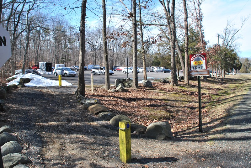
The above address is almost accurate and you won't be able to miss the parking lot upon your arrival. Like my other adventures on the Perkiomen Trail, it pretty much runs north to south so there wasn't much for changing direction. You won't need it but if you'd like to take one with you, click here for a copy of the trail map. There are also kiosk stations along the trail where you can pick one up.

The Perkiomen Trail is a rails-to-trails pathway formerly known as the Perkiomen Branch/Railroad. The rail was built in phases from Oaks to Collegeville in 1868, then to Schwenksville in 1869, and in 1872, the tracks were extended to Green Lane. In 1874, the tracks were run to Red Hill and by September of 1875 the final leg of tracks had been completed in Emmaus. For more of the history of the Perkiomen Branch/Railroad, click here.
 |
| Dirt path leading to the Perkiomen Trail |
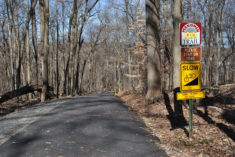
Once you get to the Perkiomen Trail, you'll see the below sign. For those of you who may not be familiar with the trail and want to hike to Green Lane Park, head towards Spring Mountain.


A little further down the trail will be one of the few hills to descend/ascend depending on the direction you're traveling. Alongside the trail, there were plenty of rocks to be seen.


Once you reach the bottom of the hill, you'll get your first view of the Perkiomen Creek and from there, the trail is pretty much flat with a few exceptions.

 |
| The Perkiomen Creek was muddy and flooded from recent snow melt and rains |
 |
| More rocks...in Pennsylvania? Never! |
No, the Apocalypse isn't coming, not yet at least. About a mile up the trail from the parking lot in Schwenksville is Spring Mountain. During Halloween, Spring Mountain has a haunted hay ride called Scream Mountain which is why the zombie is there.
Many of the locals probably already know what Spring Mountain is but for those of you who don't, it's one of the few places in the southeast where you can go skiing unless you head further north toward the Appalachian Mountains. The hills aren't that big and if you're new to skiing, this is a good place to start. My first skiing adventure was at Spring Mountain and the first half of my day was spent falling in the snow and getting soaking wet. By mid-day though, I had figured it out (mostly, stopping took some extra time) and had a blast.


As you get past Spring Mountain, you have a view of the ski slopes.


Walking past Spring Mountain, you have to cross over Spring Mountain Road and the Perkiomen Creek. The next few pictures will give you a better idea of how dirty the water was from the recent rains. I was only able to get pictures looking downstream from the bridge on Spring Mountain Road as that's the side the trail was on.


Directly across the street from Spring Mountain is Foy Park. Before continuing on my way, I walked around the park to explore for a bit.


 |
| Signs of spring were beginning to appear |

I try not to bring negativity to my blog but in this case, it's worth the mention. Fire fighters, police officers, and members of our military put their lives in danger on a nearly daily basis to make lives more safe for the rest of us. On September 12, 1988, Thomas P. Foy lost his life at the age of 22 battling a barn fire when a stone wall collapsed on him. He and another fire fighter by the name of Robert Z. Seaman both lost their lives in the line of duty when the wall collapsed, along with two others who sustained injuries. Rest in Peace!

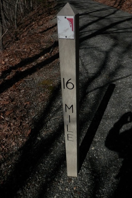
The Perkiomen Trail continues on its way north next to the corner of Main Street and Spring Mountain Roads.

 |
| One of the few mile markers I spotted along the trail |

The Perkiomen Trail crosses over the Perkiomen Creek a short distance from Foy Park.
 |
| Looking upstream on the muddy Perkiomen Creek |
 |
| Looking downstream toward Spring Mountain |

The next road to cross over is Haim Road which is a dead end street. Not much to worry about traffic-wise but always keep your head up regardless.

 |
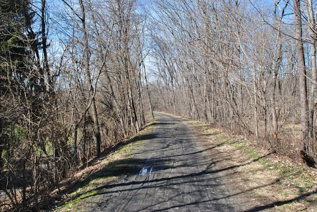
| Not my favorite type of trail to explore being long, flat, and straight! |
In hopes of adding some variety to my hike, I took the trail to the left side of this picture but it wasn't much to be excited about.


Eventually, the trail (maybe 50-60 yards) came to an end at the edge of one of the cliffs and I had to turn back.

Edge of the cliff looking towards the Perkiomen Creek

The next two roads to cross over will be Salford Station and Harmon Roads, both of which are in close proximity to each other. Alongside the trail in this area is also the William Rahmer Memorial Park. This one was very small so I didn't bother to explore it.


A short distance from the park and road crossings is Salford and Old Church Roads. Again, these roads aren't too busy so you won't see a lot of traffic in this area.


This section of the trail is one of the few areas where it actually takes a turn to the west for a short distance.


After turning to the west, the next crossing is Hendricks Station Road and shortly thereafter, the trail takes a turn back to the north. Google Maps lists this as just Hendricks Road but as you can see from the sign below, it's Hendricks Station. I also made it to mile marker 15 1/2.

 |
| Perkiomen Trail turning back to the north |

Although it was a warm day, there were still patches of ice in the shady spots.


The cliffs broke up the monotony of walking on a flat and relatively straight trail.


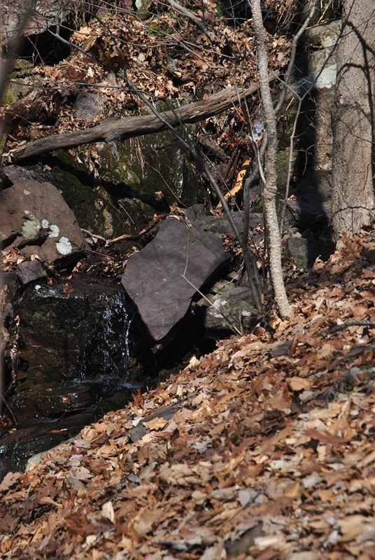


Crossing over Kratz Station Road was probably one of the more interesting sections of the adventure. As I crossed over and looked towards the Perkiomen Creek, I found some ruins. Unfortunately, I'm unable to find any information as to what it had been at one time. Perhaps a mill or train station since it was so close to the trail.


 |
| Another sign of spring! |


After exploring the ruins, I spotted this on the way back to the trail. Again, I have no idea what this might have been, perhaps a spring house.


The Perkiomen Trail then crosses over the Unami Creek.

Looking downstream to where it meets the Perkiomen Creek, you could see how muddy the Perkiomen was.


Looking upstream on the Unami Creek, there was another set of ruins on the left side but unfortunately, there was no getting a good picture of them from the trail.

In this section of the trail, this is where you definitely need to keep your eyes on the traffic. Once you cross over Crusher Road, you'll be turning to the west on Upper Ridge Road and from there, the crossing to be aware of is Gravel Pike, or State Route 29 which can be busy.


Crossing over Gravel Pike, you'll see this big brick building across the street. Note that there isn't a light at this crossing and although there's a crosswalk, don't expect drivers to stop and allow you to cross.


Another piece of equipment I wish I could have identified. This was in the back yard of the large brick building and since I wasn't sure if it was considered private property, I decided it would be best not to go walking through the lawn for a closer look.


Once you get past the brick building, you'll be crossing over the Perkiomen Creek on an old bridge that's closed to traffic.

Once you cross over the bridge, the next road you'll see will be Deep Creek Road. As stated, stay along the right shoulder of the road.

 |
| Looking back to the bridge crossing over the Perkiomen Creek |
About 100 or so yards down Deep Creek Road, you'll see this crossing and from there, you're just about within the boundaries of Green Lane Park.


The Perkiomen Trail meets up with Deep Creek Road again and from this point, I had just about made it to my destination.

Parking lot alongside Deep Creek Road. Once I arrived, I took a quick walk through the parking lot where I found the trail head for the Orange Trail. I didn't explore the trail but I now know where it is for the next time I head out to Green Lane Park, hopefully soon!

 |
| Knight Lake |
Returning to this area brought back some old memories. When I was young (which was a loooong time ago), my mother used to bring us to Green Lane Park for family picnics during the holidays. I remember running around and fishing in this area with my siblings and other family members while the parents were cooking burgers and hot dogs for everyone. It was also at Green Lane where for the first and only time, I was attacked by a goose when I got too close. Being as their height is only about waist high, I'm sure you may be able to imagine where he pecked me!


After stopping to take a break and a grab a quick snack, I was on my way back to Schwenksville. As is the routine for me when I take a "there and back" hike, I didn't take too many pictures on my return.


Somewhere during my adventure, I dropped something on the trail, never to be found again. With that being said, I added about a mile or two to my hike since I had walked a good distance before discovering that I had lost it and had to backtrack. Along the way, I enjoyed looking at the cliffs again and took a few more pictures of them.


As I was getting back toward Schwenksville, I also took a picture of whatever this might be. I love finding this stuff, the hard part is identifying what it is!

That was it for my adventure on the Perkiomen Trail. After returning home, I realized that I haven't completely finished hiking the entire trail as I missed a section of it within the boundaries of Green Lane Park. Although I was hoping to complete it that day, it's not that big of a deal since I'll be returning to check out some of the other trails within the park and will finish it then.
In all, hiking the Perkiomen Trail is, well, different. Like the Horse-Shoe Trail within Chester County, there are a lot of road crossings and the trail runs alongside homes and private property for much of the hike. It's not to say that I didn't enjoy my adventures on the trail, I just prefer walking on trails in the middle of the woods. It was on my bucket list though, and I wanted to check it out. Would I hike it again? Probably not, but it won't stop me from taking a ride on it with my mountain bike and seeing if I can ride the entire trail in one day.
One problem I have with the Perkiomen Trail is that since it's so public and long, there weren't many restrooms along the way (I think I saw one other than the restrooms at the park) and it's not like you can hide from other hikers (more accurately, parents taking their kids for a walk) when you're surrounded by homes and looking for a secluded spot. It was a relatively warm day for February so there were quite a few people on the trail, not fun!
Until next time and hopefully very soon, happy adventures and happy hiking!
The ruins you saw at Kratz road are probably part of the Kratz Ice House , as to the inverted rusted cone chimney, it is part of an old furniture factory there in Salford Station . There is a 'Postcard Book' , 'Along the Perkiomen' that will fill in some of the blanks .
ReplyDelete