Date of Hike: Sunday, December 13, 2015
Total Distance: 2.5 Miles
Avg speed: 2 MPH
Total Time: 1:13:38
Conditions: Partly Sunny, 71 degrees
Difficulty: Easy, some Moderate
On Sunday, December 13, it was yet another beautiful day for a hike and since I was already at the Hildacy Farm Preserve doing some volunteer work, I decided to check the place out. The month of December had been kind to us and since it was so nice outside, there was no reason not to take advantage of the beautiful weather.
The Hildacy Farm Preserve is the headquarters for the Natural Lands Trust which has several preserves in Eastern Pennsylvania as well as New Jersey. In total, there are 55 acres of land and about 3.5 miles of trails to explore at the preserve. The address is:
1031 Palmers Mill Road
Media, PA 19063
GPS: 39.9555897,-75.3887438
For a copy of the trail map, click here.
For some reason, my GPS tracking app was not performing too well for this hike. The only time I crossed over any water was in the northwestern section section of the preserve. Otherwise, all of the trails at the Hildacy Farm Preserve are on the eastern and northern sides of the creeks.

From the parking lot, the trail head will take you to the south. Although you likely won't need one, you can also grab a trial map at the kiosk station.
The 55 acres of the Hildacy Farm Preserve are all that remains of the 300 acre land grant of William Penn in 1683. Originally prized because of the areas large oaks and other useful wood, the forests were eventually razed to the ground to make way for agriculture.
While not much can be found for the history of this area leading up to 1936, the property was bought at that time by Hilda and Cyril Fox and the name Hildacy was born. The Fox's owned and preserved the land for 45 years where it was then donated to the Natural Lands Trust in 1981.

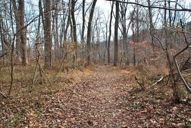
All of the trails at the Hildacy Farm Preserve are in very good condition. This is part of the combined Red and Yellow Loop Trails which head southward, then take a slight turn to the southwest.


I crossed the bridge over Martin's Run to the Purple Trail which is a short loop around a serpentine outcropping. The trail itself loops to the north, then circles back to the south.


I'm not sure what this was at one time but it looks to be the remnants of a small dam.

Not far from the above remnants were the remains of this old spring house.


Once I crossed back over Martin's Run, I continued heading south on the combined Red and Yellow Loop Trails.

Once you get close to Crum Creek, the Yellow Trail turns to the east and the Red Trail continues to the south, slowly making a turn to the east.

Across Route 252 (Newtown Street Road) to the west of the preserve is the Springfield Reservoir. What you see below is a spillway from the reservoir. Unfortunately, there was no way to get close to it so this was the best shot of the spillway I could get.

This was the first of two different access points to Crum Creek although not entirely necessary. As you go further into the preserve, there are a number of places where you can get a good view of the creek directly from the trail.

It's too bad fishing isn't permitted at the preserve, some of the water in this area is pretty deep!

Somewhere in this area, the Red Trail takes a slight turn to the northeast and an unnamed trail continues alongside Crum Creek.

Although it's not shown on the trail map, the trail continues past the boundary of the Hildacy Farm Preserve into a section of the Green Bank Farm Park.


The trail leads to a wooden fence and from there, you have to turn west back towards the preserve. Within the above meadow is this small pond or vernal pool.

View from the opposite side of the meadow looking towards Crum Creek.

Making my way back to the Red Loop Trail and heading in a northerly direction, this view is looking back towards Crum Creek.


As the Red Loop Trail takes another turn to the north, then northeast, you'll be walking through some nice woodlands. It's also around this area where the Red and Yellow Trails merge again, at least for a short distance.


This intersecting set of trails is where there's yet another merger with the Green Trail and where the Yellow Trail takes a turn to the northeast.

After taking a few turns to the southeast, then southwest, there's another unnamed side trail off the Red Trail that brings you back into woodlands. Like I usually do when I have a choice, I head for the woodlands.

The below sign describes how an overpopulation of deer can have an adverse effect on the environment with the fenced in area below protecting the habitat and preventing them from eating the small shrubs within.


Once the unnamed trail loops back to the northeast to the combined Red and Green Trails, it runs alongside a farm and some horses. I believe this could be the Green Bank Farm Park.


There's another entrance to the preserve around or close to Palmers Mill Road in the northeastern side of the preserve with this sign welcoming you. As far as I could see, there's no parking lot in this area though, you'd have to walk it to get there.


Once beyond the above sign, the trail takes a turn to the north, then another turn to the southeast.


The trail then turns again to the northwest. From the northeast corner of the preserve, there's a slight view of the Springfield Reservoir although it's not the best. I had my zoom lens fully extended for this shot.

Between the pine trees to the right side is where you can spot the reservoir although I don't think there would be much of a view had it been during the warmer months with leaves on the trees.


As described in the above sign, this was the former grove of trees that were removed in favor of plant species that are native to Pennsylvania. When I first spotted this (and before I saw the above sign), I was curious to know why it was so many trees had been cleared, my question was answered!

Now circling back to the southwest, I was just about done with my adventure.


Shortly after this area, the trail takes another turn to the northeast and back to the parking lot.


That was the end of my adventure at the Hildacy Farm Preserve. Giving the size of the preserve, this would have been one of those days where I would have visited multiple locations had I not been volunteering earlier in the day. Since I only managed to get 2.5 miles of hiking in, I definitely would have looked for other locations in the area to explore. In all, it's a nice place to visit if you'd like to take a leisure stroll and see a number of different types of habitats.
The trails are easy to find and well maintained and the preserve is small so getting lost isn't likely. If I happen to be in the area, I may eventually return but giving its size, there isn't a lot more to explore. In all, the preserve is very nice and was well worth the visit!
Until next time, happy adventures and happy hiking!
On Sunday, December 13, it was yet another beautiful day for a hike and since I was already at the Hildacy Farm Preserve doing some volunteer work, I decided to check the place out. The month of December had been kind to us and since it was so nice outside, there was no reason not to take advantage of the beautiful weather.
The Hildacy Farm Preserve is the headquarters for the Natural Lands Trust which has several preserves in Eastern Pennsylvania as well as New Jersey. In total, there are 55 acres of land and about 3.5 miles of trails to explore at the preserve. The address is:
1031 Palmers Mill Road
Media, PA 19063
GPS: 39.9555897,-75.3887438
For a copy of the trail map, click here.
For some reason, my GPS tracking app was not performing too well for this hike. The only time I crossed over any water was in the northwestern section section of the preserve. Otherwise, all of the trails at the Hildacy Farm Preserve are on the eastern and northern sides of the creeks.

From the parking lot, the trail head will take you to the south. Although you likely won't need one, you can also grab a trial map at the kiosk station.
The 55 acres of the Hildacy Farm Preserve are all that remains of the 300 acre land grant of William Penn in 1683. Originally prized because of the areas large oaks and other useful wood, the forests were eventually razed to the ground to make way for agriculture.
While not much can be found for the history of this area leading up to 1936, the property was bought at that time by Hilda and Cyril Fox and the name Hildacy was born. The Fox's owned and preserved the land for 45 years where it was then donated to the Natural Lands Trust in 1981.

All of the trails at the Hildacy Farm Preserve are in very good condition. This is part of the combined Red and Yellow Loop Trails which head southward, then take a slight turn to the southwest.


I crossed the bridge over Martin's Run to the Purple Trail which is a short loop around a serpentine outcropping. The trail itself loops to the north, then circles back to the south.

 |
| Purple Trail running alongside Martin's Run |


I'm not sure what this was at one time but it looks to be the remnants of a small dam.

Not far from the above remnants were the remains of this old spring house.


 |
| Almost back to the bridge over Martin's Run |

Once I crossed back over Martin's Run, I continued heading south on the combined Red and Yellow Loop Trails.

Once you get close to Crum Creek, the Yellow Trail turns to the east and the Red Trail continues to the south, slowly making a turn to the east.

Across Route 252 (Newtown Street Road) to the west of the preserve is the Springfield Reservoir. What you see below is a spillway from the reservoir. Unfortunately, there was no way to get close to it so this was the best shot of the spillway I could get.

This was the first of two different access points to Crum Creek although not entirely necessary. As you go further into the preserve, there are a number of places where you can get a good view of the creek directly from the trail.

 |
| View looking downstream on Crum Creek from the first access point |
 |
| Continuing eastward on the Red Trail |
It's too bad fishing isn't permitted at the preserve, some of the water in this area is pretty deep!

 |
| Red Loop Trail slowly turns to the east |
Somewhere in this area, the Red Trail takes a slight turn to the northeast and an unnamed trail continues alongside Crum Creek.
 |
| Just a few geese taking flight to their destination of choice, perhaps Springfield Reservoir |

Although it's not shown on the trail map, the trail continues past the boundary of the Hildacy Farm Preserve into a section of the Green Bank Farm Park.


The trail leads to a wooden fence and from there, you have to turn west back towards the preserve. Within the above meadow is this small pond or vernal pool.

View from the opposite side of the meadow looking towards Crum Creek.

 |
| View looking back towards Green Bank Farm Park |
 |
| Entering back into the Hildacy Farm Preserve property |
Making my way back to the Red Loop Trail and heading in a northerly direction, this view is looking back towards Crum Creek.


As the Red Loop Trail takes another turn to the north, then northeast, you'll be walking through some nice woodlands. It's also around this area where the Red and Yellow Trails merge again, at least for a short distance.


This intersecting set of trails is where there's yet another merger with the Green Trail and where the Yellow Trail takes a turn to the northeast.

After taking a few turns to the southeast, then southwest, there's another unnamed side trail off the Red Trail that brings you back into woodlands. Like I usually do when I have a choice, I head for the woodlands.

The below sign describes how an overpopulation of deer can have an adverse effect on the environment with the fenced in area below protecting the habitat and preventing them from eating the small shrubs within.


 |
| Small bench made from a log on one of the unnamed trails |

Once the unnamed trail loops back to the northeast to the combined Red and Green Trails, it runs alongside a farm and some horses. I believe this could be the Green Bank Farm Park.


 |
| The meadow to the left of this picture is known as Hilda's Meadow |

There's another entrance to the preserve around or close to Palmers Mill Road in the northeastern side of the preserve with this sign welcoming you. As far as I could see, there's no parking lot in this area though, you'd have to walk it to get there.


Once beyond the above sign, the trail takes a turn to the north, then another turn to the southeast.


The trail then turns again to the northwest. From the northeast corner of the preserve, there's a slight view of the Springfield Reservoir although it's not the best. I had my zoom lens fully extended for this shot.

Between the pine trees to the right side is where you can spot the reservoir although I don't think there would be much of a view had it been during the warmer months with leaves on the trees.

 |
| Chimney swift nest box |

As described in the above sign, this was the former grove of trees that were removed in favor of plant species that are native to Pennsylvania. When I first spotted this (and before I saw the above sign), I was curious to know why it was so many trees had been cleared, my question was answered!

Now circling back to the southwest, I was just about done with my adventure.


Shortly after this area, the trail takes another turn to the northeast and back to the parking lot.


That was the end of my adventure at the Hildacy Farm Preserve. Giving the size of the preserve, this would have been one of those days where I would have visited multiple locations had I not been volunteering earlier in the day. Since I only managed to get 2.5 miles of hiking in, I definitely would have looked for other locations in the area to explore. In all, it's a nice place to visit if you'd like to take a leisure stroll and see a number of different types of habitats.
The trails are easy to find and well maintained and the preserve is small so getting lost isn't likely. If I happen to be in the area, I may eventually return but giving its size, there isn't a lot more to explore. In all, the preserve is very nice and was well worth the visit!
Until next time, happy adventures and happy hiking!
No comments:
Post a Comment