Date of Hike: December 19, 2015
Total Distance: 4.89 Miles
Avg speed: 1.6 MPH
Total Time: 2:58:57
Conditions: Sunny, 40 Degrees
Difficulty: Easy, Moderate
On December 19, I once again met up with fellow blogger and hiker, Neil Brennen from A Taste for the Woods, to explore Nolde Forest State Park (also known as the Nolde Forest Environmental Center). It was a chilly day and seemed to be one of the coldest because of how mild the month of December had been. It turns out, it was the coldest day of December and although I've been out in weather colder than this, I had a hard time staying warm.
To start our adventure, we parked at the old saw mill. The approximate address is:
2816 New Holland Road
Reading, PA 19607
GPS: 40.281735, -75.947888
If you use Google Maps as your GPS device, you can also look up the Nolde Forest Sawmill and it looks like it should bring you right to the parking lot.
Note that the above street address isn't entirely accurate. If you're approaching from the south, keep going past 2816 until you get to the entrance to the parking lot which will be on your left. If you're approaching from the north, the parking lot will be on your right before you get to 2816. Look for Forester Road when you get close and you should be able to spot the entrance.
This isn't the actual address for the state park however. If you need that address, here it is:
2910 New Holland Road
Reading, PA 19607
GPS: 40.276444, -75.946439
Since this was my first time at Nolde Forest, I was informed by Neil that this entrance is closed off at times. If you should run into this when you go, head to the first address I provided. For a copy of the trail map, click here.

Nolde Forest State Park is approximately 665 acres and is said to have 10 miles of trails. Acquired by Jacob Nolde in 1900, the park at the time had only a single white pine tree in the middle of a meadow at the time. Inspired by this tree, Nolde hired an Austrian forester, William Kohout, to create the coniferous forest you'll see today. A total of 500,000 trees has been planted by 1910.
The Commonwealth of Pennsylvania purchased the land in the late 1960's with Project 70 funds and the Project 500 bond issues provided funds for the environmental center's development. In 1970, federal program grants and the Berks County Intermediate Unit helped to establish Nolde Forest as the first environmental education center operated by the Bureau of State Parks.

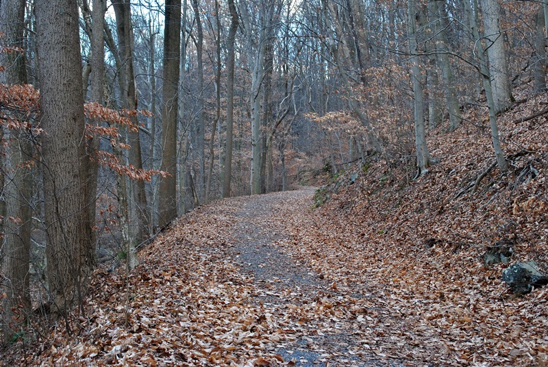
To start out our adventure, we headed north on the Watershed Trail along Angelica Creek. Most of the trails we were on were in very good condition.


This is the Aralia Spinosa, also known as the Devil's Walkingstick, and can be found throughout Nolde Forest.

As we made our way to the north on the Watershed Trail, we were walking alongside New Holland Road which eventually led us to Church Road and the northeastern corner of the park. Once we reached Church Road, we walked west along the road for a short distance, then made a turn to the southwest on a service road.

The service road eventually leads to the North Pond and the Pond Loop Trail which takes a slight turn to the south. There are service roads and trails throughout the park, many of which were built in effort to maintain the forest after it had grown to a size larger than Nolde had expected.


The Pond Loop Trail eventually runs into the Beech Trail on its way south.


Still heading south, the Beech Trail intersects with the Sheerlund and Kohout Trails along the way.


The Beech Trail intersecting with the Kohout Trail. At this point, we continued to the south on the Beech Trail


The Beech Trail intersects with the Coffee Pot Hollow Trail which turns to the west. For the time being, we stayed on the Beech Trail which continues to the south, then making a turn to the east.


Eventually, the Beech Trail then runs back into the Kohout Trail which turns to the south towards the parking lot and sawmill.


Once we passed the parking lot, we continued south on the Watershed Trail alongside Punches Run. Since Neil was in front during this part of the hike, many of my pictures were taken looking back towards the north. Although it doesn't look like it from the tracks, Punches Run is to the east of the trail.


Once past the teaching station, there are several bridges that cross over Punches Run with trails on either side that run alongside it.

The Boulevard Trail intersects with the Watershed Trail, both of which continue in a southwesterly direction. For the time being, we stayed on the Watershed Trail (left) which remained slightly closer to Punches Run.


The stone wall you see in the background is Forester Road which leads up to the C.H. McConnell Environmental Education Hall and the Nolde mansion. I did not visit either during this hike but I have plans to return to check both of them out.


Still on the Watershed Trail, we walked past this opening in the trees which is a gas pipeline that runs through the park. While not the most attractive sights you'd want to see while walking through a park, it did allow for some nice views so I took shots looking in both directions.


I believe by now, we had made our way back to the Boulevard Trail. Somewhere in this area, we took a turn to the north, then to the northeast.


This was probably the toughest part of the hike which really wasn't too difficult. The Boulevard Trail will eventually lead you to the highest point within the forest.


At this point, the Boulevard Trail intersects with the Coffee Pot Hollow and Ridge Trails at a spot called the Rock Outcrop. While there's a bit of a view from the outcrop, it wasn't really picture worthy.


Once we were done at the Rock Outcrop, we continued on the Boulevard Trail which made a turn to the southwest.


Here are a few more shots from the pipeline. I think the first one was looking to the south back into Nolde Forest and the other is looking to the north.


Once we got back to the trails along Punches Run, I didn't take many more pictures since I had already been through the area. At this point, we were almost back to the parking lot and sawmill.

As already stated, this was a sawmill at one time. These are the remnants of when it was still in operation.


I believe at one time, Punches Run used to be dammed as you can see the remnants of the structure.


That was it for our adventure at Nolde Forest State Park. In all, it was a good hike despite the cold. Giving the good condition of the trails and the fact there are numerous others that I didn't see, I'll definitely be heading back to Nolde to check out some more of the area.
Unfortunately, my return to the trail will likely take a while as I somehow managed to pinch a nerve in my neck and have been laid up since. This is also why its taken me so long to get this post up. Having a pinched nerve in the neck also brings pain to the arm and shoulder area which is very uncomfortable and made it difficult to update my blog since sitting for long periods of time at my computer didn't bode well for a painful arm and shoulder. It's getting better but I haven't yet fully recovered!
I'd like to thank Neil Brennen for his company on the trail and also for driving, I look forward to another adventure with him! Please also give his Facebook page a like! !
Until next time, happy adventures and happy hiking!!
On December 19, I once again met up with fellow blogger and hiker, Neil Brennen from A Taste for the Woods, to explore Nolde Forest State Park (also known as the Nolde Forest Environmental Center). It was a chilly day and seemed to be one of the coldest because of how mild the month of December had been. It turns out, it was the coldest day of December and although I've been out in weather colder than this, I had a hard time staying warm.
To start our adventure, we parked at the old saw mill. The approximate address is:
2816 New Holland Road
Reading, PA 19607
GPS: 40.281735, -75.947888
If you use Google Maps as your GPS device, you can also look up the Nolde Forest Sawmill and it looks like it should bring you right to the parking lot.
Note that the above street address isn't entirely accurate. If you're approaching from the south, keep going past 2816 until you get to the entrance to the parking lot which will be on your left. If you're approaching from the north, the parking lot will be on your right before you get to 2816. Look for Forester Road when you get close and you should be able to spot the entrance.
This isn't the actual address for the state park however. If you need that address, here it is:
2910 New Holland Road
Reading, PA 19607
GPS: 40.276444, -75.946439
Since this was my first time at Nolde Forest, I was informed by Neil that this entrance is closed off at times. If you should run into this when you go, head to the first address I provided. For a copy of the trail map, click here.

Nolde Forest State Park is approximately 665 acres and is said to have 10 miles of trails. Acquired by Jacob Nolde in 1900, the park at the time had only a single white pine tree in the middle of a meadow at the time. Inspired by this tree, Nolde hired an Austrian forester, William Kohout, to create the coniferous forest you'll see today. A total of 500,000 trees has been planted by 1910.
The Commonwealth of Pennsylvania purchased the land in the late 1960's with Project 70 funds and the Project 500 bond issues provided funds for the environmental center's development. In 1970, federal program grants and the Berks County Intermediate Unit helped to establish Nolde Forest as the first environmental education center operated by the Bureau of State Parks.

To start out our adventure, we headed north on the Watershed Trail along Angelica Creek. Most of the trails we were on were in very good condition.


This is the Aralia Spinosa, also known as the Devil's Walkingstick, and can be found throughout Nolde Forest.

As we made our way to the north on the Watershed Trail, we were walking alongside New Holland Road which eventually led us to Church Road and the northeastern corner of the park. Once we reached Church Road, we walked west along the road for a short distance, then made a turn to the southwest on a service road.

The service road eventually leads to the North Pond and the Pond Loop Trail which takes a slight turn to the south. There are service roads and trails throughout the park, many of which were built in effort to maintain the forest after it had grown to a size larger than Nolde had expected.

 |
| Neil up ahead shooting off a few pictures |


The Pond Loop Trail eventually runs into the Beech Trail on its way south.


Still heading south, the Beech Trail intersects with the Sheerlund and Kohout Trails along the way.


The Beech Trail intersecting with the Kohout Trail. At this point, we continued to the south on the Beech Trail


The Beech Trail intersects with the Coffee Pot Hollow Trail which turns to the west. For the time being, we stayed on the Beech Trail which continues to the south, then making a turn to the east.


Eventually, the Beech Trail then runs back into the Kohout Trail which turns to the south towards the parking lot and sawmill.


Once we passed the parking lot, we continued south on the Watershed Trail alongside Punches Run. Since Neil was in front during this part of the hike, many of my pictures were taken looking back towards the north. Although it doesn't look like it from the tracks, Punches Run is to the east of the trail.


 |
| One of numerous teaching stations scattered throughout the park |

Once past the teaching station, there are several bridges that cross over Punches Run with trails on either side that run alongside it.

The Boulevard Trail intersects with the Watershed Trail, both of which continue in a southwesterly direction. For the time being, we stayed on the Watershed Trail (left) which remained slightly closer to Punches Run.

 |
| Boulevard Trail bridge over Punches Run |

 |
| Looking back to the bridge and Boulevard Trail |

The stone wall you see in the background is Forester Road which leads up to the C.H. McConnell Environmental Education Hall and the Nolde mansion. I did not visit either during this hike but I have plans to return to check both of them out.


Still on the Watershed Trail, we walked past this opening in the trees which is a gas pipeline that runs through the park. While not the most attractive sights you'd want to see while walking through a park, it did allow for some nice views so I took shots looking in both directions.


I believe by now, we had made our way back to the Boulevard Trail. Somewhere in this area, we took a turn to the north, then to the northeast.

 |
| Old water fountain outside a restroom |
This was probably the toughest part of the hike which really wasn't too difficult. The Boulevard Trail will eventually lead you to the highest point within the forest.

 |
| Another view of the pipeline |

At this point, the Boulevard Trail intersects with the Coffee Pot Hollow and Ridge Trails at a spot called the Rock Outcrop. While there's a bit of a view from the outcrop, it wasn't really picture worthy.


Once we were done at the Rock Outcrop, we continued on the Boulevard Trail which made a turn to the southwest.

 |
| Large oak leaf, and my gloved hand...it was cold!! |

Here are a few more shots from the pipeline. I think the first one was looking to the south back into Nolde Forest and the other is looking to the north.


 |
| I'm not sure what this is or was at one time. If anyone knows, please comment below! |
Once we got back to the trails along Punches Run, I didn't take many more pictures since I had already been through the area. At this point, we were almost back to the parking lot and sawmill.

As already stated, this was a sawmill at one time. These are the remnants of when it was still in operation.


I believe at one time, Punches Run used to be dammed as you can see the remnants of the structure.


That was it for our adventure at Nolde Forest State Park. In all, it was a good hike despite the cold. Giving the good condition of the trails and the fact there are numerous others that I didn't see, I'll definitely be heading back to Nolde to check out some more of the area.
Unfortunately, my return to the trail will likely take a while as I somehow managed to pinch a nerve in my neck and have been laid up since. This is also why its taken me so long to get this post up. Having a pinched nerve in the neck also brings pain to the arm and shoulder area which is very uncomfortable and made it difficult to update my blog since sitting for long periods of time at my computer didn't bode well for a painful arm and shoulder. It's getting better but I haven't yet fully recovered!
I'd like to thank Neil Brennen for his company on the trail and also for driving, I look forward to another adventure with him! Please also give his Facebook page a like! !
Until next time, happy adventures and happy hiking!!
No comments:
Post a Comment