Date of Hike: Saturday, December 12, 2015
Total Distance: 9.38 Miles
Avg speed: 2.3 MPH
Total Time: 4:7:32
Conditions: Partly Sunny, 69 Degrees
Difficulty: Easy, Moderate, Difficult
On December 12th, I took another hike at French Creek State Park to explore a few trails I had never been on (along with a little bit of bushwhacking). It was a beautiful day, one of the warmest on record for the month of December so who could resist a day outside? My original intention was to hike at Monocacy Hill Recreation Area but it turned out that because of hunting season, it was closed for recreational use. Since French Creek State Park wasn't too far away, I decided to go there instead.
Like I usually do when I go to French Creek State Park, I parked in the Hopewell Lake parking lot and started my adventure from there. The address to the park is:
843 Park Rd
Elverson, PA 19520
GPS: 40.200145, -75.791404
The above address will take you to the campsite at French Creek State Park but the GPS coordinates are accurate. According to Google Maps, the address closest to the entrance to the Hopewell Lake parking lot is 1450 Park Rd. Unless you're approaching from the north, you won't be able to miss the parking lot. If you are approaching from the north, use the 1450 address.
For a copy of the trail map, click here.

I started out my adventure heading to the south alongside Hopewell Lake. Before really getting started, I walked around close to the edge of the lake for a short while, just to see what I could find.


Looping around the southern end of Hopewell Lake, the trail then takes a turn to the northeast. This is also where you'll find more parking, picnic areas, and the community pool. No swimming in Hopewell Lake though, the water has been polluted by geese!

In this section of the park, the trail was gravel and/or crushed stone.


One of two dams on the northeastern side of Hopewell Lake. I have to wonder if this is an emergency spillway in the event of flooding, as far as I've seen, it's never been in use.

The second of the two dams at the northeastern end of Hopewell Lake and the nicer of the two.

Once beyond Hopewell Lake and now heading north, I hopped on the Horse-Shoe Trail.


The Horse-Shoe Trail intersects with the Lenape Trail heading to the east and was where I made my turn.


After turning to the east on the Lenape Trail, I was on my way to Hopewell Furnace.

Although I've been through this area a few times, I don't recall ever seeing this building so I decided to check it out. It wasn't much but still worth exploring.

I didn't take many pictures within Hopewell Furnace since I had already been there before. If you'd like to see my pictures from my visit to the furnace, check out my post from when I hiked the Horse-Shoe Trail from St. Peters Village to Hopewell Furnace. Below are the remnants of a building although I have no idea what it might have been at one time. In the background, you can see one of the buildings that were a part of the furnace.

Alongside the road leading into Hopewell Furnace, there were horses and a bunch of sheep. Almost a great shot if I had been a little more to the left!


Alongside the entrance road to the furnace, there were all kinds of fruit trees, I believe they were apple trees although I can't confirm.


What would my blog be without a little bit of history? This stone wall is known as the East Headrace. The raceway (or section of it) you see was built under the direction of the owner of Hopewell Furnace at the time, Mark Bird. The raceway is a 1.2 mile long ditch that was dug by the workers of the furnace to harvest water from nearby springs, small streams, and Baptism Creek to power the blast furnace's water wheel.
This section which is the East Headrace was built around 1771 and restored (no date given) as a retaining wall to protect the waterway from erosion. This wall runs approximately 1800 feet and ranges in height from 6 feet to 8 inches tall.


At this point, I was on the far edge of the field the East Headrace is in and somewhere behind me was the trail. Without being able to find a trail head and being slightly familiar with this section of the park(s), I knew the trail was close so I walked through the woods until I found it.

When I spotted this old spring house, I knew where I was from a previous hike in this same area. Just on the opposite side is the Lenape Trail.


On my last adventure in this section of French Creek State Park/Hopewell Furnace, I had taken the Buzzards Trail which leads to the south before eventually looping back to the north. This time around, I headed northeast and explored the Raccoon Trail which I had never been on before.

Once again, I spotted remnants of the forest fine that occurred in April 2012.


I believe these are the remnants of the Site of Brison House, named after George Brison, an African-American woodcutter and fiddler who worked at the furnace.


Although it wasn't too bad, this was one of the more difficult sections of trail during my adventure. The best was yet to come though!


I may have mentioned this at one time or another but before I go hiking, I usually try to plan out my route. Sometimes, it works out as planned and at other times, all plans go out the window and I end up taking the wrong trail. When I first started hiking and this happened to me, I'd get nervous about it and think I was going to get lost. Over time, that feeling went away and I learned to just go with the flow. This was one of those times where plans went out the window and I went with the flow! Somewhere in this area, I had intentions of taking one trail but ended up on another. No big deal though, I still ended up where I was originally planning on going, it just took a bit longer.

Instead of turning to the north on the Mill Creek Trail as I had intended, I continued heading to the northeast on the Raccoon Trail. Note that all of the trails were pretty well marked and if I had an actual trail map, I don't think I would have made this mistake as all trails are marked with a specific color or colors.


I had now reached the end of the Raccoon Trail which intersected with a different portion of the Mill Creek Trail. For those of you who may not have hiked this area before, the Mill Creek Trail is a loop that takes you through most of the eastern side of French Creek State Park. If for any reason you'd want to cut your hike short, the Raccoon Trail is one of a few you can use to get back towards the western side of the park.


Now heading northward on the Mill Creek Trail. This is also the area where you'll find one of the most challenging sections of trail at French Creek State Park.


As you make your way up the hill on the Mill Creek Trail, you get to this spot known as Miller's Point. The last time I was in this area, I was unable to get up to the rocks because of poison ivy. This time, the path was clear. While this was pretty close to the top of the hill, the view wasn't the best so I didn't get any shots of the valley below.


After stopping for a quick rest, I was on my way again. Now heading southwest (still on the Mill Creek Trail), this was looking back to Miller's Point.


At first I didn't know what this was or why it was in the middle of the woods but then I remembered that it's hunting season. I believe this cart would be used to bring a deer out of the woods (or any type of larger game). Throughout my hike, I spotted tufts of hair on the trail which led me to think someone might have dragged a deer out without one of these.


The Mill Creek Trail is pretty wide, likely used as a roadway when the Hopewell Furnace was in operation to bring charcoal to the furnace.


This threw me off a little bit and to be honest, it still does. Nowhere on the map of French Creek State Park does it state that hunting is prohibited in this section of the park or that this area is a wildlife refuge. To add to the confusion was seeing the cart back a distance. Unless this is something new, I can only guess as to why this sign is here. Once you get into the property of Hopewell Furnace, hunting is prohibited.


I didn't take pictures for a short distance and by this time, I had crossed back over Route 345 (Swamp Road) and was on the Lenape Trail still heading to the southwest in the direction of Hopewell Lake.

I veered off the Lenape Trail heading south on the Colliers Trail which eventually leads back to the Horse-Shoe Trail through an unnamed connecting trail.

While not much to look at, this is the restored remnants of a charcoal hearth where wood was burned to make charcoal for Hopewell Furnace.

The Colliers Trail isn't as widely used as some of the others throughout the park. It was still covered with leaves making walking a bit difficult since you couldn't tell what was underneath them.


The Colliers Trail eventually brought me back to the Horse-Shoe Trail by way of another connecting trail (unnamed) and from there, I turned to the west.

Back on the Horse-Shoe Trail and heading south, you could see Hopewell Lake in the background.


Once you get alongside Hopewell Lake, the trail takes a slight turn to the southwest. As far as I can see, this isn't the Horse-Shoe Trail and is not shown on the map of French Creek State Park.

I've hiked a number of times at French Creek State Park but for some reason, it's very rare that I end up on this side of Hopewell Lake. After thinking about it, I realized I hadn't seen this side of the lake for several years.


I don't often see a freshly fallen tree due to the work of a beaver, pretty cool stuff!

The trail that runs alongside Hopewell Lake isn't marked but in areas, it does merge with the Horse-Shoe Trail.


This was one of the only spots throughout the hike where the trail was actually pretty muddy. I managed to sneak through without too much effort though.


At this point, I was getting pretty close to being back to the parking lot.

Although I didn't stop, this looks to be a pretty nice spot to sit and enjoy the sounds of nature.


Another cool find. I don't think in all the years I've been hiking that I've ever seen a beaver dam. I guess there's a first time for everything. I didn't get to see the beaver though, maybe next time!


Almost back to the parking lot. If you look to the right side of this picture, you'll see that I was getting close to civilization again.


Once last shot of Hopewell Lake before the day came to an end.

That was it for my unplanned adventure at French Creek State Park. I've always enjoyed hiking there so even though it was my fallback plan, it was well worth the trip out there. I was glad to have brought a trail map with me since my plans to hike Monocacy Hill ended up being a wash. Make note to self, if you plan on hiking somewhere new and you aren't sure if the place you're going might be closed for hunting, be sure to check their website (if they have one) or go on a Sunday!
Here are a few more of my adventures from French Creek State Park, at least the ones I documented.
French Creek State Park - July 2014
Horse-Shoe Trail at French Creek State Park - August 2014
French Creek State Park - Return to Six Penny - October 2014
I guess it goes without saying that I'd gladly return to explore some more. For the most part, I've covered a good portion of the trails at French Creek State Park with only a few left that I haven't explored yet!
Until next time, happy exploring and happy hiking!
On December 12th, I took another hike at French Creek State Park to explore a few trails I had never been on (along with a little bit of bushwhacking). It was a beautiful day, one of the warmest on record for the month of December so who could resist a day outside? My original intention was to hike at Monocacy Hill Recreation Area but it turned out that because of hunting season, it was closed for recreational use. Since French Creek State Park wasn't too far away, I decided to go there instead.
Like I usually do when I go to French Creek State Park, I parked in the Hopewell Lake parking lot and started my adventure from there. The address to the park is:
843 Park Rd
Elverson, PA 19520
GPS: 40.200145, -75.791404
The above address will take you to the campsite at French Creek State Park but the GPS coordinates are accurate. According to Google Maps, the address closest to the entrance to the Hopewell Lake parking lot is 1450 Park Rd. Unless you're approaching from the north, you won't be able to miss the parking lot. If you are approaching from the north, use the 1450 address.
For a copy of the trail map, click here.

I started out my adventure heading to the south alongside Hopewell Lake. Before really getting started, I walked around close to the edge of the lake for a short while, just to see what I could find.


 |
| Still a little bit of color to be found late in the year! |
 |
| Even the dandelions were fooled by the warm weather! |


Looping around the southern end of Hopewell Lake, the trail then takes a turn to the northeast. This is also where you'll find more parking, picnic areas, and the community pool. No swimming in Hopewell Lake though, the water has been polluted by geese!

In this section of the park, the trail was gravel and/or crushed stone.

 |
| View of Hopewell Lake looking northeast from the pier |


One of two dams on the northeastern side of Hopewell Lake. I have to wonder if this is an emergency spillway in the event of flooding, as far as I've seen, it's never been in use.

The second of the two dams at the northeastern end of Hopewell Lake and the nicer of the two.

Once beyond Hopewell Lake and now heading north, I hopped on the Horse-Shoe Trail.


The Horse-Shoe Trail intersects with the Lenape Trail heading to the east and was where I made my turn.


After turning to the east on the Lenape Trail, I was on my way to Hopewell Furnace.

Although I've been through this area a few times, I don't recall ever seeing this building so I decided to check it out. It wasn't much but still worth exploring.

I didn't take many pictures within Hopewell Furnace since I had already been there before. If you'd like to see my pictures from my visit to the furnace, check out my post from when I hiked the Horse-Shoe Trail from St. Peters Village to Hopewell Furnace. Below are the remnants of a building although I have no idea what it might have been at one time. In the background, you can see one of the buildings that were a part of the furnace.

Alongside the road leading into Hopewell Furnace, there were horses and a bunch of sheep. Almost a great shot if I had been a little more to the left!


Alongside the entrance road to the furnace, there were all kinds of fruit trees, I believe they were apple trees although I can't confirm.


What would my blog be without a little bit of history? This stone wall is known as the East Headrace. The raceway (or section of it) you see was built under the direction of the owner of Hopewell Furnace at the time, Mark Bird. The raceway is a 1.2 mile long ditch that was dug by the workers of the furnace to harvest water from nearby springs, small streams, and Baptism Creek to power the blast furnace's water wheel.
This section which is the East Headrace was built around 1771 and restored (no date given) as a retaining wall to protect the waterway from erosion. This wall runs approximately 1800 feet and ranges in height from 6 feet to 8 inches tall.


At this point, I was on the far edge of the field the East Headrace is in and somewhere behind me was the trail. Without being able to find a trail head and being slightly familiar with this section of the park(s), I knew the trail was close so I walked through the woods until I found it.

When I spotted this old spring house, I knew where I was from a previous hike in this same area. Just on the opposite side is the Lenape Trail.


On my last adventure in this section of French Creek State Park/Hopewell Furnace, I had taken the Buzzards Trail which leads to the south before eventually looping back to the north. This time around, I headed northeast and explored the Raccoon Trail which I had never been on before.

Once again, I spotted remnants of the forest fine that occurred in April 2012.

 |
| A little bit of color during this time of year is always welcome! |


I believe these are the remnants of the Site of Brison House, named after George Brison, an African-American woodcutter and fiddler who worked at the furnace.


Although it wasn't too bad, this was one of the more difficult sections of trail during my adventure. The best was yet to come though!


I may have mentioned this at one time or another but before I go hiking, I usually try to plan out my route. Sometimes, it works out as planned and at other times, all plans go out the window and I end up taking the wrong trail. When I first started hiking and this happened to me, I'd get nervous about it and think I was going to get lost. Over time, that feeling went away and I learned to just go with the flow. This was one of those times where plans went out the window and I went with the flow! Somewhere in this area, I had intentions of taking one trail but ended up on another. No big deal though, I still ended up where I was originally planning on going, it just took a bit longer.

Instead of turning to the north on the Mill Creek Trail as I had intended, I continued heading to the northeast on the Raccoon Trail. Note that all of the trails were pretty well marked and if I had an actual trail map, I don't think I would have made this mistake as all trails are marked with a specific color or colors.


 |
| Meep Meep!! Always funny finding trees that have what looks like faces on them! |

I had now reached the end of the Raccoon Trail which intersected with a different portion of the Mill Creek Trail. For those of you who may not have hiked this area before, the Mill Creek Trail is a loop that takes you through most of the eastern side of French Creek State Park. If for any reason you'd want to cut your hike short, the Raccoon Trail is one of a few you can use to get back towards the western side of the park.

 |
| Section of Mill Creek next to both the Raccoon and Mill Creek Trails |


Now heading northward on the Mill Creek Trail. This is also the area where you'll find one of the most challenging sections of trail at French Creek State Park.


As you make your way up the hill on the Mill Creek Trail, you get to this spot known as Miller's Point. The last time I was in this area, I was unable to get up to the rocks because of poison ivy. This time, the path was clear. While this was pretty close to the top of the hill, the view wasn't the best so I didn't get any shots of the valley below.


After stopping for a quick rest, I was on my way again. Now heading southwest (still on the Mill Creek Trail), this was looking back to Miller's Point.


At first I didn't know what this was or why it was in the middle of the woods but then I remembered that it's hunting season. I believe this cart would be used to bring a deer out of the woods (or any type of larger game). Throughout my hike, I spotted tufts of hair on the trail which led me to think someone might have dragged a deer out without one of these.


The Mill Creek Trail is pretty wide, likely used as a roadway when the Hopewell Furnace was in operation to bring charcoal to the furnace.


This threw me off a little bit and to be honest, it still does. Nowhere on the map of French Creek State Park does it state that hunting is prohibited in this section of the park or that this area is a wildlife refuge. To add to the confusion was seeing the cart back a distance. Unless this is something new, I can only guess as to why this sign is here. Once you get into the property of Hopewell Furnace, hunting is prohibited.


I didn't take pictures for a short distance and by this time, I had crossed back over Route 345 (Swamp Road) and was on the Lenape Trail still heading to the southwest in the direction of Hopewell Lake.

I veered off the Lenape Trail heading south on the Colliers Trail which eventually leads back to the Horse-Shoe Trail through an unnamed connecting trail.

While not much to look at, this is the restored remnants of a charcoal hearth where wood was burned to make charcoal for Hopewell Furnace.

The Colliers Trail isn't as widely used as some of the others throughout the park. It was still covered with leaves making walking a bit difficult since you couldn't tell what was underneath them.


The Colliers Trail eventually brought me back to the Horse-Shoe Trail by way of another connecting trail (unnamed) and from there, I turned to the west.

Back on the Horse-Shoe Trail and heading south, you could see Hopewell Lake in the background.


Once you get alongside Hopewell Lake, the trail takes a slight turn to the southwest. As far as I can see, this isn't the Horse-Shoe Trail and is not shown on the map of French Creek State Park.

I've hiked a number of times at French Creek State Park but for some reason, it's very rare that I end up on this side of Hopewell Lake. After thinking about it, I realized I hadn't seen this side of the lake for several years.


I don't often see a freshly fallen tree due to the work of a beaver, pretty cool stuff!

The trail that runs alongside Hopewell Lake isn't marked but in areas, it does merge with the Horse-Shoe Trail.


This was one of the only spots throughout the hike where the trail was actually pretty muddy. I managed to sneak through without too much effort though.

 |
| This is Scotts Run which runs from Scotts Run Lake to Hopewell Lake |

At this point, I was getting pretty close to being back to the parking lot.

Although I didn't stop, this looks to be a pretty nice spot to sit and enjoy the sounds of nature.


Another cool find. I don't think in all the years I've been hiking that I've ever seen a beaver dam. I guess there's a first time for everything. I didn't get to see the beaver though, maybe next time!


Almost back to the parking lot. If you look to the right side of this picture, you'll see that I was getting close to civilization again.


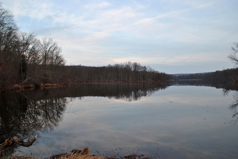
Once last shot of Hopewell Lake before the day came to an end.
That was it for my unplanned adventure at French Creek State Park. I've always enjoyed hiking there so even though it was my fallback plan, it was well worth the trip out there. I was glad to have brought a trail map with me since my plans to hike Monocacy Hill ended up being a wash. Make note to self, if you plan on hiking somewhere new and you aren't sure if the place you're going might be closed for hunting, be sure to check their website (if they have one) or go on a Sunday!
Here are a few more of my adventures from French Creek State Park, at least the ones I documented.
French Creek State Park - July 2014
Horse-Shoe Trail at French Creek State Park - August 2014
French Creek State Park - Return to Six Penny - October 2014
I guess it goes without saying that I'd gladly return to explore some more. For the most part, I've covered a good portion of the trails at French Creek State Park with only a few left that I haven't explored yet!
Until next time, happy exploring and happy hiking!
No comments:
Post a Comment