Date of Hike: Saturday, September 5, 2015
Total Distance: 4.40 Miles
Avg speed: 1.81 MPH
Avg moving speed: 2.19 MPH
Moving Time: 2:00:14
Total Time: 2:25:41
Conditions: Sunny, 77 Degrees
Difficulty: Moderate
This past Saturday, I made my way out to Woody's Woods in the Pottstown, PA area. Like many of the other places scattered throughout this part of Chester County, there seems to be a little bit of history within these trails but unfortunately, not a lot of information about Woody's Woods itself. There are two different parking lots to choose from should you decide to hike there.
3131 Coventryville Road
Pottstown, PA 19465
GPS: 40.183915,-75.680407
and
1560 Harmonyville Road
Pottstown, PA 19464
GPS: 40.2031198,-75.6703926
Had I not gone hiking at the Coventry Woods Preserve the week before, I would have never known about this place. In all there are approximately 260 acres of land to hike at Woody's Woods. To obtain a copy of the trail map, you can find it on the South Coventry Township's website in the Parks and Recreation section or you can click here.

I parked at the Coventryville Road entrance. Note that the parking lot is to the left side of this sign.

Also take note that during deer archery hunting season, Woody's Woods is closed to the public from Monday through Saturday. I'm glad I got there when I did. Had I been here a few weeks later, I wouldn't have been able to go hiking since I was there on a Saturday.

When you start your hike (if you park at the Coventryville Road entrance), you'll be following a paved road north up a pretty long hill. It's not real steep but it's long enough to get the blood pumping. Most of the way up the hill, the White Trail splits in two directions to the northwest and also to the northeast. I turned to the northwest. The trails aren't named on the map but the trail markers coincide with what's on the map (for the most part, more on this later). Once you turn to the northwest, the trails turn from being paved to gravel.

If anyone has any idea what these are supposed to be, I'm all ears. I think it may have something to do with hunting but I'm not a hunter so I'm not really sure. There are three of them within Woody's Woods.

Once you reach the top of the hill, there are unmarked trails that split off in different directions and from what it looks like on the trail map, they don't really lead to anywhere. At this point, the trails turn from being gravel to a natural surface.


Sadly, a lot of the trails within Woody's Woods are not very well maintained. If you want to check it out, I'd recommend you wear long pants.

Where the White Trail makes its turn to the northeast, the Blue Trail intersects going in a southwest direction and was the trail I followed.

The Blue Trail makes a turn to the west, then another turn to the northeast

Along the western border of Woody's Woods, there looks to be yet another shooting range in the area which brings the total up to four that I'm aware of within the vicinity of French Creek State Park.

The Blue Trail gradually makes a turn to the east, then in a southeast direction.
When you arrive at the second safety post, the Blue Trail intersects with the the White Trail and also the Read Trail which heads in a northwest direction and was the trail I turned on.


I'm not really sure what this is, perhaps a fungus or maybe some sort of spider web but in recent weeks, I've been seeing quite a bit of it.


The Red Trail turns to the northeast and intersects with the Orange Trail (color not shown on the map) continuing in a northwest direction and was the trail I took.


With fall being just around the corner and the summer season coming to an end, I've walked through more spider webs in the last few weeks than I have all summer. It seems they're getting their last meals in before the weather turns cold.


The Orange Trail will lead you to the Harmonyville Road parking lot. The above benches are about 50-100 yards up the trail from the entrance. On either side of Woody's Woods, if you decide to hike here, you'll be starting your adventure heading uphill.

In this area, the trail map is virtually useless due to the trails not being maintained. I unsuccessfully tried in a few spots to take what looked like they used to be trails according to the map. Unfortunately, they eventually led to areas that were overgrown so I ended up turning back. At this point, I was retracing my steps on the Orange Trail (trail to the right) heading southeast and trying to find a different route back (trail to the left) to the top of the hill.

You can still see remnants of what used to be a trail in this area but as you push further into the woods, the trail gets more and more difficult to walk through.


After trying and not finding a few different trails back up the hill from the Harmonyville Road parking lot, I stayed on the Orange Trail and made my way back to the Red Trail, then turned to the northeast.

Although they were overgrown, a number of the trails at Woody's Woods looked to be wide enough that a vehicle could have passed through at one time. Giving the history in the area regarding the iron industry, it wouldn't surprise me if these were once used to transport supplies from one place to another.

The Red Trail turns to the southeast in this area. Shortly after your turn, you'll see this bench.


The Red Trail eventually leads to these towers.

I walked past the above towers then cut behind them to see if I could find some more trails. They are marked on the trail map but from what I had already seen, my hopes of finding another passable one were pretty slim.

Thankfully, I found one that was passable and decided to check it out. Unfortunately, other than this one, the trails that are shown on the map were hard to find.


After heading north for a distance, the trail "dead ends" at private property. Technically, it wasn't really a dead end and I could have kept going but turned around to head back to the towers on the top of the hill.


On the trail map, you'll see a few areas that are marked with a "CH". I'm pretty sure that this represents charcoal hearths that are scattered throughout Woody's Woods and throughout the area for that matter. According to their trail map, there are seven of them. I've touched on what a charcoal hearth was in my post on the Coventry Woods Preserve and will go into more detail about this in an upcoming post. As I mentioned, they're not really much to look at and unless you're aware they exist, you might walk right past them without even noticing.


Once I returned from the trail behind the towers, the Red Trail continues south where it runs directly into the White Trail and from there, I was just about done with my hike.

This is the spot where the White Trail split off to the northwest and where I first turned off to head towards the Blue Trail.

That was it for my adventure at Woody's Woods. In all, it was a decent hike that could have been much better if the trails were better maintained and the map were a bit more accurate. This place definitely has the potential to be an excellent hiking spot and I'm glad to have found and explored it. Will I return? It's possible but with the numerous other places to hike in the vicinity, many of which have trails that are in much better condition, it would likely be a last resort.
Until next time, happy exploring and happy hiking!
Please give my Facebook page a like!
This past Saturday, I made my way out to Woody's Woods in the Pottstown, PA area. Like many of the other places scattered throughout this part of Chester County, there seems to be a little bit of history within these trails but unfortunately, not a lot of information about Woody's Woods itself. There are two different parking lots to choose from should you decide to hike there.
3131 Coventryville Road
Pottstown, PA 19465
GPS: 40.183915,-75.680407
and
1560 Harmonyville Road
Pottstown, PA 19464
GPS: 40.2031198,-75.6703926
Had I not gone hiking at the Coventry Woods Preserve the week before, I would have never known about this place. In all there are approximately 260 acres of land to hike at Woody's Woods. To obtain a copy of the trail map, you can find it on the South Coventry Township's website in the Parks and Recreation section or you can click here.

I parked at the Coventryville Road entrance. Note that the parking lot is to the left side of this sign.

Also take note that during deer archery hunting season, Woody's Woods is closed to the public from Monday through Saturday. I'm glad I got there when I did. Had I been here a few weeks later, I wouldn't have been able to go hiking since I was there on a Saturday.

When you start your hike (if you park at the Coventryville Road entrance), you'll be following a paved road north up a pretty long hill. It's not real steep but it's long enough to get the blood pumping. Most of the way up the hill, the White Trail splits in two directions to the northwest and also to the northeast. I turned to the northwest. The trails aren't named on the map but the trail markers coincide with what's on the map (for the most part, more on this later). Once you turn to the northwest, the trails turn from being paved to gravel.
If anyone has any idea what these are supposed to be, I'm all ears. I think it may have something to do with hunting but I'm not a hunter so I'm not really sure. There are three of them within Woody's Woods.

Once you reach the top of the hill, there are unmarked trails that split off in different directions and from what it looks like on the trail map, they don't really lead to anywhere. At this point, the trails turn from being gravel to a natural surface.


 |
| Trail marker for the White Trail |
 |
| The White Trail then makes a turn to the northeast. |
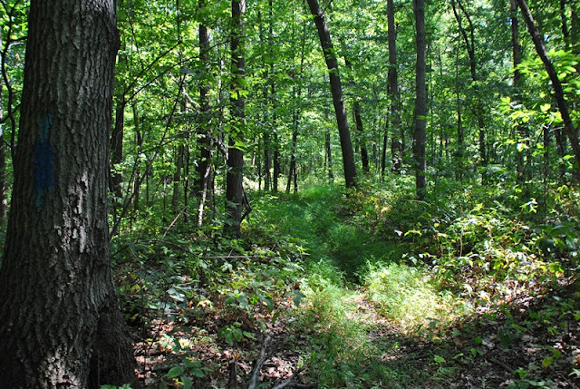
Sadly, a lot of the trails within Woody's Woods are not very well maintained. If you want to check it out, I'd recommend you wear long pants.

Where the White Trail makes its turn to the northeast, the Blue Trail intersects going in a southwest direction and was the trail I followed.

The Blue Trail makes a turn to the west, then another turn to the northeast
 |
| While the trails aren't very well maintained, there are plenty of markers to help you find your way. |

Along the western border of Woody's Woods, there looks to be yet another shooting range in the area which brings the total up to four that I'm aware of within the vicinity of French Creek State Park.

The Blue Trail gradually makes a turn to the east, then in a southeast direction.

When you arrive at the second safety post, the Blue Trail intersects with the the White Trail and also the Read Trail which heads in a northwest direction and was the trail I turned on.

 |
| Heading northwest on the Red Trail |

I'm not really sure what this is, perhaps a fungus or maybe some sort of spider web but in recent weeks, I've been seeing quite a bit of it.


The Red Trail turns to the northeast and intersects with the Orange Trail (color not shown on the map) continuing in a northwest direction and was the trail I took.


With fall being just around the corner and the summer season coming to an end, I've walked through more spider webs in the last few weeks than I have all summer. It seems they're getting their last meals in before the weather turns cold.


The Orange Trail will lead you to the Harmonyville Road parking lot. The above benches are about 50-100 yards up the trail from the entrance. On either side of Woody's Woods, if you decide to hike here, you'll be starting your adventure heading uphill.

 |
| Harmonyville Road parking lot |
In this area, the trail map is virtually useless due to the trails not being maintained. I unsuccessfully tried in a few spots to take what looked like they used to be trails according to the map. Unfortunately, they eventually led to areas that were overgrown so I ended up turning back. At this point, I was retracing my steps on the Orange Trail (trail to the right) heading southeast and trying to find a different route back (trail to the left) to the top of the hill.

You can still see remnants of what used to be a trail in this area but as you push further into the woods, the trail gets more and more difficult to walk through.

 |
| This was where I finally decided to turn back to the Orange Trail |


After trying and not finding a few different trails back up the hill from the Harmonyville Road parking lot, I stayed on the Orange Trail and made my way back to the Red Trail, then turned to the northeast.

Although they were overgrown, a number of the trails at Woody's Woods looked to be wide enough that a vehicle could have passed through at one time. Giving the history in the area regarding the iron industry, it wouldn't surprise me if these were once used to transport supplies from one place to another.
 |
| Another trail that I passed while walking on the Red Trail |

The Red Trail turns to the southeast in this area. Shortly after your turn, you'll see this bench.


The Red Trail eventually leads to these towers.

I walked past the above towers then cut behind them to see if I could find some more trails. They are marked on the trail map but from what I had already seen, my hopes of finding another passable one were pretty slim.

Thankfully, I found one that was passable and decided to check it out. Unfortunately, other than this one, the trails that are shown on the map were hard to find.


After heading north for a distance, the trail "dead ends" at private property. Technically, it wasn't really a dead end and I could have kept going but turned around to head back to the towers on the top of the hill.


On the trail map, you'll see a few areas that are marked with a "CH". I'm pretty sure that this represents charcoal hearths that are scattered throughout Woody's Woods and throughout the area for that matter. According to their trail map, there are seven of them. I've touched on what a charcoal hearth was in my post on the Coventry Woods Preserve and will go into more detail about this in an upcoming post. As I mentioned, they're not really much to look at and unless you're aware they exist, you might walk right past them without even noticing.


 |
| Almost back to the towers |
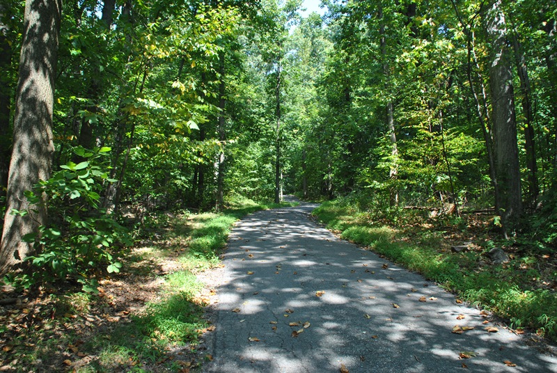
Once I returned from the trail behind the towers, the Red Trail continues south where it runs directly into the White Trail and from there, I was just about done with my hike.

This is the spot where the White Trail split off to the northwest and where I first turned off to head towards the Blue Trail.

 |
| Back to the parking lot |
That was it for my adventure at Woody's Woods. In all, it was a decent hike that could have been much better if the trails were better maintained and the map were a bit more accurate. This place definitely has the potential to be an excellent hiking spot and I'm glad to have found and explored it. Will I return? It's possible but with the numerous other places to hike in the vicinity, many of which have trails that are in much better condition, it would likely be a last resort.
Until next time, happy exploring and happy hiking!
Please give my Facebook page a like!
No comments:
Post a Comment