Total Distance: 11.31 Miles
Avg Speed: 2.21 MPH
Avg Moving Speed: 2.42 MPH
Moving Time: 4:40:31
Total Time: 5:07:02
Conditions: Sunny, 86 Degrees
Difficulty: Fiddlers Creek Preserve - Easy
Difficulty: Baldpate Mountain - Moderate to Difficult
After my hike at Gwynedd Wildlife Preserve on Saturday the 9th, I was a little disappointed with how easy it was and the moderate amount of distance I had gone (6 miles is moderate for me, that wasn't the case earlier in the spring) so I decided to head to Fiddler's Creek Preserve and Baldpate Mountain...and yes, this isn't in Southeastern PA, it's just across the Delaware River in Titusville, NJ and it was well worth the drive. Technically, it's called the Ted Stiles Preserve at Baldpate Mountain. At one time, it used to be called Kuser Mountain. For some more on the history, click here.
Approximate address:
12 Fiddlers Creek Road
Titusville, PA 08560
GPS: 40.317185, -74.889569
As usual, the street address isn't entirely accurate but the GPS coordinates are. There are two entrances to Baldpate Mountain within a short distance of each other, one of which will bring you up the hill to the main area and another that's maybe a few hundred yards off Fiddler's Creek Road. If you're coming from the west like I was and want to park in the one closer to Fiddler's Creek Road, pass the main entrance and it will be on your left a short distance further down the road.

I started my hike heading south into Fiddler's Creek Preserve. From the parking lot, there's a short trail that will lead you to the road heading up to the main parking area of Baldpate Mountain. Follow it down to Fiddler's Creek Road and across the street and a bit to the left, you'll find the preserve trail head. The blue trail markers are supposed to represent what's called the Overlook Trail since it's above the Delaware River but during the summer, there's no view. You can see Baldpate Mountain from the trail though.
 |
| Fiddler's Creek Preserve Trail Head |


For the most part, the trails in the preserve are in good condition. I only found one area that was a bit overgrown and it was a span of about 50 feet. Otherwise, hiking in this area was a breeze for the most part. Please note that the current trail map for Fiddler's Creek Preserve does not show all of the trails. I got to one point where the trail actually split off in at least three different directions before I got to the fenced in area.


Another trail that isn't marked on the map although the fence is. You can follow it around the outside perimeter and at five different spots, there are gates you can walk through to check out the interior.

 |
| Spider Web with the Morning Dew |
 |
| Thistle Leaf with Morning Dew |
Have I mentioned morning dew? I hadn't thought about it until I was walking on the trails but I started my day earlier than I normally do. For the most part, the trails inside the preserve are grass and it was just starting to warm up. Safe to say, I'll have to keep this in mind for my next hike since my pants and boots were soaked in no time. Glad my boots are waterproof but it made me think to bring another extra pair of socks with me for my next hike. I always carry extra socks but when feet get wet, you can never have enough...need to prevent those blisters! My boots are brown but they look almost black here. I'm thinking I may need to treat my boots with some waterproofing just in case.

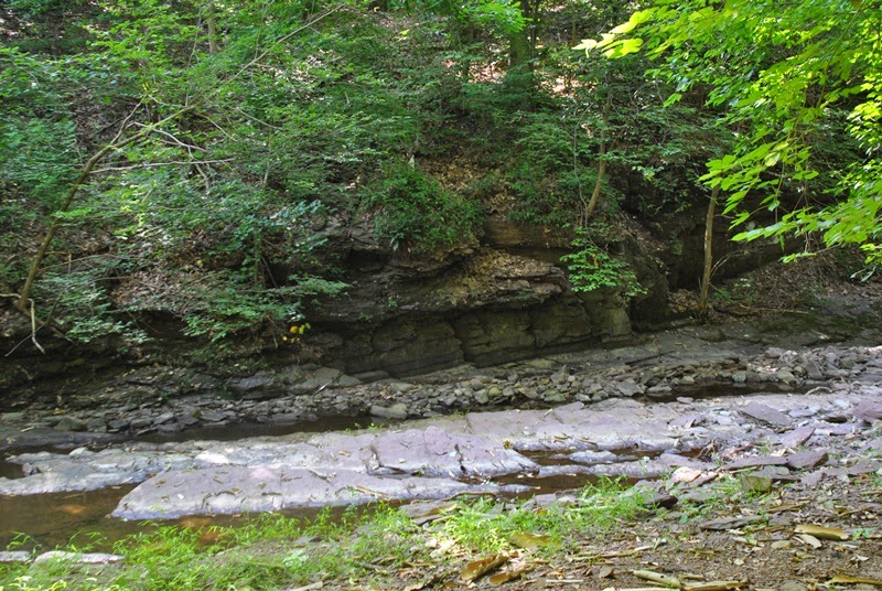
After walking around the perimeter of the fence to the northeastern side of the preserve, I headed down the Ravine Trail to check out Fiddler's Creek.

 |
| Ravine Trail with Red Trail Marker |

 |
| I took a quick detour and checked out the Stoneface Trail |


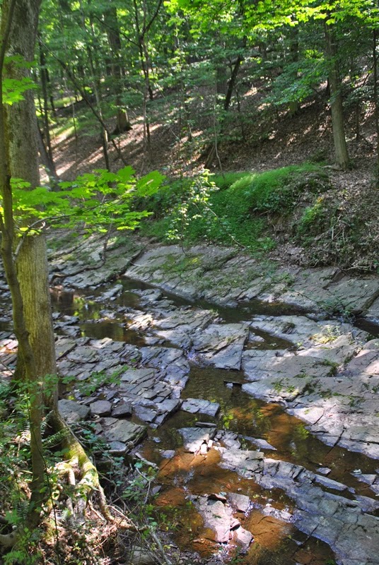 |
| Back down to Fiddler's Creek |
As a hiker, it's a given you're going to walk through spider webs, it happens all the time. In the Fiddler's Creek Preserve, you should be prepared to walk through more than you've ever walked through in your lifetime, they were all over the place! If anyone else hiked these trails after I did, you're welcome. I got them out of the way for you.
Too bad this picture is a bit blurry but I was shooting it from a distance. Maybe next time.


I circled back up the hill from Fiddler's creek and walked through the gate to check out the interior. There's a sign posted at each gate making sure you know bikers and horseback riders are not permitted within the fenced in area.


Another reason I originally avoided the interior part of the preserve...no shade!


 |
| Heading back out of the preserve |
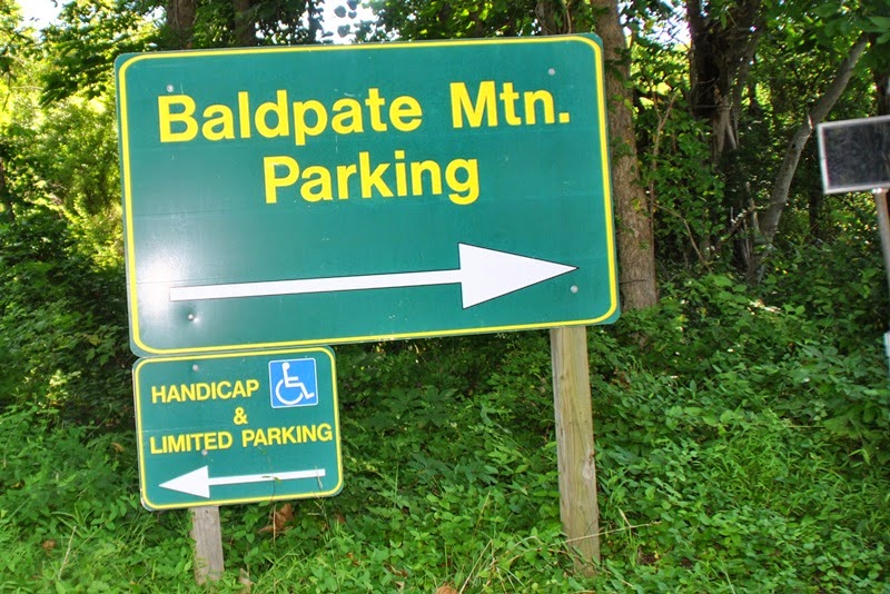 |
| Baldpate Mountain sign at the main entrance |
 |
| Map of Baldpate Mountain at the Summit Trail starting point |

Finished at the preserve, I headed up Summit Trail towards the top of Baldpate Mountain. Most of the trails are in very good condition. This was also where my hike got fun. Not to say Fiddler's Creek Preserve wasn't fun but I was looking for a challenge.

After seeing this sign, it made me curious to know what rare wildlife this sign is referring to. I just started reading into it and have found a document that describes a recent survey on the land but so far, it seems the rare species (or at least some of them) are being kept a secret. More to follow. If I find the document worthy of posting, I'll put a link up.


When I got to this point, I had to stop for a second to look around, where did the trail go? After looking more carefully, this WAS the trail. Very cool! Whoever designed this did a great job at placing the rocks in such a way that they blend in nicely and also provide flat spots to walk on a natural staircase leading through the rocks.


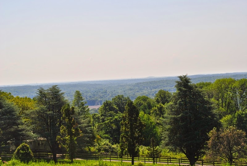
When I reached the summit, I headed west on the Ridge Trail. Directly to my right from where I shot this picture, there is a small grove of picnic tables.

 |
| Checking out the view into good 'ol Pennsylvania from the top of Baldpate Mountain |
 |
| Looking back towards the picnic tables. |

I took a quick peek through the view finder (don't really know what these are called) and scoped out the area.


Three way intersection where the Ridge, Switchback and Northwest Loop Trails meet. I took the Northwest Loop Trail.


 |
| It seems some people don't like to use the trails provided and want to create their own. |
 |
| Heading down the hill on the Northwest Loop Trail |
Seeing this sign explained why I saw the one a short distance back about unauthorized trails being created. It's located in an area within the proximity of a quarry and likely leads to it.


As I mentioned, most of the trails were in very good condition but you can't stop Mother Nature from doing her thing and knocking trees down over them. This was relatively new, the colors of the broken areas were still light. If you look at the branch on the right side, you can see a little bit of the break in the wood.

This area is another where one of trail maps I have doesn't show all of the trails that are in this preserve. Before heading here, I printed out two different ones and I was glad I did. The map provided by the New Jersey Trails Association shows the Pleasant Valley Access Trail heading in a northeasterly direction then cutting back to the northwest. What it doesn't show are another two "unmarked" trails (Pine Grove and Wild Raspberry) that are mentioned on the Hidden Trenton website which continue east once the Pleasant Valley Access Trail cuts back to the northwest. After seeing the other signs about unauthorized trails being made, I kept my fingers crossed and went for it anyway. Thankfully, there were no signs so I didn't end up having to turn back. That would have been a bummer.


Somewhere in this area, I put my legs on cruise control and stopped taking pictures for a distance. There was a relatively steep hill to climb with some switchbacks and taking pictures while breathing heavy is near impossible. Once I reached the top of the hill, I did my usual and headed down a trail that wasn't marked by either website and strolled past this tree stand. When I got to the opening and saw the power lines, I decided to turn back. The trail does lead to a parking lot on the other side of the hill but I wasn't interested in looking at power lines or baking in the sun, not here at least.


 |
| Caught this butterfly somewhere on the "unmarked" Wild Raspberry Trail |
I made my way to the Ridge Trail and continued east.
 |
| I think it's a bit early for leaves to be changing colors already |
 |
| Directly to the right of these tree stumps is the Copper Hill Trail |
I made my way to the parking lot off Pleasant Valley Road and from there, I hopped onto Power Line Road (it's really a trail, no idea why it's called a road) and followed the power lines until I found the Kusar Trail and started heading south.

 |
| Another tree stand |
These Robberflies were attached to each other and landed on some leaves close to me. Too bad the picture came out blurry, I was in a hurry to get the shot before they flew off again. They look scary but will rarely bite a human unless provoked.


Things got a little bit tricky in this area. I took what I thought was the Stone Bridge Trail but it turned out I took the second left instead of the first and ended up on the southern end of Hollow Road. Hollow Road looks like at one time it was a road but is now overgrown. Just before I approached it, there was this small stream crossing. When I figured out where I was, I turned back to the Honey Hollow Trail.


As I was walking down the Honey Hollow Trail, I could hear a chainsaw in the distance. When I got closer, it turned out to be a few volunteers who were clearing one of the trails that were pretty badly damaged from fallen trees, several of them were cedar. They had just gotten done cutting new trails around all the trees that were down. I asked if I could cut through, they said ok and asked if I could bring some tools next time!
 |
| I love the smell of fresh cut cedar! |
I took what I thought was the Cedar Grove Trail but ended up coming to a screeching halt when the trail ended at a fallen tree. I doubled back to find the trail the volunteers had just made and wound around several more fallen cedar trees. Brand new trails are not as easy to follow since they're still green. I had to follow the downed weeds and branches from the machete one of the volunteers had.

 |
| Dead end trail! Had to double back again. |

I eventually found my way out of the new trail maze and located the Copper Hill Trail. About half way up the hill you'll run into what looks like the remains of a house that's now been converted into a stone chair with a fireplace.


I made my way back to the Ridge Trail and put the legs on cruise control until I got to these abandoned houses. I had to check them out.


 |
| The front door was open so I poked my head in, coffee anyone? |
A little further down the hill was another abandoned house. The doors were open in this one too but I thought better of going in despite my curiosity. I love checking places like this out but I also don't want to fall through an unstable floor and getting hurt or into trouble for being somewhere I wasn't supposed to be...or both!


 |
| Spring house just down from the second abandoned house, there was a pond on the other side but no openings to get pictures |

My last picture of the hike. I was on my way back to the Summit Trail and had already taken pictures there.

Another awesome day of hiking and a second weekend in a row of 10+ miles in a single day. I was hoping to reach my objective of 12 miles but no go this time. In all, this is a cool place and I look forward to returning. I missed one trail that I should have paid closer attention to (Switchback Trail) so it gives me an excuse, like I need one in the first place! Apparently, it's a pretty steep climb so I'll be coming back to tackle it eventually.
One last note to mention and something I was truly impressed with which gives me yet another reason to return. Besides at the very beginning of my hike on the Summit Trail and at one other spot, I didn't see any trash anywhere. As I started to notice (or not notice really) there wasn't any, I actually started to look for it towards the end and I didn't even spot a cigarette butt which I almost always see on trails. I'm glad to see this place is being well taken care of and I hope you find the same if you decide to take an adventure out there.
Happy exploring and happy hiking!
Please give my Facebook page a like!
No comments:
Post a Comment