Date of Hike: Saturday, May 16, 2015
Total Distance: 13.22 Miles (Approximate)
Avg speed: 2.25 MPH
Avg moving speed: 2.47 MPH
Moving Time: 5:20:58
Total Time: 5:52:38
Conditions: Sunny, 83 Degrees
Difficulty: Easy, Moderate, Difficult
My tracking app stopped working for a short distance during the hike so the mileage isn't entirely accurate but it's close enough as it only stopped tracking for a few moments.
I'm way late with getting this post up. I went hiking at Ridley Creek State Park on May 16th and to say the least, it was an awesome adventure and the longest distance I've hiked since August 24th of last year at French Creek State Park. I can safely say that this was my favorite hike of the season so far. The trails are in excellent condition, the terrain is varied and challenging, and there are some places within the park that will make you feel completely secluded. To make it even better, there are a lot of side trails that aren't listed on the map of the park and there was very little trash to be found anywhere. I didn't explore many of the side trails I spotted so it gives me an excuse to return, like I really need one to go hiking!
Take note that as of right now, the map of Ridley Creek State Park will not print from Adobe Reader. I had to take a screenshot of it and print from there. Also note that while the trails on the map are marked, they're difficult to see due to the color patterns used (white, yellow, blue). Once I took the screenshot, I cropped out Tyler Arboretum and used Microsoft Paint to darken the trails which made them easier to see. Since I cropped out the arboretum, it enlarged the map of the park when printed which also helped to make it easier to see.
I parked in the parking lot of the Hunting Hill Mansion
Address:
351 Gradyville Rd
Newtown Square, PA 19073
GPS: 39.9470346,-75.4494372
There are several other parking lots throughout the park if you want to avoid the Hunting Hill Mansion. Take a look at the trail map to locate the others.


I don't have any information about this other than it being called Jefford's Greenhouse. I was at Ridley Creek State Park previous to this where I was able to get inside and take pictures but it seems the doorway that was open previously has now been locked shut.

Mother fox with her kit. Unfortunately, I couldn't get a closer shot. They were a long distance off and didn't stay out in the open long.


Before starting my hike, I checked out the gardens that are alongside the Hunting Hill Mansion.


While I was walking around the gardens, there was a photographer and what looked to be the beginning of a wedding party walking around the area. I'm guessing this is why the podium was set up.


The Hunting Hill Mansion was originally built in or around 1789. In 1914, the then farmhouse was expanded by the Jeffords family to include the ballroom, grand staircase room, park office reception area, bride's room, kitchen facilities, and the second floor offices. Walter M. Jeffords Sr. was a successful investment banker and owner/breeder of Thoroughbred racehorses. Starting around 1912, the Jeffords purchased small parcels of land until they owned over 2,000 acres which by 1960 was the largest privately owned undeveloped property in the Philadelphia area. The land was then purchased from the Jeffords by the Commonwealth of Pennsylvania in 1966.


After walking around the mansion for a short while, I was time to start my adventure. I started out east to northeast towards the Hidden Valley Farm.


In the back of one of the parking lots, you'll find the trail head to the equestrian trails in the park.


Most of the trails throughout this section of the park were similar to what you see below. They're nice and wide with plenty of room for horses and hikers.


The trail leads you west under a bridge on Gradyville Road. Once you get beyond this point, note that hunting is permitted in the area. If you're hiking/horseback riding during hunting season, be sure to wear orange clothing that will identify you as human. This section of the trail runs alongside Ridley Creek but as you push further in, there's not much of a view of the creek.


Alongside Ridley Creek, there are fisherman's trails throughout the area.Whenever I could find one, I would do what I could to walk alongside the creek.The trails were relatively short and usually ended up being "dead ends" pushing me back to the horse trail.


A little something to note and a reason to return to Ridley Creek State Park. Throughout the hike, there were numerous side trails that aren't mentioned on the map of the park. I didn't investigate them since I had already charted my course for the day but I will be returning to check some of them out. The trail in the below picture went straight up a hill...I'm always up for the challenge!


As the trail starts turning to the southwest, it also thins out some and looks more like a walking trail instead of for horseback riding. It also looked like this section of trail wasn't used as much as some of the others.


The trail opens back up after a distance with plenty of room for horseback riders and hikers.While they're not that big of a challenge, there are some hills in this area to climb.


Somewhere in this area, you'll be relatively close to Delchester Road and the trail will start to cut to the southeast, then take a sharp turn to the east.


It's hard to tell from the picture but both sides of this field were lined with honeysuckle trees. The smell was awesome! Note that you'll also be crossing close to private property in this area. Please be sure to stay on the trail.


The trail circles back to Ridley Creek and from there, you'll be doing some overlapping until you get back to the Hidden Valley Farm.

Instead of following the horse trail back to the farm, I tried locating trails that ran directly alongside Ridley Creek. This worked for a distance but eventually, I was forced to turn back and find the horse trail again. I found a few nice fishing spots though!


This is off one of the side trails from the horse trail, likely fisherman's trails.

On my return to the Hidden Valley Farm area, I didn't shoot many pictures since I had already been through there. Once I arrived back at the farm, I took a short break to grab a quick bite to eat and change out of my sweaty socks.

I walked along a road (unnamed) for a distance until I found the White Trail. Once I found the trail, it was all woods and was nice and secluded. It almost felt like you were in a jungle in some areas.


I veered off the White Trail to an unnamed one first heading northwest, then it cut back to the southeast alongside Ridley Creek. My guess is that this is another fisherman's trail but it was in good condition.


After a distance, the unnamed trail merged with the White Trail again.


The below picture if a good example of how nice and clean these trails were (as clean as dirt can be that is). They are very well kept and probably the best I've seen since my hike on the mountain bike trails at Nockamixon State Park last year.


This large boulder was alongside the trail. Around the other side from this picture, it was sloped enough that you could climb to the top of it. I took some pictures of the trail from the top and was on my way again.


Not too far from the first boulder I spotted was another cluster of boulders. They could have been climbed as well but there were some other hikers on them so I took what shots I could and was on my way.


Towards the southeastern end of the park, the Yellow Trail intersects with the White Trail and at this point, I veered off the White Trail heading east to follow the Yellow for a distance. Throughout my hike, I would flip-flop between the White and Yellow Trails.


Walking down a hill towards the Forge Road Trail. The Forge Road and Sycamore Mills Road Trails are a combined 5 mile paved multi-use trail within the park which for the most part, I avoided.


When the Yellow Trail reaches its southeastern corner (where there are trails, the park continues southeast alongside Ridley Creek for a good distance past this), it then turns to the southwest bordering the Tyler Arboretum.


Somewhere in this area, the Yellow and White Trails intersect. I veered off the Yellow Trail and followed the White Trail still heading to the southwest.


The trail then cuts to the northwest and once you cross over what could be Sandy Drive South (not sure), you'll find a section of the Blue Trail that continues west, then to the southwest.

I went a little picture crazy here. I've said it before and I'll say it again...I love finding ruins of old buildings/homes, etc. As you walk along the blue trail, you'll find these ruins (said to be the Mosser House) and a few others tucked back a short distance from the trail. I believe I spotted a total of three different sets of ruins. There are quite a few pictures of these ruins on Flickr, but there doesn't seem to be any historical information readily available. If/when I find some, I'll update accordingly.


Along another set of ruins close to the Mosser House (perhaps a barn), there was what looked like some old farming equipment buried in the rocks and weeds.


Once I was done checking out the ruins (so I had thought), I continued southwest along the blue trail. I'm not sure why but I didn't take many pictures in this area.


When I got back to the ruins after checking out the Blue Trail loop, I took some more pictures. I just couldn't help it!

I also found another set of ruins tucked further into the woods. I didn't see these when I passed them the first time.


The reason I didn't see the ruins? This trail leads to them and although I saw it when I passed the first time, I was interested in taking pictures of the Mosser House which is visible from where I took this picture.

Back to the White Trail and now heading northward. The White and Blue Trails merge for a while until the White Trail cuts back to the southwest. Somewhere in this area was also where I picked up the pace a little bit. It was still a distance off but there was bad weather on the way.


Although I didn't want to, I did cut my hike a bit short since there was bad weather on the way and I didn't know how long it would be before it arrived. Once I crossed over the Sycamore Mills Road Trail, I jumped onto the Yellow Trail again.


By this time, I was almost back to the parking lot.


A little something I hadn't mentioned earlier. Throughout my hike at Ridley Creek, I took notice to the trees in this area and found that there were quite a few of them that were enormous, similar to what you see below. Not all of them had this shape but the trunks of the trees I saw were pretty big and the trees themselves were pretty tall.


That was it for my adventure at Ridley Creek State Park. In all and as I already stated, this was an awesome adventure. I'd like to return here during the winter so that I'll be able to see further into the woods and perhaps spot more of the ruins I had seen since they won't be shrouded by greenery. There are also other ruins within the park that I didn't see and would like to locate.
Until next time which will be very soon since it took me so long to post this, I hope you enjoyed the tour.
Happy adventures and happy hiking!
Please give my Facebook page a like!
One last item to note. While I was hiking at Ridley Creek State Park, I found this on one of the trails (what it is and where I found it is up to the person who lost it to state) and turned it in to the lost and found located in the Hunting Hill Mansion. If you happen to have lost it and somehow find my blog, I hope you read this and get it back. These are not the most expensive but they're not cheap either.
My tracking app stopped working for a short distance during the hike so the mileage isn't entirely accurate but it's close enough as it only stopped tracking for a few moments.
I'm way late with getting this post up. I went hiking at Ridley Creek State Park on May 16th and to say the least, it was an awesome adventure and the longest distance I've hiked since August 24th of last year at French Creek State Park. I can safely say that this was my favorite hike of the season so far. The trails are in excellent condition, the terrain is varied and challenging, and there are some places within the park that will make you feel completely secluded. To make it even better, there are a lot of side trails that aren't listed on the map of the park and there was very little trash to be found anywhere. I didn't explore many of the side trails I spotted so it gives me an excuse to return, like I really need one to go hiking!
Take note that as of right now, the map of Ridley Creek State Park will not print from Adobe Reader. I had to take a screenshot of it and print from there. Also note that while the trails on the map are marked, they're difficult to see due to the color patterns used (white, yellow, blue). Once I took the screenshot, I cropped out Tyler Arboretum and used Microsoft Paint to darken the trails which made them easier to see. Since I cropped out the arboretum, it enlarged the map of the park when printed which also helped to make it easier to see.
I parked in the parking lot of the Hunting Hill Mansion
Address:
351 Gradyville Rd
Newtown Square, PA 19073
GPS: 39.9470346,-75.4494372
There are several other parking lots throughout the park if you want to avoid the Hunting Hill Mansion. Take a look at the trail map to locate the others.


I don't have any information about this other than it being called Jefford's Greenhouse. I was at Ridley Creek State Park previous to this where I was able to get inside and take pictures but it seems the doorway that was open previously has now been locked shut.

Mother fox with her kit. Unfortunately, I couldn't get a closer shot. They were a long distance off and didn't stay out in the open long.


Before starting my hike, I checked out the gardens that are alongside the Hunting Hill Mansion.


While I was walking around the gardens, there was a photographer and what looked to be the beginning of a wedding party walking around the area. I'm guessing this is why the podium was set up.


 |
| Looking back towards the gardens |

The Hunting Hill Mansion was originally built in or around 1789. In 1914, the then farmhouse was expanded by the Jeffords family to include the ballroom, grand staircase room, park office reception area, bride's room, kitchen facilities, and the second floor offices. Walter M. Jeffords Sr. was a successful investment banker and owner/breeder of Thoroughbred racehorses. Starting around 1912, the Jeffords purchased small parcels of land until they owned over 2,000 acres which by 1960 was the largest privately owned undeveloped property in the Philadelphia area. The land was then purchased from the Jeffords by the Commonwealth of Pennsylvania in 1966.


After walking around the mansion for a short while, I was time to start my adventure. I started out east to northeast towards the Hidden Valley Farm.


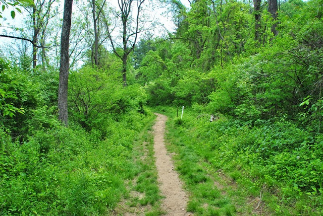
In the back of one of the parking lots, you'll find the trail head to the equestrian trails in the park.


Most of the trails throughout this section of the park were similar to what you see below. They're nice and wide with plenty of room for horses and hikers.


 |
| One of many side trails leading to Ridley Creek |


The trail leads you west under a bridge on Gradyville Road. Once you get beyond this point, note that hunting is permitted in the area. If you're hiking/horseback riding during hunting season, be sure to wear orange clothing that will identify you as human. This section of the trail runs alongside Ridley Creek but as you push further in, there's not much of a view of the creek.


 |
| Looking back at one of the intersecting trails |

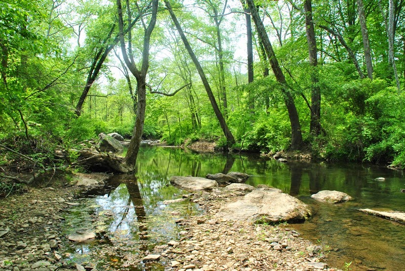
 |
| Another side trail leading to Ridley Creek |

Alongside Ridley Creek, there are fisherman's trails throughout the area.Whenever I could find one, I would do what I could to walk alongside the creek.The trails were relatively short and usually ended up being "dead ends" pushing me back to the horse trail.


A little something to note and a reason to return to Ridley Creek State Park. Throughout the hike, there were numerous side trails that aren't mentioned on the map of the park. I didn't investigate them since I had already charted my course for the day but I will be returning to check some of them out. The trail in the below picture went straight up a hill...I'm always up for the challenge!


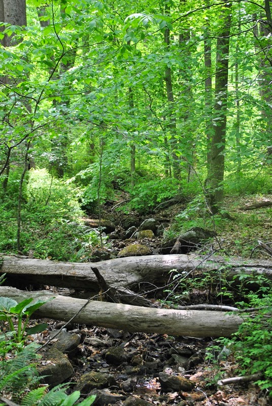
As the trail starts turning to the southwest, it also thins out some and looks more like a walking trail instead of for horseback riding. It also looked like this section of trail wasn't used as much as some of the others.

 |
| Fallen tree blocking the trail |

The trail opens back up after a distance with plenty of room for horseback riders and hikers.While they're not that big of a challenge, there are some hills in this area to climb.


Somewhere in this area, you'll be relatively close to Delchester Road and the trail will start to cut to the southeast, then take a sharp turn to the east.


It's hard to tell from the picture but both sides of this field were lined with honeysuckle trees. The smell was awesome! Note that you'll also be crossing close to private property in this area. Please be sure to stay on the trail.


The trail circles back to Ridley Creek and from there, you'll be doing some overlapping until you get back to the Hidden Valley Farm.

Instead of following the horse trail back to the farm, I tried locating trails that ran directly alongside Ridley Creek. This worked for a distance but eventually, I was forced to turn back and find the horse trail again. I found a few nice fishing spots though!


This is off one of the side trails from the horse trail, likely fisherman's trails.

On my return to the Hidden Valley Farm area, I didn't shoot many pictures since I had already been through there. Once I arrived back at the farm, I took a short break to grab a quick bite to eat and change out of my sweaty socks.

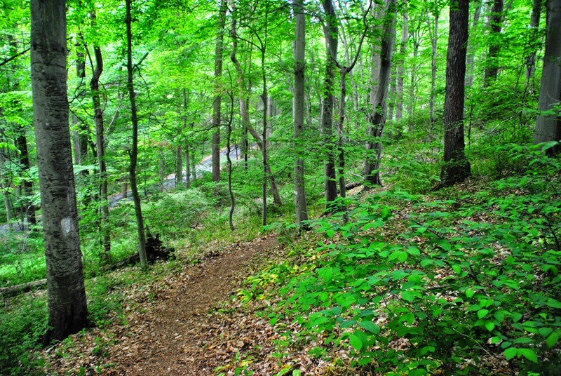
I walked along a road (unnamed) for a distance until I found the White Trail. Once I found the trail, it was all woods and was nice and secluded. It almost felt like you were in a jungle in some areas.


 |
| Small picnic grove along the White Trail |


I veered off the White Trail to an unnamed one first heading northwest, then it cut back to the southeast alongside Ridley Creek. My guess is that this is another fisherman's trail but it was in good condition.


After a distance, the unnamed trail merged with the White Trail again.


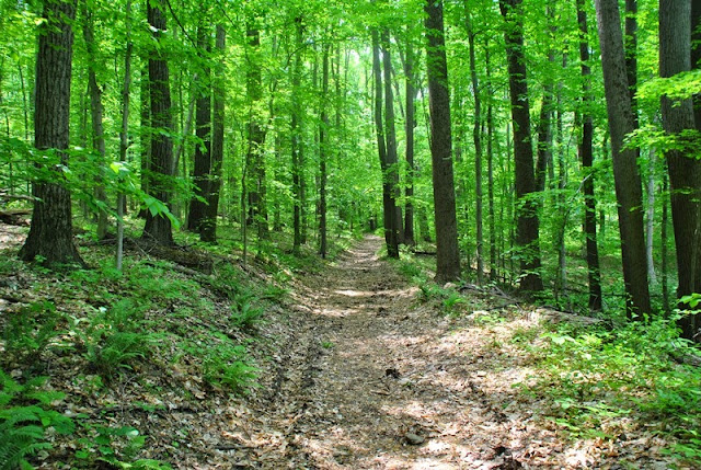
The below picture if a good example of how nice and clean these trails were (as clean as dirt can be that is). They are very well kept and probably the best I've seen since my hike on the mountain bike trails at Nockamixon State Park last year.

 |
| Bench overlooking Ridley Creek |

This large boulder was alongside the trail. Around the other side from this picture, it was sloped enough that you could climb to the top of it. I took some pictures of the trail from the top and was on my way again.


Not too far from the first boulder I spotted was another cluster of boulders. They could have been climbed as well but there were some other hikers on them so I took what shots I could and was on my way.


Towards the southeastern end of the park, the Yellow Trail intersects with the White Trail and at this point, I veered off the White Trail heading east to follow the Yellow for a distance. Throughout my hike, I would flip-flop between the White and Yellow Trails.


Walking down a hill towards the Forge Road Trail. The Forge Road and Sycamore Mills Road Trails are a combined 5 mile paved multi-use trail within the park which for the most part, I avoided.


When the Yellow Trail reaches its southeastern corner (where there are trails, the park continues southeast alongside Ridley Creek for a good distance past this), it then turns to the southwest bordering the Tyler Arboretum.


Somewhere in this area, the Yellow and White Trails intersect. I veered off the Yellow Trail and followed the White Trail still heading to the southwest.


The trail then cuts to the northwest and once you cross over what could be Sandy Drive South (not sure), you'll find a section of the Blue Trail that continues west, then to the southwest.

I went a little picture crazy here. I've said it before and I'll say it again...I love finding ruins of old buildings/homes, etc. As you walk along the blue trail, you'll find these ruins (said to be the Mosser House) and a few others tucked back a short distance from the trail. I believe I spotted a total of three different sets of ruins. There are quite a few pictures of these ruins on Flickr, but there doesn't seem to be any historical information readily available. If/when I find some, I'll update accordingly.


Along another set of ruins close to the Mosser House (perhaps a barn), there was what looked like some old farming equipment buried in the rocks and weeds.


Once I was done checking out the ruins (so I had thought), I continued southwest along the blue trail. I'm not sure why but I didn't take many pictures in this area.


When I got back to the ruins after checking out the Blue Trail loop, I took some more pictures. I just couldn't help it!

I also found another set of ruins tucked further into the woods. I didn't see these when I passed them the first time.


The reason I didn't see the ruins? This trail leads to them and although I saw it when I passed the first time, I was interested in taking pictures of the Mosser House which is visible from where I took this picture.

Back to the White Trail and now heading northward. The White and Blue Trails merge for a while until the White Trail cuts back to the southwest. Somewhere in this area was also where I picked up the pace a little bit. It was still a distance off but there was bad weather on the way.


Although I didn't want to, I did cut my hike a bit short since there was bad weather on the way and I didn't know how long it would be before it arrived. Once I crossed over the Sycamore Mills Road Trail, I jumped onto the Yellow Trail again.


By this time, I was almost back to the parking lot.


A little something I hadn't mentioned earlier. Throughout my hike at Ridley Creek, I took notice to the trees in this area and found that there were quite a few of them that were enormous, similar to what you see below. Not all of them had this shape but the trunks of the trees I saw were pretty big and the trees themselves were pretty tall.


That was it for my adventure at Ridley Creek State Park. In all and as I already stated, this was an awesome adventure. I'd like to return here during the winter so that I'll be able to see further into the woods and perhaps spot more of the ruins I had seen since they won't be shrouded by greenery. There are also other ruins within the park that I didn't see and would like to locate.
Until next time which will be very soon since it took me so long to post this, I hope you enjoyed the tour.
Happy adventures and happy hiking!
Please give my Facebook page a like!

One last item to note. While I was hiking at Ridley Creek State Park, I found this on one of the trails (what it is and where I found it is up to the person who lost it to state) and turned it in to the lost and found located in the Hunting Hill Mansion. If you happen to have lost it and somehow find my blog, I hope you read this and get it back. These are not the most expensive but they're not cheap either.
No comments:
Post a Comment