Date of Hike: Saturday, May 23, 2015
Total Distance: 2.14 Miles
Avg speed: 1.44 MPH
Avg moving speed: 1.66 MPH
Moving Time: 1:17:13
Total Time: 1:28:53
Conditions: Sunny, 64 Degrees
Difficulty: Easy
This is the second of three different preserves I visited this past Saturday the 23rd. The Rushton Woods Preserve is another of the Willistown Conservation Trust preserves in the area. This preserve is also a bit different than the others I was at due to there being a wildflower garden which was actually pretty cool. There's also a farm on the property that's privately operated.
Approximate address:
1075 Delchester Rd
Newtown Square, PA 19073
39.9835167,-75.489004

I didn't think to check for a trail map while I was there but there is a kiosk station. To be safe, you might want to bring one with you.

Since the flower gardens were right next to the parking lot, they were the first part of the preserve I checked out. Giving this is a farm, there were more than just flowers planted, there were also vegetables and fruits growing throughout the gardens as well. This section pretty much speaks for itself so there isn't much to be said other than to enjoy the colors!


Once I was done exploring the gardens, it was off to the trails heading in a southeasterly direction.


As I neared the farm house, I found a trail head next to the tractor barn and headed into the woods.The trail in this area is not well maintained which will be explained in a moment.


Here's why the trail wasn't too well maintained in this area. Where I went into the woods at the trail head next to the barn, there weren't any signs stating that hiking wasn't allowed (or at the least, it certainly wasn't encouraged). This shot is looking back on the trail that I had entered into the woods from. Sorry about that!

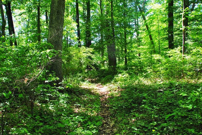
Once I was in an area that I was supposed to be in and heading northeast, the trails were in better condition and easier to walk on for the most part.


Argh! More signs stating that hiking wasn't permitted! There are quite a few trails within this preserve where these signs are posted. As much as I wanted to explore them, I chose not to and followed the trails that permitted hiking. On the Willistown Conservation Trust's website, it states there are trails with connections to a broader network of trails in the Willistown area and beyond. I'd be curious to know what they're about and if these trails are somehow related to what's stated on the WCT's website.


By now, I had turned to the north and was heading towards the northeast side of the preserve.


Another obstacle and something I didn't catch on to until I saw these signs. In this area, the trail map states "site of future trail restoration project" which I didn't know what it meant. It turns out the trail is temporarily closed. At this point, I didn't know why. After passing these signs, I continued north for a while longer.

A little further north from the closed trail is this small stream called Indian Run


Once I reached the boundary of the preserve, I turned around and started to head back towards Indian Run


My original intention was to hike as far north as possible, then double back to other trails leading off the one I had been on. On the trail map, you'll see where a boy scout bridge over Indian Run was built. This was it but unfortunately, it leads to the trail that's temporarily closed so this trail was not being maintained and was pretty well overgrown. I turned around and went back to the previous trail I had been on.

This preserve is open to equestrian use...I'm glad we haven't had much rain recently (even though we need it pretty badly right now) since the ground is usually pretty beat up from the weight of the horses which causes deep mud when the trails are wet. I was able to walk over these ruts without sinking in the mud.

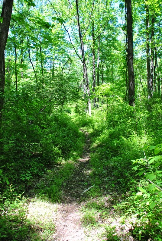
I finally had doubled back to a trail that was open and turned to the northwest.

Here's the reason the trail in this section of the preserve is closed. It had eroded away to the point where there was some deep gullies going down the middle of the trail. You can see a bit of it in the below picture.

Pushing towards the western side of the preserve, the trail splits in a southeast and northeast direction. I took the trail heading northeast.

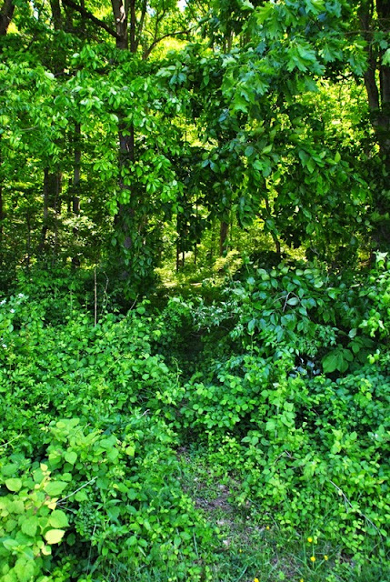
This was another section of trail that could have used a little bit of TLC.

Another trail where no hiking is permitted, my guess is again into some of the trails mentioned on the WCT's website.


I believe these are the same chimney swallow habitats that I saw in the beginning of the hike. I wasn't aware of it at the time but I had circled back to where I had started.

That was it for my tour of the Rushton Woods Preserve. Like the Kirkwood Preserve, it was a pretty decent place to check out, especially all of the wildflowers and gardens, and it had more cover from the sun. I'd still advise bringing some sunscreen along for those times you'll be out in the sun since there are stretches where you'll be exposed. It also took a little more than an hour to explore this preserve so like the Kirkwood preserve, if you're looking to take a day trip, bring a lunch or plan on visiting more than one of these preserves throughout the day.
This was preserve number two of the day, it was time to head over to the Okehocking Preserve a short distance down the road from Rushton Woods.
Happy adventures and happy hiking!
Please give my Facebook page a like!
This is the second of three different preserves I visited this past Saturday the 23rd. The Rushton Woods Preserve is another of the Willistown Conservation Trust preserves in the area. This preserve is also a bit different than the others I was at due to there being a wildflower garden which was actually pretty cool. There's also a farm on the property that's privately operated.
Approximate address:
1075 Delchester Rd
Newtown Square, PA 19073
39.9835167,-75.489004

I didn't think to check for a trail map while I was there but there is a kiosk station. To be safe, you might want to bring one with you.

Since the flower gardens were right next to the parking lot, they were the first part of the preserve I checked out. Giving this is a farm, there were more than just flowers planted, there were also vegetables and fruits growing throughout the gardens as well. This section pretty much speaks for itself so there isn't much to be said other than to enjoy the colors!


Once I was done exploring the gardens, it was off to the trails heading in a southeasterly direction.


 |
| View from the trail looking back to the parking lot |

As I neared the farm house, I found a trail head next to the tractor barn and headed into the woods.The trail in this area is not well maintained which will be explained in a moment.


Here's why the trail wasn't too well maintained in this area. Where I went into the woods at the trail head next to the barn, there weren't any signs stating that hiking wasn't allowed (or at the least, it certainly wasn't encouraged). This shot is looking back on the trail that I had entered into the woods from. Sorry about that!

Once I was in an area that I was supposed to be in and heading northeast, the trails were in better condition and easier to walk on for the most part.


Argh! More signs stating that hiking wasn't permitted! There are quite a few trails within this preserve where these signs are posted. As much as I wanted to explore them, I chose not to and followed the trails that permitted hiking. On the Willistown Conservation Trust's website, it states there are trails with connections to a broader network of trails in the Willistown area and beyond. I'd be curious to know what they're about and if these trails are somehow related to what's stated on the WCT's website.


 |
| Another "no hiking" sign |

By now, I had turned to the north and was heading towards the northeast side of the preserve.

Another obstacle and something I didn't catch on to until I saw these signs. In this area, the trail map states "site of future trail restoration project" which I didn't know what it meant. It turns out the trail is temporarily closed. At this point, I didn't know why. After passing these signs, I continued north for a while longer.

A little further north from the closed trail is this small stream called Indian Run

 |
| Looking upstream on Indian Run |

Once I reached the boundary of the preserve, I turned around and started to head back towards Indian Run


My original intention was to hike as far north as possible, then double back to other trails leading off the one I had been on. On the trail map, you'll see where a boy scout bridge over Indian Run was built. This was it but unfortunately, it leads to the trail that's temporarily closed so this trail was not being maintained and was pretty well overgrown. I turned around and went back to the previous trail I had been on.

This preserve is open to equestrian use...I'm glad we haven't had much rain recently (even though we need it pretty badly right now) since the ground is usually pretty beat up from the weight of the horses which causes deep mud when the trails are wet. I was able to walk over these ruts without sinking in the mud.

I finally had doubled back to a trail that was open and turned to the northwest.

Here's the reason the trail in this section of the preserve is closed. It had eroded away to the point where there was some deep gullies going down the middle of the trail. You can see a bit of it in the below picture.

Pushing towards the western side of the preserve, the trail splits in a southeast and northeast direction. I took the trail heading northeast.

This was another section of trail that could have used a little bit of TLC.

Another trail where no hiking is permitted, my guess is again into some of the trails mentioned on the WCT's website.


 |
| From here, the trail cuts back to the south |
 |
| Finally back to a trail that wasn't overgrown and turning to the northwest again |


 |
| Heading southeast, then turning to the south |

 |
| Tulip Poplar |
 |
| Somewhere in this area, the trail turns back to the east, then northeast |
 |
| This is shown on the map as a bird banding station. I took a quick break here and grabbed a snack. |


I believe these are the same chimney swallow habitats that I saw in the beginning of the hike. I wasn't aware of it at the time but I had circled back to where I had started.

 |
| One last picture from the Rushton Woods Preserve |
That was it for my tour of the Rushton Woods Preserve. Like the Kirkwood Preserve, it was a pretty decent place to check out, especially all of the wildflowers and gardens, and it had more cover from the sun. I'd still advise bringing some sunscreen along for those times you'll be out in the sun since there are stretches where you'll be exposed. It also took a little more than an hour to explore this preserve so like the Kirkwood preserve, if you're looking to take a day trip, bring a lunch or plan on visiting more than one of these preserves throughout the day.
This was preserve number two of the day, it was time to head over to the Okehocking Preserve a short distance down the road from Rushton Woods.
Happy adventures and happy hiking!
Please give my Facebook page a like!
No comments:
Post a Comment