Date of Hike: Monday, November 9, 2015
Total Distance: 7.53 Miles
Avg speed: 2.3 MPH
Total Time: 3:16:28
Conditions: Partly Sunny, 57 degrees
Difficulty: Easy, Moderate, Some Difficult
On Monday, November 9th, I took a hike around the Diamond Rock Preserve located in the Malvern, PA area. To add some extra distance since the preserve is small (approximately 52 acres), I started out at the Great Valley Nature Center and hiked the Horse-Shoe Trail to get to the preserve.
Part of the Open Land Conservancy, the Diamond Rock Preserve is one of eight preserves within the Great Valley area, most of which are in Tredyffrin Township. The Open Land Conservancy was established in 1939 and has since protected and preserved approximately 482 acres. The above mentioned eight preserves total 380 acres that are open to the public and and additional 118 acres are conservation easements. The original land at the Diamond Rock Preserve consisted of 24.2 acres and was gifted to the Open Land Conservancy in 1994 by the Natural Lands Trust.
The Diamond Rock Preserve is in the eastern end of the below track, closest to the Pennsylvania Turnpike. From what I've found, none of the preserves from the Open Land Conservancy are on Google Maps.

As stated, I parked at the Great Valley Nature Center and hiked the Horse-Shoe Trail to get to the preserve. That address is:
4180 Hollow Road
Malvern, PA 19355
GPS: 40.0908442,-75.5442263
If you just want to explore the Diamond Rock Preserve, there's a small place to park in a cul-de-sac on Chautauqua Trail. That approximate address is:
2000 Chautauqua Trail
Malvern, PA 19355
GPS: 40.0908442,-75.5442263
Below is a zoomed in shot of the Diamond Rock Preserve, Chautauqua Trail is the road furthest to the east and where I turned around to head back to the nature center after exploring. For a copy of the trail map, click here. Make sure to bring it along if you decide to go, none were available at the preserve.
Since I already hiked this section of the Horse-Shoe Trail back in September, I didn't take many pictures until I got to the preserve. The below trees were alongside Union Hill Road


One of the cool parts of hiking when there aren't any leaves on the trees is that you can see further into the woods. The last time I passed through this section of the Horse-Shoe Trail, I didn't spot this boat seemingly in the middle of the woods. There is some private property close bye but it's not very close.


Once I took pictures of the boat, I didn't take any more until I arrived on the outskirts of the Diamond Rock Preserve. At this point, the Horse-Shoe Trail turns in a northeasterly direction (left) and the trail(s) of the preserve continue heading eastward (right).


There's quite a bit of rock in this area although there aren't any to climb over on the trails.

Like most of my hike to the Diamond Rock Preserve, leaves from the trees are now covering most trails, especially those that aren't used often.


While continuing my trek in an eastward direction, I spotted some trail markers to the north and decided to take a quick look. I didn't go too far (yet) since it led me in the direction of the Horse-Shoe Trail and most of the preserve trails are to the south.


After exploring the section of trail to the north and turning back to the main trail of the preserve, I turned to the east again. By now, I was outside the boundaries of the preserve although the trail keeps going. A little further to the east, you'll find this metal contraption whatever it may be.

The trail continues to the east and another trail takes a turn to the northeast leading to the remnants of what used to be a quarry. Unfortunately, I could not find any information on what this quarry was about or what materials it was mined for.


I circled around to the lower part of the quarry following the above road (heading northward) alongside the cliffs. This quarry wasn't too deep and the bottom wasn't filled with water like you'd see with other abandoned quarries. I still used caution walking around though, who knows if there may have been deep holes in the ground!


As I reached close to the top of this small hill, I turned back. Just behind the below cliff was private property and although I didn't see any "no trespassing" signs, I'm not sure I was supposed to be in this area in the first place.


Returning back to the main trail, I headed back to the west until I found a trail marker leading me to the south.

At first, the walk down this hill was gradual and took me in a southwest direction.


Eventually, the trail took another turn heading south, then to the southeast. With this turn, the trail also became more steep.


I previously mentioned that one of the advantages of hiking during the fall (and winter) is that you can see much further into the woods and spot things you may not find while there are still leaves on the trees.
However, there are also a few disadvantages to hiking in the fall as well. With leaves covering the trails, especially ones that aren't used often, it's near impossible to walk quietly while stepping on dry leaves. Perhaps this worked to my advantage this time around because I saw a good number of deer running away during my hike.
Another more dangerous disadvantage of leaves on the ground is that you have no idea what's underneath them. You're walking on uneven terrain in the woods among rocks, tree roots, and pockets or small holes in the ground. While I'm well aware of this, it's impossible to avoid. During this adventure, I stepped on a slanted rock which twisted my ankle and made me fall on my keyster. I knock on wood as I say this and hope karma doesn't come back to bite me for doing so, but I've thankfully never been injured on the trail. I got lucky this time around!

One more disadvantage of hiking in the fall, especially on trails that aren't well used is that you can't always find the trail! Had it not been for the trail markers throughout the Diamond Rock Preserve, there's no way I would have been able to make my way through as well as I did. While the trail markers at the preserve are pretty good, there were also a number of places where I had to stop and look around to find the next one since I had no idea where the actual trails were.

By now, I was headed in a northward direction and back up the hill. Getting down the hill wasn't so tough but this hill was a relatively steep climb upward and a reason I rated this hike as "some difficult".


Back to the main trail that headed in an east/west direction, I cut across and continued to the north overlapping where I had been earlier in the day. This time, I continued northward until I reached the Horse-Shoe Trail. Note that while there are trail markers in this section of the preserve, the trails are not shown on the map.

Back on the Horse-Shoe Trail and on the eastern side of the Diamond Rock Preserve, you'll find this sign.

Once back on the Horse-Shoe Trail, I turned to the northeast and hiked until I reached Chautauqua Trail. I believe this is the area where you can park if you just want to check out the preserve. In all, I think you may get a mile, maybe two within the preserve itself.

Once I was done at Chautauqua Trail, I turned back to the southwest to head back to the car. Along the way, I took a few more pictures within the preserve and the rest of the way back, I was on cruise control.


Almost back to the car by now, I spotted this tree with the red leaves and got a close-up. I believe by now, I was close to Aldham Road which is a short distance from the Great Valley Nature Center.

That was it for my adventure to the Diamond Rock Preserve. In all, if you decide you only want to explore the preserve, your adventure will be relatively short. I'd suggest if you want to go this route that you make this one of your stops and not the only one unless you're looking to get a quick hour's worth of hiking in (maybe a little more depending on your pace). If you'd like to increase the distance of your hike, you can park at the Great Valley Nature Center or Valley Forge and head to the preserve by way of the Horse-Shoe Trail.
Perhaps I'll eventually return to the Diamond Rock Preserve but giving how small it is, it won't be on the top of my priority list. The preserve is quite nice and was worth the adventure to get out there. Despite falling on my keyster, the challenge of the terrain and checking out the abandoned quarry made it worth while.
Until next time, happy exploring and happy hiking!
Please give my Facebook page a like!
On Monday, November 9th, I took a hike around the Diamond Rock Preserve located in the Malvern, PA area. To add some extra distance since the preserve is small (approximately 52 acres), I started out at the Great Valley Nature Center and hiked the Horse-Shoe Trail to get to the preserve.
Part of the Open Land Conservancy, the Diamond Rock Preserve is one of eight preserves within the Great Valley area, most of which are in Tredyffrin Township. The Open Land Conservancy was established in 1939 and has since protected and preserved approximately 482 acres. The above mentioned eight preserves total 380 acres that are open to the public and and additional 118 acres are conservation easements. The original land at the Diamond Rock Preserve consisted of 24.2 acres and was gifted to the Open Land Conservancy in 1994 by the Natural Lands Trust.
The Diamond Rock Preserve is in the eastern end of the below track, closest to the Pennsylvania Turnpike. From what I've found, none of the preserves from the Open Land Conservancy are on Google Maps.

As stated, I parked at the Great Valley Nature Center and hiked the Horse-Shoe Trail to get to the preserve. That address is:
4180 Hollow Road
Malvern, PA 19355
GPS: 40.0908442,-75.5442263
If you just want to explore the Diamond Rock Preserve, there's a small place to park in a cul-de-sac on Chautauqua Trail. That approximate address is:
2000 Chautauqua Trail
Malvern, PA 19355
GPS: 40.0908442,-75.5442263
Below is a zoomed in shot of the Diamond Rock Preserve, Chautauqua Trail is the road furthest to the east and where I turned around to head back to the nature center after exploring. For a copy of the trail map, click here. Make sure to bring it along if you decide to go, none were available at the preserve.
 |
| Zoomed in shot of the Diamond Rock Preserve |
Since I already hiked this section of the Horse-Shoe Trail back in September, I didn't take many pictures until I got to the preserve. The below trees were alongside Union Hill Road


One of the cool parts of hiking when there aren't any leaves on the trees is that you can see further into the woods. The last time I passed through this section of the Horse-Shoe Trail, I didn't spot this boat seemingly in the middle of the woods. There is some private property close bye but it's not very close.


Once I took pictures of the boat, I didn't take any more until I arrived on the outskirts of the Diamond Rock Preserve. At this point, the Horse-Shoe Trail turns in a northeasterly direction (left) and the trail(s) of the preserve continue heading eastward (right).


There's quite a bit of rock in this area although there aren't any to climb over on the trails.

Like most of my hike to the Diamond Rock Preserve, leaves from the trees are now covering most trails, especially those that aren't used often.


While continuing my trek in an eastward direction, I spotted some trail markers to the north and decided to take a quick look. I didn't go too far (yet) since it led me in the direction of the Horse-Shoe Trail and most of the preserve trails are to the south.


After exploring the section of trail to the north and turning back to the main trail of the preserve, I turned to the east again. By now, I was outside the boundaries of the preserve although the trail keeps going. A little further to the east, you'll find this metal contraption whatever it may be.

The trail continues to the east and another trail takes a turn to the northeast leading to the remnants of what used to be a quarry. Unfortunately, I could not find any information on what this quarry was about or what materials it was mined for.


 |
| If you look to the lower right side of this picture, you can see the remnants of a road/trail. |
I circled around to the lower part of the quarry following the above road (heading northward) alongside the cliffs. This quarry wasn't too deep and the bottom wasn't filled with water like you'd see with other abandoned quarries. I still used caution walking around though, who knows if there may have been deep holes in the ground!


 |
| A layer of what looks like quartz in the middle of the cliff. |

As I reached close to the top of this small hill, I turned back. Just behind the below cliff was private property and although I didn't see any "no trespassing" signs, I'm not sure I was supposed to be in this area in the first place.


Returning back to the main trail, I headed back to the west until I found a trail marker leading me to the south.

At first, the walk down this hill was gradual and took me in a southwest direction.


 |
| Still a few colors left on the trees! |
Eventually, the trail took another turn heading south, then to the southeast. With this turn, the trail also became more steep.


I previously mentioned that one of the advantages of hiking during the fall (and winter) is that you can see much further into the woods and spot things you may not find while there are still leaves on the trees.
However, there are also a few disadvantages to hiking in the fall as well. With leaves covering the trails, especially ones that aren't used often, it's near impossible to walk quietly while stepping on dry leaves. Perhaps this worked to my advantage this time around because I saw a good number of deer running away during my hike.
Another more dangerous disadvantage of leaves on the ground is that you have no idea what's underneath them. You're walking on uneven terrain in the woods among rocks, tree roots, and pockets or small holes in the ground. While I'm well aware of this, it's impossible to avoid. During this adventure, I stepped on a slanted rock which twisted my ankle and made me fall on my keyster. I knock on wood as I say this and hope karma doesn't come back to bite me for doing so, but I've thankfully never been injured on the trail. I got lucky this time around!

One more disadvantage of hiking in the fall, especially on trails that aren't well used is that you can't always find the trail! Had it not been for the trail markers throughout the Diamond Rock Preserve, there's no way I would have been able to make my way through as well as I did. While the trail markers at the preserve are pretty good, there were also a number of places where I had to stop and look around to find the next one since I had no idea where the actual trails were.
 |
| The Pennsylvania Turnpike is in the background. By now, I was close to the bottom of the hill. |

By now, I was headed in a northward direction and back up the hill. Getting down the hill wasn't so tough but this hill was a relatively steep climb upward and a reason I rated this hike as "some difficult".


Back to the main trail that headed in an east/west direction, I cut across and continued to the north overlapping where I had been earlier in the day. This time, I continued northward until I reached the Horse-Shoe Trail. Note that while there are trail markers in this section of the preserve, the trails are not shown on the map.

Back on the Horse-Shoe Trail and on the eastern side of the Diamond Rock Preserve, you'll find this sign.

Once back on the Horse-Shoe Trail, I turned to the northeast and hiked until I reached Chautauqua Trail. I believe this is the area where you can park if you just want to check out the preserve. In all, I think you may get a mile, maybe two within the preserve itself.

 |
| View from Chautauqua Trail looking to the north |
Once I was done at Chautauqua Trail, I turned back to the southwest to head back to the car. Along the way, I took a few more pictures within the preserve and the rest of the way back, I was on cruise control.


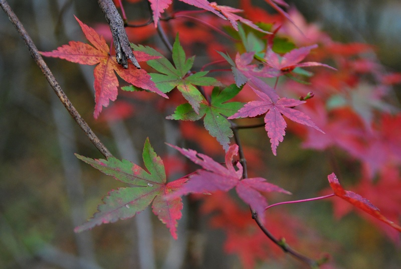
Almost back to the car by now, I spotted this tree with the red leaves and got a close-up. I believe by now, I was close to Aldham Road which is a short distance from the Great Valley Nature Center.
That was it for my adventure to the Diamond Rock Preserve. In all, if you decide you only want to explore the preserve, your adventure will be relatively short. I'd suggest if you want to go this route that you make this one of your stops and not the only one unless you're looking to get a quick hour's worth of hiking in (maybe a little more depending on your pace). If you'd like to increase the distance of your hike, you can park at the Great Valley Nature Center or Valley Forge and head to the preserve by way of the Horse-Shoe Trail.
Perhaps I'll eventually return to the Diamond Rock Preserve but giving how small it is, it won't be on the top of my priority list. The preserve is quite nice and was worth the adventure to get out there. Despite falling on my keyster, the challenge of the terrain and checking out the abandoned quarry made it worth while.
Until next time, happy exploring and happy hiking!
Please give my Facebook page a like!


